
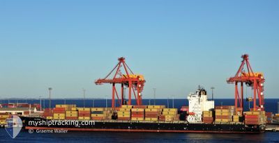
MSC SHAHAR
Container Ship
Current Trip
| Trip Time | 1 day |
|---|---|
| Trip Distance | 528.56 nm |
| AVG Speed | 14.4 Knop |
| MAX Speed | 18.3 Knop |
| Djupgående | 11.5 m |
| AVG Wind | 5.7 knots |
| MAX Wind | 12 knots |
| MIN Temp | 19.1°C / 66.38°F |
| MAX Temp | 26.3°C / 79.34°F |
| Position mottagen | 9 d sen |
Current Position
| Longitud | 31.27055° |
|---|---|
| Latitude | -29.74329° |
| Status | Under way using engine |
| Fart | 16.2 Knop |
| Kurs | 41.9° |
| Område | Indian Ocean |
| Station | T-AIS |
| Position mottagen | 9 d sen |
Info
Information
The current position of MSC SHAHAR is in Indian Ocean with coordinates -29.74329° / 31.27055° as reported on 2024-04-15 06:20 by AIS to our vessel tracker app. The vessel's current speed is 16.2 Knop and is currently inside the port of BEIRA.
The vessel MSC SHAHAR (IMO: 9471238, MMSI: 636020782) is a Container Ship that was built in 2011 ( 13 År gammal ). It's sailing under the flag of [LR] Liberia.
In this page you can find informations about the vessels current position, last detected port calls, and current voyage information. If the vessels is not in coverage by AIS you will find the latest position.
The current position of MSC SHAHAR is detected by our AIS receivers and we are not responsible for the reliability of the data. The last position was recorded while the vessel was in Coverage by the Ais receivers of our vessel tracking app.
The current draught of MSC SHAHAR as reported by AIS is 11.5 meters
Weather
| Temperature | 24.6°C / 76.28°F |
|---|---|
| Wind Speed | 6 knots |
| Direction | 111° ESE |
| Pressure | 1013.9 hPa |
| Humidity | 75.1 % |
| Cloud Coverage | --- |
Featured Company
Last Port Calls
| Port | Arrival | Departure | Time In Port |
|---|---|---|---|
| 2024-04-24 15:18 | |||
| 2024-04-20 13:39 | 2024-04-23 02:59 | 2 d | |
| 2024-04-08 11:52 | 2024-04-15 05:29 | 6 d | |
| 2024-03-23 08:37 | 2024-03-26 18:11 | 3 d | |
| 2024-02-28 05:58 | 2024-03-01 11:11 | 2 d | |
| 2024-02-22 14:53 | 2024-02-24 14:30 | 1 d | |
| 2024-02-10 22:55 | 2024-02-14 09:09 | 3 d |
Last Trips
| Origin | Departure | Destination | Arrival | Distance | |
|---|---|---|---|---|---|
| 2024-04-23 04:59 | 2024-04-24 17:18 | 528.56 nm | |||
| 2024-04-15 07:29 | 2024-04-20 15:39 | 464.99 nm | |||
| 2024-03-26 20:11 | 2024-04-08 13:52 | 1041.78 nm | |||
| 2024-03-01 13:11 | 2024-03-23 10:37 | 1450.82 nm | |||
| 2024-02-24 16:30 | 2024-02-28 07:58 | 640.07 nm | |||
| 2024-02-14 12:09 | 2024-02-22 16:53 | 1456.06 nm | |||
| 2024-02-01 02:16 | 2024-02-11 01:55 | 2545.98 nm |
Events
| Tid | Event | Detaljer | Position / Dest | Information |
|---|---|---|---|---|
| 2024-04-24 15:26 | STOPPAR förflyttning |
-19.81667 / 34.83333
[MZ] BEIRA
|
Fart: Kurs: -1° |
|
| 2024-04-24 15:18 | ANLÄNDER HAMN |
|
-19.81804 / 34.83290
[MZ] BEIRA
|
Fart: 4.1 kn Kurs: 20° |
| 2024-04-23 02:59 | AVGÅTT HAMN |
|
-25.97854 / 32.56661
MZMPM
|
Fart: 6.8 kn Kurs: 124° |
| 2024-04-23 02:51 | STARTAR förflyttning |
-25.96982 / 32.55336
[MZ] MAPUTO
|
Fart: 5.3 kn Kurs: 125° |
|
| 2024-04-20 13:39 | STOPPAR förflyttning |
-25.96238 / 32.54611
[MZ] MAPUTO
|
Fart: 0.1 kn Kurs: 308° |
|
| 2024-04-20 13:39 | ANLÄNDER HAMN |
|
-25.96238 / 32.54611
[MZ] MAPUTO
|
Fart: 4.4 kn Kurs: 311° |
| 2024-04-20 08:06 | STARTAR förflyttning |
-25.69999 / 32.98104
MZMPM
|
Fart: 3.3 kn Kurs: 13° |
|
| 2024-04-19 14:20 | STOPPAR förflyttning |
-25.67667 / 33.13500
MZMPM
|
Fart: Kurs: -1° |
|
| 2024-04-18 18:29 | STOPPAR förflyttning |
-25.68167 / 33.10333
MZMPM
|
Fart: Kurs: -1° |
|
| 2024-04-18 14:23 | STARTAR förflyttning |
-25.63285 / 33.00491
MZMPM
|
Fart: 6.2 kn Kurs: 116° |