
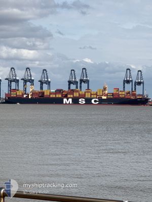
MSC ROSE
Cargo A
Current Trip
| Time Travelled | 31 days |
|---|---|
| Remaining Time | 9 h, 53 mins |
| Distance Travelled | 12312.68 nm |
| Remaining Distance | 45.44 nm |
| AVG Speed | 15.2 Knots |
| MAX Speed | 21.3 Knots |
| AVG Wind | 15.3 knots |
| MAX Wind | 33 knots |
| MIN Temp | 10.9°C / 51.62°F |
| MAX Temp | 29.9°C / 85.82°F |
| Draught | 15.9 m |
| Position Received | 2 m ago |
Current Position
| Longitude | --- |
|---|---|
| Latitude | --- |
| Status | Under way using engine |
| Speed | 6.2 Knots |
| Course | 196.9° |
| Area | North Sea |
| Station | T-AIS |
| Position Received | 2 m ago |
Info
Information
The current position of MSC ROSE is in North Sea with coordinates 52.03589° / 2.40812° as reported on 2025-12-10 20:18 by AIS to our vessel tracker app. The vessel's current speed is 6.2 Knots and is heading at the port of FELIXSTOWE. The estimated time of arrival as calculated by MyShipTracking vessel tracking app is 2025-12-11 06:14 LT
The vessel MSC ROSE (IMO: 9957359, MMSI: 636023564) is a Cargo A It's sailing under the flag of [LR] Liberia.
In this page you can find informations about the vessels current position, last detected port calls, and current voyage information. If the vessels is not in coverage by AIS you will find the latest position.
The current position of MSC ROSE is detected by our AIS receivers and we are not responsible for the reliability of the data. The last position was recorded while the vessel was in Coverage by the Ais receivers of our vessel tracking app.
The current draught of MSC ROSE as reported by AIS is 15.9 meters
Weather
| Temperature | 11.4°C / 52.52°F |
|---|---|
| Wind Speed | 20 knots |
| Direction | 246° WSW |
| Pressure | 1019.9 hPa |
| Humidity | 83.7 % |
| Cloud Coverage | --- |
Featured Company
Last Trips
| Origin | Departure | Destination | Arrival | Distance | |
|---|---|---|---|---|---|
| 2025-11-04 03:20 | 2025-11-08 02:25 | 1486.90 nm | |||
| 2025-10-25 03:48 | 2025-11-03 13:04 | 1522.14 nm | |||
| 2025-10-20 17:08 | 2025-10-24 02:44 | 777.25 nm | |||
| 2025-10-11 19:11 | 2025-10-19 03:08 | 2874.14 nm | |||
| 2025-09-13 13:03 | 2025-10-09 04:12 | 10291.13 nm |
Events
| Time | Event | Details | Position / Dest | Info |
|---|---|---|---|---|
| 2025-12-10 20:18 | Status Changed | Under way using engine Default |
52.03589 / 2.40812
GBFXT
|
Speed: 6.2 kn Course: 197° |
| 2025-12-10 20:13 | Status Changed | Default Under way using engine |
52.04457 / 2.41253
GBFXT
|
Speed: 6 kn Course: 215.8° |
| 2025-12-10 20:02 | Status Changed | Under way using engine Default |
52.05961 / 2.42829
GBFXT
|
Speed: 5.9 kn Course: 216° |
| 2025-12-10 19:57 | Status Changed | Default Under way using engine |
52.06654 / 2.43642
GBFXT
|
Speed: 5.5 kn Course: 198.3° |
| 2025-12-10 19:40 | Status Changed | Under way using engine Default |
52.09019 / 2.44848
GBFXT
|
Speed: 3.6 kn Course: 200° |
| 2025-12-10 19:25 | Status Changed | Default Under way using engine |
52.09971 / 2.44539
GBFXT
|
Speed: 3.4 kn Course: 111° |
| 2025-12-10 19:18 | Status Changed | Under way using engine Default |
52.09863 / 2.43660
GBFXT
|
Speed: 4.4 kn Course: 77° |
| 2025-12-10 18:53 | Status Changed | Default Under way using engine |
52.08131 / 2.44521
GBFXT
|
Speed: 1.1 kn Course: 198° |
| 2025-12-10 18:46 | Status Changed | Under way using engine Default |
52.08123 / 2.44137
GBFXT
|
Speed: 1 kn Course: 200° |
| 2025-12-10 18:41 | Status Changed | Default Under way using engine |
52.08133 / 2.43923
GBFXT
|
Speed: 1 kn Course: 199° |