
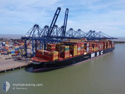
MSC RAYA
Cargo
Current Trip
LAEM CHABANG
| Time Travelled | 2 days |
|---|---|
| Remaining Time | --- |
| Distance Travelled | 562.01 nm |
| Remaining Distance | --- |
| AVG Speed | 15 Knots |
| MAX Speed | 18.4 Knots |
| AVG Wind | 25.6 knots |
| MAX Wind | 30 knots |
| MIN Temp | 10.5°C / 50.9°F |
| MAX Temp | 17.3°C / 63.14°F |
| Draught | 13 m |
| Position Received | 20 d ago |
Current Position
| Longitude | --- |
|---|---|
| Latitude | --- |
| Status | Under way using engine |
| Speed | 16.2 Knots |
| Course | 84.7° |
| Area | Singapore Strait |
| Station | T-AIS |
| Position Received | 20 d ago |
Info
Information
The current position of MSC RAYA is in Singapore Strait with coordinates 1.28405° / 104.29125° as reported on 2024-11-23 09:08 by AIS to our vessel tracker app. The vessel's current speed is 16.2 Knots
The vessel MSC RAYA (IMO: 9930052, MMSI: 636022103) is a Cargo It's sailing under the flag of [LR] Liberia.
In this page you can find informations about the vessels current position, last detected port calls, and current voyage information. If the vessels is not in coverage by AIS you will find the latest position.
The current position of MSC RAYA is detected by our AIS receivers and we are not responsible for the reliability of the data. The last position was recorded while the vessel was in Coverage by the Ais receivers of our vessel tracking app.
The current draught of MSC RAYA as reported by AIS is 13 meters
Weather
| Temperature | 18.2°C / 64.76°F |
|---|---|
| Wind Speed | 9 knots |
| Direction | 109° ESE |
| Pressure | 1019.1 hPa |
| Humidity | 70.8 % |
| Cloud Coverage | 57 % |
Featured Company
Last Port Calls
| Port | Arrival | Departure | Time In Port |
|---|---|---|---|
| 2024-12-10 08:19 | 2024-12-11 09:20 | 1 d | |
| 2024-11-26 11:00 | 2024-11-28 12:40 | 2 d | |
| 2024-11-20 09:11 | 2024-11-23 12:02 | 3 d | |
| 2024-10-19 02:07 | 2024-10-19 17:11 | 15 h | |
| 2024-10-17 00:32 | 2024-10-18 05:21 | 1 d | |
| 2024-10-05 09:21 | 2024-10-11 07:48 | 5 d | |
| 2024-10-02 09:36 | 2024-10-04 03:38 | 1 d | |
| 2024-10-01 17:20 |
Most Visited Ports (Last year)
| Port | Arrivals | |
|---|---|---|
| 4 | ||
| 3 | ||
| 3 | ||
| 3 | ||
| 3 | ||
| 3 |
Last Trips
| Origin | Departure | Destination | Arrival | Distance | |
|---|---|---|---|---|---|
| 2024-11-28 12:40 | 2024-12-10 08:19 | 2639.39 nm | |||
| 2024-11-23 12:02 | 2024-11-26 11:00 | 850.35 nm | |||
| 2024-10-19 17:11 | 2024-11-20 09:11 | 10790.09 nm | |||
| 2024-10-18 05:21 | 2024-10-19 02:07 | 91.23 nm | |||
| 2024-10-11 07:48 | 2024-10-17 00:32 | 1547.04 nm | |||
| 2024-10-04 03:38 | 2024-10-05 09:21 | 263.07 nm | |||
| 2024-10-01 17:20 | 2024-10-02 09:36 | 289.65 nm |
Events
| Time | Event | Details | Position / Dest | Info |
|---|---|---|---|---|
| 2024-12-12 14:51 | STOP Moving | 1.94 nm, North West of ZHANGZHOU |
24.44110 / 118.03424
LAEM CHABANG
|
Speed: Course: 272° |
| 2024-12-11 01:36 | START Moving | 2.89 nm, West of YANGSHAN |
30.60498 / 122.07873
LAEM CHABANG
|
Speed: 4.2 kn Course: 115° |
| 2024-12-11 01:20 | PORT DEPARTURE |
|
30.61182 / 122.07378
LAEM CHABANG
|
Speed: 0.6 kn Course: 302° |
| 2024-12-10 00:19 | PORT ARRIVAL |
|
30.61279 / 122.07501
[CN] YANGSHAN
|
Speed: Course: 306° |
| 2024-12-09 11:53 | STOP Moving | 3.1 nm, West of YANGSHAN |
30.61268 / 122.07487
LAEM CHABANG
|
Speed: 0.2 kn Course: 306° |
| 2024-12-09 00:54 | START Moving |
30.35380 / 123.21171
LAEM CHABANG
|
Speed: 3.7 kn Course: 348° |
|
| 2024-12-08 21:27 | STOP Moving |
30.37231 / 123.22150
LAEM CHABANG
|
Speed: Course: 308° |
|
| 2024-12-08 21:03 | START Moving |
30.36292 / 123.23463
LAEM CHABANG
|
Speed: 3.2 kn Course: 330° |
|
| 2024-12-08 18:39 | STOP Moving |
30.37852 / 123.23071
LAEM CHABANG
|
Speed: Course: 25° |
|
| 2024-12-08 17:57 | START Moving |
30.35745 / 123.21915
LAEM CHABANG
|
Speed: 3.6 kn Course: 31° |