
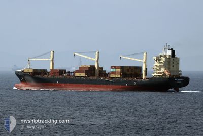
MSC NAISHA III
Container Ship
Current Trip
| Time Travelled | 21 h, 41 mins |
|---|---|
| Remaining Time | 11 h, 3 mins |
| Distance Travelled | 330.68 nm |
| Remaining Distance | 192.10 nm |
| AVG Speed | 16.8 Knots |
| MAX Speed | 16.8 Knots |
| AVG Wind | 9 knots |
| MAX Wind | 14 knots |
| MIN Temp | 1.7°C / 35.06°F |
| MAX Temp | 3.7°C / 38.66°F |
| Draught | 10.4 m |
| Position Received | Now |
Current Position
| Longitude | --- |
|---|---|
| Latitude | --- |
| Status | Under way using engine |
| Speed | 16.9 Knots |
| Course | 302.4° |
| Area | Baltic Sea |
| Station | T-AIS |
| Position Received | Now |
Info
Information
The current position of MSC NAISHA III is in Baltic Sea with coordinates 54.64372° / 10.87481° as reported on 2025-03-14 01:19 by AIS to our vessel tracker app. The vessel's current speed is 16.9 Knots and is heading at the port of BREMERHAVEN. The estimated time of arrival as calculated by MyShipTracking vessel tracking app is 2025-03-14 13:23 LT
The vessel MSC NAISHA III (IMO: 9307839, MMSI: 636021061) is a Container Ship that was built in 2005 ( 20 years old ). It's sailing under the flag of [LR] Liberia.
In this page you can find informations about the vessels current position, last detected port calls, and current voyage information. If the vessels is not in coverage by AIS you will find the latest position.
The current position of MSC NAISHA III is detected by our AIS receivers and we are not responsible for the reliability of the data. The last position was recorded while the vessel was in Coverage by the Ais receivers of our vessel tracking app.
The current draught of MSC NAISHA III as reported by AIS is 10.4 meters
Weather
| Temperature | 3.2°C / 37.76°F |
|---|---|
| Wind Speed | 9 knots |
| Direction | 358° N |
| Pressure | 1001.1 hPa |
| Humidity | 82.8 % |
| Cloud Coverage | 100 % |
Featured Company
Last Port Calls
| Port | Arrival | Departure | Time In Port |
|---|---|---|---|
| 2025-03-11 15:31 | 2025-03-13 04:39 | 1 d | |
| 2025-03-09 10:00 | 2025-03-10 06:14 | 20 h | |
| 2025-03-05 07:05 | 2025-03-08 01:21 | 2 d | |
| 2025-02-27 04:26 | 2025-02-28 08:18 | 1 d | |
| 2025-02-25 04:58 | 2025-02-26 03:46 | 22 h | |
| 2025-02-20 14:58 | 2025-02-21 21:37 | 1 d | |
| 2025-02-19 05:24 | 2025-02-19 22:32 | 17 h | |
| 2025-02-13 01:56 | 2025-02-14 11:32 | 1 d | |
| 2025-02-09 00:24 | 2025-02-09 10:35 | 10 h | |
| 2025-02-06 13:53 | 2025-02-07 23:21 | 1 d |
Last Trips
| Origin | Departure | Destination | Arrival | Distance | |
|---|---|---|---|---|---|
| 2025-03-10 06:14 | 2025-03-11 15:31 | 193.00 nm | |||
| 2025-03-08 01:21 | 2025-03-09 10:00 | 502.11 nm | |||
| 2025-02-28 08:18 | 2025-03-05 07:05 | 1543.06 nm | |||
| 2025-02-26 03:46 | 2025-02-27 04:26 | 381.46 nm | |||
| 2025-02-21 21:37 | 2025-02-25 04:58 | 1164.70 nm | |||
| 2025-02-19 22:32 | 2025-02-20 14:58 | 282.65 nm | |||
| 2025-02-14 11:32 | 2025-02-19 05:24 | 1286.39 nm | |||
| 2025-02-09 10:35 | 2025-02-13 01:56 | 1162.41 nm | |||
| 2025-02-07 23:21 | 2025-02-09 00:24 | 371.01 nm | |||
| 2025-02-04 21:34 | 2025-02-06 13:53 | 327.23 nm |
Events
| Time | Event | Details | Position / Dest | Info |
|---|---|---|---|---|
| 2025-03-14 01:16 | Change Sea Area | Danish part of the Baltic Sea German part of the Baltic Sea |
54.63617 / 10.89558
Baltic Sea
DEBRV
|
Speed: 16.9 kn Course: 302.6° |
| 2025-03-14 00:34 | Change Sea Area | German part of the Baltic Sea Danish part of the Baltic Sea |
54.60104 / 11.22246
Baltic Sea
DEBRV
|
Speed: 17.5 kn Course: 298.8° |
| 2025-03-14 00:25 | Change Sea Area | Danish part of the Baltic Sea German part of the Baltic Sea |
54.57992 / 11.28828
Baltic Sea
DEBRV
|
Speed: 17.4 kn Course: 298.4° |
| 2025-03-14 00:22 | Change Sea Area | German part of the Baltic Sea Danish part of the Baltic Sea |
54.57294 / 11.31017
Baltic Sea
DEBRV
|
Speed: 17.3 kn Course: 299° |
| 2025-03-13 22:37 | Change Sea Area | Danish part of the Baltic Sea German part of the Baltic Sea |
54.43746 / 12.12910
Baltic Sea
DEBRV
|
Speed: 17.6 kn Course: 264.1° |
| 2025-03-13 22:22 | Change Sea Area | German part of the Baltic Sea Danish part of the Baltic Sea |
54.48817 / 12.20729
Baltic Sea
DEBRV
|
Speed: 17.9 kn Course: 194.5° |
| 2025-03-13 21:40 | Change Sea Area | Danish part of the Baltic Sea German part of the Baltic Sea |
54.64710 / 12.38920
Baltic Sea
DEBRV
|
Speed: 17 kn Course: 237.1° |
| 2025-03-13 21:13 | Change Sea Area | German part of the Baltic Sea Danish part of the Baltic Sea |
54.71975 / 12.57516
Baltic Sea
DEBRV
|
Speed: 17.2 kn Course: 234.1° |
| 2025-03-13 20:31 | Change Sea Area | Danish part of the Baltic Sea German part of the Baltic Sea |
54.81354 / 12.87676
Baltic Sea
DEBRV
|
Speed: 16.8 kn Course: 249.4° |
| 2025-03-13 17:04 | Change Sea Area | German part of the Baltic Sea Danish part of the Kattegat |
54.62842 / 14.44300
Baltic Sea
DEBRV
|
Speed: 17.1 kn Course: 261.7° |