
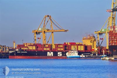
MSC NAHARA
Cargo A
Current Trip
| Time Travelled | 3 days |
|---|---|
| Remaining Time | 5 days |
| Distance Travelled | 1254.16 nm |
| Remaining Distance | 2121.65 nm |
| AVG Speed | 14.5 Knots |
| MAX Speed | 17.7 Knots |
| AVG Wind | 15.8 knots |
| MAX Wind | 25 knots |
| MIN Temp | 9.7°C / 49.46°F |
| MAX Temp | 14.3°C / 57.74°F |
| Draught | 11 m |
| Position Received | 3 d ago |
Current Position
| Longitude | --- |
|---|---|
| Latitude | --- |
| Status | Under way using engine |
| Speed | 13.5 Knots |
| Course | 304.6° |
| Area | English Channel |
| Station | T-AIS |
| Position Received | 3 d ago |
Info
Information
The current position of MSC NAHARA is in English Channel with coordinates 49.92010° / -1.16791° as reported on 2025-12-21 00:06 by AIS to our vessel tracker app. The vessel's current speed is 13.5 Knots and is heading at the port of MONTREAL. The estimated time of arrival as calculated by MyShipTracking vessel tracking app is 2025-12-29 04:17 LT
The vessel MSC NAHARA (IMO: 9955789, MMSI: 636023312) is a Cargo A It's sailing under the flag of [LR] Liberia.
In this page you can find informations about the vessels current position, last detected port calls, and current voyage information. If the vessels is not in coverage by AIS you will find the latest position.
The current position of MSC NAHARA is detected by our AIS receivers and we are not responsible for the reliability of the data. The last position was recorded while the vessel was in Coverage by the Ais receivers of our vessel tracking app.
The current draught of MSC NAHARA as reported by AIS is 11 meters
Weather
| Temperature | 14.3°C / 57.74°F |
|---|---|
| Wind Speed | 19 knots |
| Direction | 151° SSE |
| Pressure | 1023.4 hPa |
| Humidity | 82.5 % |
| Cloud Coverage | 52 % |
Featured Company
Last Port Calls
| Port | Arrival | Departure | Time In Port |
|---|---|---|---|
| 2025-12-19 20:58 | 2025-12-20 20:16 | 23 h | |
| 2025-12-17 13:41 | 2025-12-18 23:56 | 1 d | |
| 2025-12-10 05:58 | 2025-12-11 19:37 | 1 d | |
| 2025-12-05 18:08 | 2025-12-08 10:53 | 2 d | |
| 2025-11-29 08:31 | 2025-12-01 01:18 | 1 d | |
| 2025-11-22 19:05 | 2025-11-27 13:45 | 4 d | |
| 2025-11-17 23:56 | 2025-11-20 05:12 | 2 d | |
| 2025-11-13 03:58 | 2025-11-15 00:20 | 1 d | |
| 2025-10-28 09:06 | 2025-10-29 18:18 | 1 d | |
| 2025-10-26 12:28 | 2025-10-27 07:16 | 18 h |
Last Trips
| Origin | Departure | Destination | Arrival | Distance | |
|---|---|---|---|---|---|
| 2025-12-18 23:56 | 2025-12-19 20:58 | 260.67 nm | |||
| 2025-12-11 19:37 | 2025-12-17 13:41 | 2065.52 nm | |||
| 2025-12-08 10:53 | 2025-12-10 05:58 | 491.71 nm | |||
| 2025-12-01 01:18 | 2025-12-05 18:08 | 1910.90 nm | |||
| 2025-11-27 13:45 | 2025-11-29 08:31 | 636.07 nm | |||
| 2025-11-20 05:12 | 2025-11-22 19:05 | 161.53 nm | |||
| 2025-11-15 00:20 | 2025-11-17 23:56 | 12.31 nm | |||
| 2025-10-29 18:18 | 2025-11-13 03:58 | 5158.35 nm | |||
| 2025-10-27 07:16 | 2025-10-28 09:06 | 382.40 nm | |||
| 2025-10-24 16:34 | 2025-10-26 12:28 | 683.45 nm |
Events
| Time | Event | Details | Position / Dest | Info |
|---|---|---|---|---|
| 2025-12-21 00:12 | Status Changed | Default Under way using engine |
49.93302 / -1.19801
CAMTR
|
Speed: 13.5 kn Course: 304.6° |
| 2025-12-21 00:06 | OUT of Coverage |
49.92010 / -1.16791
English Channel
CAMTR
|
Speed: 13.5 kn Course: 304.6° |
|
| 2025-12-20 22:21 | ETA Changed | 2025/12/29 23:30 2025/12/19 18:30 |
49.71699 / -.70672
CAMTR
|
Speed: 11.6 kn Course: 305.5° |
| 2025-12-20 19:30 | Status Changed | Under way using engine Moored |
49.49304 / .04474
CAMTR
|
Speed: 12 kn Course: 286° |
| 2025-12-20 19:16 | PORT DEPARTURE |
|
49.47255 / .09476
CAMTR
|
Speed: 9.4 kn Course: 320° |
| 2025-12-20 18:58 | START Moving |
49.46037 / .13678
[FR] LE HAVRE
|
Speed: 3.1 kn Course: 274° |
|
| 2025-12-20 17:03 | Draught Changed | 11 9.3 |
49.46084 / .14205
[FR] LE HAVRE
|
Speed: Course: 282° |
| 2025-12-20 16:57 | Destination Changed | CAMTR BEANR>FRLEH |
49.46092 / .14211
[FR] LE HAVRE
|
Speed: Course: 282° |
| 2025-12-20 16:57 | Status Changed | Moored Default |
49.46092 / .14211
[FR] LE HAVRE
|
Speed: Course: 282° |
| 2025-12-20 16:54 | Status Changed | Default Moored |
49.46081 / .14208
[FR] LE HAVRE
|
Speed: Course: 282° |