
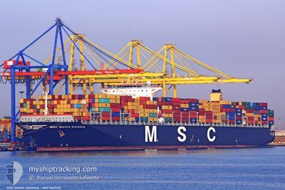
MSC MARIA SAVERIA
Container Ship
Current Trip
| Time Travelled | 5 days |
|---|---|
| Remaining Time | --- |
| Distance Travelled | 735.13 nm |
| Remaining Distance | 725.30 nm |
| AVG Speed | 10.5 Knots |
| MAX Speed | 16.5 Knots |
| AVG Wind | 17.2 knots |
| MAX Wind | 27 knots |
| MIN Temp | 6.1°C / 42.98°F |
| MAX Temp | 12.1°C / 53.78°F |
| Draught | 11.2 m |
| Position Received | 22 d ago |
Current Position
| Longitude | --- |
|---|---|
| Latitude | --- |
| Status | Under way using engine |
| Speed | 17.6 Knots |
| Course | 47° |
| Area | South China Sea |
| Station | T-AIS |
| Position Received | 22 d ago |
Info
Information
The current position of MSC MARIA SAVERIA is in South China Sea with coordinates 1.35526° / 104.41291° as reported on 2024-11-23 14:05 by AIS to our vessel tracker app. The vessel's current speed is 17.6 Knots and is heading at the port of TIANJIN.
The vessel MSC MARIA SAVERIA (IMO: 9467421, MMSI: 372400000) is a Container Ship that was built in 2011 ( 13 years old ). It's sailing under the flag of [PA] Panama.
In this page you can find informations about the vessels current position, last detected port calls, and current voyage information. If the vessels is not in coverage by AIS you will find the latest position.
The current position of MSC MARIA SAVERIA is detected by our AIS receivers and we are not responsible for the reliability of the data. The last position was recorded while the vessel was in Coverage by the Ais receivers of our vessel tracking app.
The current draught of MSC MARIA SAVERIA as reported by AIS is 11.2 meters
Weather
| Temperature | 10.2°C / 50.36°F |
|---|---|
| Wind Speed | 15 knots |
| Direction | 331° NNW |
| Pressure | 1027.4 hPa |
| Humidity | 49.9 % |
| Cloud Coverage | 20 % |
Featured Company
Last Port Calls
| Port | Arrival | Departure | Time In Port |
|---|---|---|---|
| 2024-12-09 21:13 | 2024-12-10 14:24 | 17 h | |
| 2024-12-03 03:40 | 2024-12-05 13:44 | 2 d | |
| 2024-11-17 15:38 | 2024-11-18 17:34 | 1 d | |
| 2024-11-13 10:10 | 2024-11-13 22:46 | 12 h | |
| 2024-11-10 17:18 | 2024-11-12 07:34 | 1 d | |
| 2024-10-19 17:09 | 2024-10-20 19:25 | 1 d | |
| 2024-10-15 11:55 | 2024-10-16 11:55 | 23 h | |
| 2024-10-05 01:32 | 2024-10-05 17:38 | 16 h | |
| 2024-10-01 17:29 | 2024-10-03 09:59 | 1 d |
Most Visited Ports (Last year)
| Port | Arrivals | |
|---|---|---|
| 3 | ||
| 3 | ||
| 3 | ||
| 3 | ||
| 3 | ||
| 2 |
Last Trips
| Origin | Departure | Destination | Arrival | Distance | |
|---|---|---|---|---|---|
| 2024-12-05 13:44 | 2024-12-09 21:13 | 1133.47 nm | |||
| 2024-11-18 17:34 | 2024-12-03 03:40 | 4534.42 nm | |||
| 2024-11-13 22:46 | 2024-11-17 15:38 | 930.26 nm | |||
| 2024-11-12 07:34 | 2024-11-13 10:10 | 423.11 nm | |||
| 2024-10-20 19:25 | 2024-11-10 17:18 | 7990.77 nm | |||
| 2024-10-16 11:55 | 2024-10-19 17:09 | 418.75 nm | |||
| 2024-10-05 17:38 | 2024-10-15 11:55 | 3739.39 nm | |||
| 2024-10-03 09:59 | 2024-10-05 01:32 | 212.47 nm | |||
| 2024-09-29 23:03 | 2024-10-01 17:29 | 626.35 nm |
Events
| Time | Event | Details | Position / Dest | Info |
|---|---|---|---|---|
| 2024-12-15 01:26 | STOP Moving |
29.46599 / 122.64797
CNTXG
|
Speed: 0.2 kn Course: 55° |
|
| 2024-12-14 13:39 | START Moving | 6.15 nm, West of YANGSHAN |
30.64603 / 122.02445
CNTXG
|
Speed: 5.5 kn Course: 152° |
| 2024-12-13 23:27 | STOP Moving | 6.54 nm, North West of YANGSHAN |
30.65308 / 122.01988
CNTXG
|
Speed: Course: 106° |
| 2024-12-13 05:39 | START Moving |
31.95024 / 124.17262
CNTXG
|
Speed: 3.2 kn Course: 44° |
|
| 2024-12-13 01:03 | STOP Moving |
32.03935 / 124.08579
CNTXG
|
Speed: Course: 64° |
|
| 2024-12-12 20:56 | START Moving |
31.83800 / 124.10969
CNTXG
|
Speed: 3.1 kn Course: 19° |
|
| 2024-12-12 12:49 | STOP Moving |
32.02217 / 124.09816
CNTXG
|
Speed: 0.3 kn Course: 54° |
|
| 2024-12-12 10:02 | START Moving |
31.79903 / 124.12015
CNTXG
|
Speed: 3.7 kn Course: 333° |
|
| 2024-12-12 09:06 | STOP Moving |
31.80333 / 124.13666
CNTXG
|
Speed: Course: -1° |
|
| 2024-12-11 19:12 | START Moving |
31.94408 / 123.91868
CNTXG
|
Speed: 3.1 kn Course: 54° |