
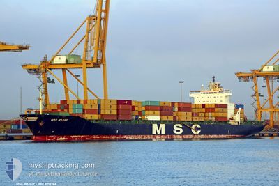
MSC MANDY III
Container Ship
Current Trip
AO LAD>NA WVB
| Time Travelled | 3 days |
|---|---|
| Remaining Time | --- |
| Distance Travelled | 1155.39 nm |
| Remaining Distance | --- |
| AVG Speed | 14.2 Knots |
| MAX Speed | 16 Knots |
| AVG Wind | 15.9 knots |
| MAX Wind | 30.1 knots |
| MIN Temp | 15.9°C / 60.62°F |
| MAX Temp | 24.1°C / 75.38°F |
| Draught | 8.6 m |
| Position Received | 1 d ago |
Current Position
| Longitude | --- |
|---|---|
| Latitude | --- |
| Status | Under way using engine |
| Speed | 15 Knots |
| Course | 114.2° |
| Area | South Atlantic Ocean |
| Station | T-AIS |
| Position Received | 1 d ago |
Info
Information
The current position of MSC MANDY III is in South Atlantic Ocean with coordinates -34.72686° / 19.11610° as reported on 2025-03-02 16:50 by AIS to our vessel tracker app. The vessel's current speed is 15 Knots
The vessel MSC MANDY III (IMO: 8918966, MMSI: 354537000) is a Container Ship that was built in 1993 ( 32 years old ). It's sailing under the flag of [PA] Panama.
In this page you can find informations about the vessels current position, last detected port calls, and current voyage information. If the vessels is not in coverage by AIS you will find the latest position.
The current position of MSC MANDY III is detected by our AIS receivers and we are not responsible for the reliability of the data. The last position was recorded while the vessel was in Coverage by the Ais receivers of our vessel tracking app.
The current draught of MSC MANDY III as reported by AIS is 8.6 meters
Weather
| Temperature | 23°C / 73.4°F |
|---|---|
| Wind Speed | 10 knots |
| Direction | 47° NE |
| Pressure | 1006.6 hPa |
| Humidity | 86.7 % |
| Cloud Coverage | 100 % |
Featured Company
Last Port Calls
| Port | Arrival | Departure | Time In Port |
|---|---|---|---|
| 2025-02-27 04:08 | 2025-02-28 13:24 | 1 d | |
| 2025-02-22 01:16 | 2025-02-23 12:27 | 1 d | |
| 2025-02-20 07:28 | 2025-02-21 08:20 | 1 d | |
| 2025-02-15 01:57 | 2025-02-16 11:17 | 1 d | |
| 2025-02-11 06:40 | 2025-02-12 07:21 | 1 d | |
| 2025-02-09 08:35 | 2025-02-09 22:43 | 14 h | |
| 2025-02-03 12:33 | 2025-02-04 10:24 | 21 h | |
| 2025-01-31 21:20 | 2025-02-02 06:22 | 1 d | |
| 2025-01-26 21:17 | 2025-01-28 12:20 | 1 d | |
| 2025-01-21 12:25 | 2025-01-22 16:30 | 1 d |
Most Visited Ports (Last year)
| Port | Arrivals | |
|---|---|---|
| 20 | ||
| 17 | ||
| 3 | ||
| 3 | ||
| 2 | ||
| 2 |
Last Trips
| Origin | Departure | Destination | Arrival | Distance | |
|---|---|---|---|---|---|
| 2025-02-23 12:27 | 2025-02-27 04:08 | 941.89 nm | |||
| 2025-02-21 08:20 | 2025-02-22 01:16 | 301.25 nm | |||
| 2025-02-16 11:17 | 2025-02-20 07:28 | 1003.39 nm | |||
| 2025-02-12 07:21 | 2025-02-15 01:57 | 1155.64 nm | |||
| 2025-02-09 22:43 | 2025-02-11 06:40 | 482.65 nm | |||
| 2025-02-04 10:24 | 2025-02-09 08:35 | 876.06 nm | |||
| 2025-02-02 06:22 | 2025-02-03 12:33 | 538.37 nm | |||
| 2025-01-28 12:20 | 2025-01-31 21:20 | 559.05 nm | |||
| 2025-01-22 16:30 | 2025-01-26 21:17 | 1255.15 nm | |||
| 2025-01-20 11:30 | 2025-01-21 12:25 | 166.33 nm |
Events
| Time | Event | Details | Position / Dest | Info |
|---|---|---|---|---|
| 2025-03-04 01:04 | START Moving | 15.99 nm, South East of PORT ELIZABETH |
-34.08498 / 25.92214
AO LAD>NA WVB
|
Speed: 5.6 kn Course: 136° |
| 2025-03-04 00:49 | STOP Moving | 15.74 nm, South East of PORT ELIZABETH |
-34.08107 / 25.91893
AO LAD>NA WVB
|
Speed: 0.3 kn Course: 109° |
| 2025-03-03 23:52 | START Moving | 11.13 nm, South East of PORT ELIZABETH |
-34.04024 / 25.84035
AO LAD>NA WVB
|
Speed: 5 kn Course: 107° |
| 2025-03-03 21:13 | STOP Moving | 13.51 nm, South East of PORT ELIZABETH |
-34.05019 / 25.88765
AO LAD>NA WVB
|
Speed: 0.3 kn Course: 68° |
| 2025-03-03 18:00 | START Moving | 11.06 nm, South East of PORT ELIZABETH |
-34.06368 / 25.82120
AO LAD>NA WVB
|
Speed: 3.3 kn Course: 9° |
| 2025-03-03 17:08 | STOP Moving | 12.57 nm, South East of PORT ELIZABETH |
-34.05775 / 25.86184
AO LAD>NA WVB
|
Speed: 0.2 kn Course: 75° |
| 2025-03-02 16:56 | Status Changed | Default Under way using engine |
-34.73626 / 19.14110
AO LAD>NA WVB
|
Speed: 15 kn Course: 114.2° |
| 2025-03-02 16:50 | Status Changed | Under way using engine Default |
-34.72686 / 19.11610
AO LAD>NA WVB
|
Speed: 15 kn Course: 114° |
| 2025-03-02 16:50 | OUT of Coverage |
-34.72686 / 19.11610
South Atlantic Ocean
|
Speed: 15 kn Course: 114.2° |
|
| 2025-03-02 16:43 | IN Coverage |
-34.72686 / 19.11610
South Atlantic Ocean
AO LAD>NA WVB
|
Speed: 15 kn Course: 114.2° |