
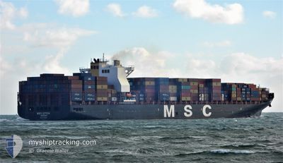
MSC LETIZIA
Cargo A
Current Trip
| Time Travelled | 1 day |
|---|---|
| Remaining Time | 10 days |
| Distance Travelled | 723.31 nm |
| Remaining Distance | 4082.97 nm |
| AVG Speed | 15 Knots |
| MAX Speed | 17 Knots |
| AVG Wind | 7.6 knots |
| MAX Wind | 14.3 knots |
| MIN Temp | 10.7°C / 51.26°F |
| MAX Temp | 17°C / 62.6°F |
| Draught | 14 m |
| Position Received | Now |
Current Position
| Longitude | 141.14577° |
|---|---|
| Latitude | 41.61089° |
| Status | Under way using engine |
| Speed | 15.9 Knots |
| Course | 88.9° |
| Area | Japan Sea |
| Station | T-AIS |
| Position Received | Now |
Info
Information
The current position of MSC LETIZIA is in Japan Sea with coordinates 41.61089° / 141.14577° as reported on 2024-04-27 20:14 by AIS to our vessel tracker app. The vessel's current speed is 15.9 Knots and is heading at the port of VANCOUVER. The estimated time of arrival as calculated by MyShipTracking vessel tracking app is 2024-05-08 18:00 LT
The vessel MSC LETIZIA (IMO: 9702065, MMSI: 255806490) is a Cargo A It's sailing under the flag of [PT] Portugal.
In this page you can find informations about the vessels current position, last detected port calls, and current voyage information. If the vessels is not in coverage by AIS you will find the latest position.
The current position of MSC LETIZIA is detected by our AIS receivers and we are not responsible for the reliability of the data. The last position was recorded while the vessel was in Coverage by the Ais receivers of our vessel tracking app.
The current draught of MSC LETIZIA as reported by AIS is 14 meters
Weather
| Temperature | 11.1°C / 51.98°F |
|---|---|
| Wind Speed | 8 knots |
| Direction | 278° W |
| Pressure | 1012 hPa |
| Humidity | 74.5 % |
| Cloud Coverage | --- |
Featured Company
Last Port Calls
| Port | Arrival | Departure | Time In Port |
|---|---|---|---|
| 2024-04-24 08:20 | 2024-04-25 21:50 | 1 d | |
| 2024-04-20 09:52 | 2024-04-21 06:48 | 20 h | |
| 2024-04-10 19:57 | 2024-04-11 10:49 | 14 h | |
| 2024-04-07 02:49 | 2024-04-08 01:38 | 22 h | |
| 2024-04-03 21:43 | 2024-04-04 06:23 | 8 h | |
| 2024-03-16 07:04 | 2024-03-23 15:47 | 7 d | |
| 2024-03-04 21:32 | 2024-03-07 21:21 | 2 d | |
| 2024-02-20 07:54 | 2024-02-20 20:39 | 12 h | |
| 2024-02-16 23:34 | 2024-02-17 21:35 | 22 h | |
| 2024-02-11 13:29 | 2024-02-12 13:43 | 1 d |
Most Visited Ports (Last year)
| Port | Arrivals | |
|---|---|---|
| 8 | ||
| 7 | ||
| 6 | ||
| 5 | ||
| 4 | ||
| 4 |
Last Trips
| Origin | Departure | Destination | Arrival | Distance | |
|---|---|---|---|---|---|
| 2024-04-21 14:48 | 2024-04-24 17:20 | 542.38 nm | |||
| 2024-04-11 18:49 | 2024-04-20 17:52 | 1317.11 nm | |||
| 2024-04-08 10:38 | 2024-04-11 03:57 | 1168.86 nm | |||
| 2024-04-04 15:23 | 2024-04-07 11:49 | 924.21 nm | |||
| 2024-03-23 08:47 | 2024-04-04 06:43 | 4573.64 nm | |||
| 2024-03-07 13:21 | 2024-03-16 00:04 | 1381.57 nm | |||
| 2024-02-21 05:39 | 2024-03-04 13:32 | 4202.08 nm | |||
| 2024-02-18 06:35 | 2024-02-20 16:54 | 905.65 nm | |||
| 2024-02-12 21:43 | 2024-02-17 08:34 | 757.69 nm | |||
| 2024-02-01 18:45 | 2024-02-11 21:29 | 1256.35 nm |
Events
| Time | Event | Details | Position / Dest | Info |
|---|---|---|---|---|
| 2024-04-27 20:07 | Status Changed | Under way using engine Default |
41.61031 / 141.10640
CAVAN
|
Speed: 15.3 kn Course: 94° |
| 2024-04-27 19:48 | Status Changed | Default Under way using engine |
41.61281 / 140.99815
CAVAN
|
Speed: 15.7 kn Course: 96.4° |
| 2024-04-27 19:40 | Status Changed | Under way using engine Default |
41.61664 / 140.95015
CAVAN
|
Speed: 15.2 kn Course: 93° |
| 2024-04-27 19:28 | Status Changed | Default Under way using engine |
41.61858 / 140.87929
CAVAN
|
Speed: 15.1 kn Course: 62.8° |
| 2024-04-27 19:20 | Status Changed | Under way using engine Default |
41.60245 / 140.84268
CAVAN
|
Speed: 15 kn Course: 54° |
| 2024-04-27 19:01 | Status Changed | Default Under way using engine |
41.55368 / 140.75708
CAVAN
|
Speed: 15.5 kn Course: 45.6° |
| 2024-04-27 17:37 | Status Changed | Under way using engine Default |
41.34139 / 140.33294
CAVAN
|
Speed: 16.1 kn Course: 56° |
| 2024-04-27 17:32 | Status Changed | Default Under way using engine |
41.33096 / 140.31189
CAVAN
|
Speed: 15.8 kn Course: 56° |
| 2024-04-27 17:22 | Status Changed | Under way using engine Default |
41.30655 / 140.26317
CAVAN
|
Speed: 15.9 kn Course: 56° |
| 2024-04-27 16:40 | Status Changed | Default Under way using engine |
41.19433 / 140.04866
CAVAN
|
Speed: 15.8 kn Course: 54.9° |