
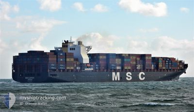
MSC LETIZIA
Cargo A
Current Trip
| Trip Time | 3 days |
|---|---|
| Trip Distance | 542.38 nm |
| AVG Speed | 8.2 Knop |
| MAX Speed | 11.7 Knop |
| Djupgående | 12 m |
| AVG Wind | 16.1 knots |
| MAX Wind | 28 knots |
| MIN Temp | 11.4°C / 52.52°F |
| MAX Temp | 17.2°C / 62.96°F |
| Position mottagen | 1 d sen |
Current Position
| Longitud | 128.81286° |
|---|---|
| Latitude | 34.98029° |
| Status | Under way using engine |
| Fart | 4.8 Knop |
| Kurs | 336° |
| Område | Japan Sea |
| Station | T-AIS |
| Position mottagen | 1 d sen |
Info
Information
The current position of MSC LETIZIA is in Japan Sea with coordinates 34.98029° / 128.81286° as reported on 2024-04-24 07:10 by AIS to our vessel tracker app. The vessel's current speed is 4.8 Knop and is currently inside the port of BUSAN NEW PORT.
The vessel MSC LETIZIA (IMO: 9702065, MMSI: 255806490) is a Cargo A It's sailing under the flag of [PT] Portugal.
In this page you can find informations about the vessels current position, last detected port calls, and current voyage information. If the vessels is not in coverage by AIS you will find the latest position.
The current position of MSC LETIZIA is detected by our AIS receivers and we are not responsible for the reliability of the data. The last position was recorded while the vessel was in Coverage by the Ais receivers of our vessel tracking app.
The current draught of MSC LETIZIA as reported by AIS is 12 meters
Weather
| Temperature | 17.5°C / 63.5°F |
|---|---|
| Wind Speed | 3 knots |
| Direction | 227° SW |
| Pressure | 1009.3 hPa |
| Humidity | 66.4 % |
| Cloud Coverage | 100 % |
Featured Company
Last Port Calls
| Port | Arrival | Departure | Time In Port |
|---|---|---|---|
| 2024-04-24 08:20 | |||
| 2024-04-20 09:52 | 2024-04-21 06:48 | 20 h | |
| 2024-04-10 19:57 | 2024-04-11 10:49 | 14 h | |
| 2024-04-07 02:49 | 2024-04-08 01:38 | 22 h | |
| 2024-04-03 21:43 | 2024-04-04 06:23 | 8 h | |
| 2024-03-16 07:04 | 2024-03-23 15:47 | 7 d | |
| 2024-03-04 21:32 | 2024-03-07 21:21 | 2 d | |
| 2024-02-20 07:54 | 2024-02-20 20:39 | 12 h | |
| 2024-02-16 23:34 | 2024-02-17 21:35 | 22 h | |
| 2024-02-11 13:29 | 2024-02-12 13:43 | 1 d |
Most Visited Ports (Last year)
| Port | Arrivals | |
|---|---|---|
| 8 | ||
| 7 | ||
| 6 | ||
| 5 | ||
| 4 | ||
| 4 |
Last Trips
| Origin | Departure | Destination | Arrival | Distance | |
|---|---|---|---|---|---|
| 2024-04-21 14:48 | 2024-04-24 17:20 | 542.38 nm | |||
| 2024-04-11 18:49 | 2024-04-20 17:52 | 1317.11 nm | |||
| 2024-04-08 10:38 | 2024-04-11 03:57 | 1168.86 nm | |||
| 2024-04-04 15:23 | 2024-04-07 11:49 | 924.21 nm | |||
| 2024-03-23 08:47 | 2024-04-04 06:43 | 4573.64 nm | |||
| 2024-03-07 13:21 | 2024-03-16 00:04 | 1381.57 nm | |||
| 2024-02-21 05:39 | 2024-03-04 13:32 | 4202.08 nm | |||
| 2024-02-18 06:35 | 2024-02-20 16:54 | 905.65 nm | |||
| 2024-02-12 21:43 | 2024-02-17 08:34 | 757.69 nm | |||
| 2024-02-01 18:45 | 2024-02-11 21:29 | 1256.35 nm |
Events
| Tid | Event | Detaljer | Position / Dest | Information |
|---|---|---|---|---|
| 2024-04-24 08:20 | STOPPAR förflyttning |
35.07745 / 128.82939
[KR] BUSAN NEW PORT
|
Fart: Kurs: 90° |
|
| 2024-04-24 08:20 | ANLÄNDER HAMN |
|
35.07745 / 128.82939
[KR] BUSAN NEW PORT
|
Fart: 0.7 kn Kurs: 88° |
| 2024-04-24 07:12 | Status ändrad | Default Under way using engine |
34.98267 / 128.81158
KRPUS
|
Fart: 4.8 kn Kurs: 336° |
| 2024-04-24 07:10 | UTANFÖR täckningsområde |
34.98029 / 128.81286
Japan Sea
KRPUS
|
Fart: 4.8 kn Kurs: 336.4° |
|
| 2024-04-24 04:25 | ETA ändrat | 2024/04/24 06:50 2024/04/24 06:00 |
34.65506 / 128.96240
KRPUS
|
Fart: 11.6 kn Kurs: 15.8° |
| 2024-04-24 04:02 | Status ändrad | Under way using engine Default |
34.58425 / 128.92960
KRPUS
|
Fart: 11.6 kn Kurs: 22° |
| 2024-04-24 04:00 | Status ändrad | Default Under way using engine |
34.58018 / 128.92757
KRPUS
|
Fart: 11.5 kn Kurs: 22.5° |
| 2024-04-24 03:53 | Status ändrad | Under way using engine Default |
34.55819 / 128.91671
KRPUS
|
Fart: 11.6 kn Kurs: 22° |
| 2024-04-24 03:40 | I täckningsområde |
34.56117 / 128.91819
Japan Sea
KRPUS
|
Fart: 11.5 kn Kurs: 22.5° |
|
| 2024-04-24 03:12 | STARTAR förflyttning | 19.71 nm, North West of NIRASAKI |
34.45094 / 128.86455
KRPUS
|
Fart: 3.5 kn Kurs: 342° |