
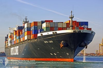
MSC LEO VI
Container Ship
Current Trip
| Time Travelled | 17 days |
|---|---|
| Remaining Time | --- |
| Distance Travelled | 6618.14 nm |
| Remaining Distance | --- |
| AVG Speed | 16 Knots |
| MAX Speed | 19.2 Knots |
| AVG Wind | 12.7 knots |
| MAX Wind | 27.5 knots |
| MIN Temp | 14.3°C / 57.74°F |
| MAX Temp | 29.3°C / 84.74°F |
| Draught | 13.9 m |
| Position Received | 5 d ago |
Current Position
| Longitude | 17.39868° |
|---|---|
| Latitude | -33.72749° |
| Status | Under way using engine |
| Speed | 15.4 Knots |
| Course | 316.9° |
| Area | South Atlantic Ocean |
| Station | T-AIS |
| Position Received | 5 d ago |
Info
Information
The current position of MSC LEO VI is in South Atlantic Ocean with coordinates -33.72749° / 17.39868° as reported on 2024-06-01 05:03 by AIS to our vessel tracker app. The vessel's current speed is 15.4 Knots and is heading at the port of SINES. The estimated time of arrival as calculated by MyShipTracking vessel tracking app is 2024-06-14 23:59 LT
The vessel MSC LEO VI (IMO: 9229312, MMSI: 636017306) is a Container Ship that was built in 2002 ( 22 years old ). It's sailing under the flag of [LR] Liberia.
In this page you can find informations about the vessels current position, last detected port calls, and current voyage information. If the vessels is not in coverage by AIS you will find the latest position.
The current position of MSC LEO VI is detected by our AIS receivers and we are not responsible for the reliability of the data. The last position was recorded while the vessel was in Coverage by the Ais receivers of our vessel tracking app.
The current draught of MSC LEO VI as reported by AIS is 13.9 meters
Weather
| Temperature | 25.5°C / 77.9°F |
|---|---|
| Wind Speed | 17 knots |
| Direction | 141° SE |
| Pressure | 1016.7 hPa |
| Humidity | 72.6 % |
| Cloud Coverage | 91 % |
Featured Company
Most Visited Ports (Last year)
| Port | Arrivals | |
|---|---|---|
| 4 | ||
| 4 | ||
| 3 | ||
| 3 | ||
| 2 | ||
| 2 |
Last Trips
| Origin | Departure | Destination | Arrival | Distance | |
|---|---|---|---|---|---|
| 2024-05-03 20:50 | 2024-05-17 03:06 | 4737.82 nm | |||
| 2024-04-23 07:31 | 2024-04-28 12:07 | 1037.65 nm | |||
| 2024-04-09 07:29 | 2024-04-19 12:13 | 3256.93 nm | |||
| 2024-04-03 21:11 | 2024-04-07 13:33 | 405.60 nm | |||
| 2024-03-09 22:18 | 2024-04-03 10:03 | 7200.74 nm |
Events
| Time | Event | Details | Position / Dest | Info |
|---|---|---|---|---|
| 2024-06-01 05:06 | Status Changed | Default Under way using engine |
-33.71960 / 17.38996
PTSIE
|
Speed: 15.4 kn Course: 316.9° |
| 2024-06-01 05:03 | OUT of Coverage |
-33.72749 / 17.39868
South Atlantic Ocean
PTSIE
|
Speed: 15.4 kn Course: 316.9° |
|
| 2024-06-01 04:56 | Status Changed | Under way using engine Default |
-33.74958 / 17.42327
PTSIE
|
Speed: 15.6 kn Course: 317° |
| 2024-06-01 04:44 | Status Changed | Default Under way using engine |
-33.79059 / 17.46850
PTSIE
|
Speed: 15.7 kn Course: 321.2° |
| 2024-06-01 04:01 | Status Changed | Under way using engine Default |
-33.93983 / 17.59422
PTSIE
|
Speed: 16.1 kn Course: 317° |
| 2024-06-01 03:56 | Status Changed | Default Under way using engine |
-33.95721 / 17.61241
PTSIE
|
Speed: 16.2 kn Course: 317.7° |
| 2024-06-01 03:41 | Status Changed | Under way using engine Default |
-34.00974 / 17.66750
PTSIE
|
Speed: 16.3 kn Course: 321° |
| 2024-06-01 03:16 | Status Changed | Default Under way using engine |
-34.09730 / 17.74911
PTSIE
|
Speed: 16.2 kn Course: 325.7° |
| 2024-05-31 23:46 | Status Changed | Under way using engine Default |
-34.71017 / 18.59679
PTSIE
|
Speed: 16.3 kn Course: 289° |
| 2024-05-31 23:28 | Status Changed | Default Under way using engine |
-34.73642 / 18.68513
PTSIE
|
Speed: 16.1 kn Course: 292.7° |