
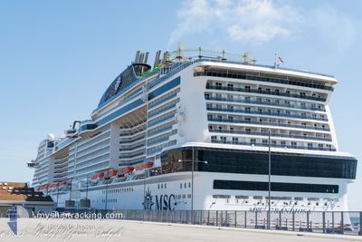
MSC GRANDIOSA
Passenger
Current Trip
| Time Travelled | 7 h, 7 mins |
|---|---|
| Remaining Time | 6 h, 12 mins |
| Distance Travelled | 141.49 nm |
| Remaining Distance | --- |
| AVG Speed | 21.9 Knots |
| MAX Speed | 23 Knots |
| AVG Wind | 8.6 knots |
| MAX Wind | 16 knots |
| MIN Temp | 21.1°C / 69.98°F |
| MAX Temp | 23.1°C / 73.58°F |
| Draught | 8.6 m |
| Position Received | 1 h, 16 m ago |
Current Position
| Longitude | --- |
|---|---|
| Latitude | --- |
| Status | Under way using engine |
| Speed | 21.2 Knots |
| Course | 313.3° |
| Area | North Atlantic Ocean |
| Station | T-AIS |
| Position Received | 1 h, 16 m ago |
Info
Information
The current position of MSC GRANDIOSA is in North Atlantic Ocean with coordinates 26.51072° / -78.91173° as reported on 2026-01-04 02:30 by AIS to our vessel tracker app. The vessel's current speed is 21.2 Knots and is heading at the port of CAPE CANAVERAL. The estimated time of arrival as calculated by MyShipTracking vessel tracking app is 2026-01-04 04:58 LT
The vessel MSC GRANDIOSA (IMO: 9803613, MMSI: 215325000) is a Passenger It's sailing under the flag of [MT] Malta.
In this page you can find informations about the vessels current position, last detected port calls, and current voyage information. If the vessels is not in coverage by AIS you will find the latest position.
The current position of MSC GRANDIOSA is detected by our AIS receivers and we are not responsible for the reliability of the data. The last position was recorded while the vessel was in Coverage by the Ais receivers of our vessel tracking app.
The current draught of MSC GRANDIOSA as reported by AIS is 8.6 meters
Weather
| Temperature | 23.1°C / 73.58°F |
|---|---|
| Wind Speed | 18 knots |
| Direction | 238° WSW |
| Pressure | 1014.5 hPa |
| Humidity | 63.4 % |
| Cloud Coverage | 2 % |
Featured Company
Last Port Calls
| Port | Arrival | Departure | Time In Port |
|---|---|---|---|
| 2026-01-03 06:35 | 2026-01-03 15:39 | 9 h | |
| 2026-01-01 06:48 | 2026-01-01 16:52 | 10 h | |
| 2025-12-30 06:53 | 2025-12-30 17:18 | 10 h | |
| 2025-12-27 04:09 | 2025-12-27 19:29 | 15 h | |
| 2025-12-26 07:01 | 2025-12-26 14:55 | 7 h | |
| 2025-12-24 06:22 | 2025-12-24 17:23 | 11 h | |
| 2025-12-20 04:13 | 2025-12-20 17:43 | 13 h | |
| 2025-12-19 06:22 | 2025-12-19 15:02 | 8 h | |
| 2025-12-17 07:33 | 2025-12-17 18:02 | 10 h | |
| 2025-12-15 07:15 | 2025-12-15 17:38 | 10 h |
Last Trips
| Origin | Departure | Destination | Arrival | Distance | |
|---|---|---|---|---|---|
| 2026-01-01 16:52 | 2026-01-03 06:35 | 602.35 nm | |||
| 2025-12-30 17:18 | 2026-01-01 06:48 | 563.13 nm | |||
| 2025-12-27 19:29 | 2025-12-30 06:53 | 740.07 nm | |||
| 2025-12-26 14:55 | 2025-12-27 04:09 | 270.97 nm | |||
| 2025-12-24 17:23 | 2025-12-26 07:01 | 781.83 nm | |||
| 2025-12-20 17:43 | 2025-12-24 06:22 | 1141.71 nm | |||
| 2025-12-19 15:02 | 2025-12-20 04:13 | 271.21 nm | |||
| 2025-12-17 18:02 | 2025-12-19 06:22 | 686.03 nm | |||
| 2025-12-15 17:38 | 2025-12-17 07:33 | 543.99 nm | |||
| 2025-12-13 18:25 | 2025-12-15 07:15 | 681.67 nm |
Events
| Time | Event | Details | Position / Dest | Info |
|---|---|---|---|---|
| 2026-01-04 02:39 | Status Changed | Default Under way using engine |
26.54584 / -78.95335
KYGEC
|
Speed: 21.2 kn Course: 313.3° |
| 2026-01-04 02:30 | OUT of Coverage |
26.51072 / -78.91173
North Atlantic Ocean
|
Speed: 21.2 kn Course: 313.3° |
|
| 2026-01-04 00:56 | Status Changed | Under way using engine Default |
26.19289 / -78.40383
KYGEC
|
Speed: 22.8 kn Course: 301° |
| 2026-01-04 00:54 | IN Coverage |
26.19289 / -78.40383
North Atlantic Ocean
|
Speed: 22.8 kn Course: 300.7° |
|
| 2026-01-03 22:29 | Status Changed | Default Under way using engine |
25.68167 / -77.59167
KYGEC
|
Speed: 22.2 kn Course: 334.9° |
| 2026-01-03 22:23 | OUT of Coverage |
25.64813 / -77.57396
North Atlantic Ocean
|
Speed: 22.2 kn Course: 334.9° |
|
| 2026-01-03 22:22 | Status Changed | Under way using engine Default |
25.64308 / -77.57139
KYGEC
|
Speed: 22 kn Course: 338° |
| 2026-01-03 21:32 | Status Changed | Default Under way using engine |
25.35333 / -77.45333
KYGEC
|
Speed: 22.1 kn Course: 342.5° |
| 2026-01-03 20:39 | PORT DEPARTURE |
|
25.08939 / -77.35559
KYGEC
|
Speed: 7.1 kn Course: 324° |
| 2026-01-03 20:34 | START Moving |
25.08360 / -77.34888
[BS] NASSAU
|
Speed: 3.4 kn Course: 290° |