
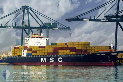
MSC GINA
Container Ship
Current Trip
| Trip Time | 12 days |
|---|---|
| Trip Distance | 2221.62 nm |
| AVG Speed | 8.3 Knots |
| MAX Speed | 12.9 Knots |
| Draught | 7.1 m |
| AVG Wind | 5 knots |
| MAX Wind | 11.9 knots |
| MIN Temp | 27.4°C / 81.32°F |
| MAX Temp | 31.5°C / 88.7°F |
| Position Received | 19 d ago |
Current Position
| Longitude | 78.27639° |
|---|---|
| Latitude | 7.22731° |
| Status | Default |
| Speed | 13.3 Knots |
| Course | 98° |
| Area | Laccadive Sea |
| Station | T-AIS |
| Position Received | 19 d ago |
Info
Information
The current position of MSC GINA is in Laccadive Sea with coordinates 7.22731° / 78.27639° as reported on 2024-04-23 17:45 by AIS to our vessel tracker app. The vessel's current speed is 13.3 Knots and is currently inside the port of DJIBOUTI.
The vessel MSC GINA (IMO: 9202663, MMSI: 357542000) is a Container Ship that was built in 1999 ( 25 years old ). It's sailing under the flag of [PA] Panama.
In this page you can find informations about the vessels current position, last detected port calls, and current voyage information. If the vessels is not in coverage by AIS you will find the latest position.
The current position of MSC GINA is detected by our AIS receivers and we are not responsible for the reliability of the data. The last position was recorded while the vessel was in Coverage by the Ais receivers of our vessel tracking app.
The current draught of MSC GINA as reported by AIS is 7.1 meters
Weather
| Temperature | 33.2°C / 91.76°F |
|---|---|
| Wind Speed | 10 knots |
| Direction | 70° ENE |
| Pressure | 1004.9 hPa |
| Humidity | 54.2 % |
| Cloud Coverage | 20 % |
Featured Company
Last Port Calls
| Port | Arrival | Departure | Time In Port |
|---|---|---|---|
| 2024-05-13 06:00 | |||
| 2024-04-28 17:10 | 2024-05-01 07:26 | 2 d | |
| 2024-04-26 13:32 | 2024-04-27 06:21 | 16 h | |
| 2024-04-13 22:38 | |||
| 2024-04-07 03:54 | |||
| 2024-03-27 06:15 | 2024-03-27 20:03 | 13 h | |
| 2024-03-23 12:59 | 2024-03-25 10:22 | 1 d | |
| 2024-03-22 10:32 | 2024-03-23 01:54 | 15 h | |
| 2024-03-20 02:58 | 2024-03-21 07:26 | 1 d |
Last Trips
| Origin | Departure | Destination | Arrival | Distance | |
|---|---|---|---|---|---|
| 2024-05-01 07:26 | 2024-05-13 06:00 | 2221.62 nm | |||
| 2024-04-27 06:21 | 2024-04-28 17:10 | 175.65 nm | |||
| 2024-03-27 20:03 | 2024-04-07 03:54 | 2758.36 nm | |||
| 2024-03-25 10:22 | 2024-03-27 06:15 | 24.25 nm | |||
| 2024-03-23 01:54 | 2024-03-23 12:59 | 148.97 nm | |||
| 2024-03-21 07:26 | 2024-03-22 10:32 | 152.11 nm | |||
| 2024-02-24 21:21 | 2024-03-20 02:58 | 4421.04 nm |
Events
| Time | Event | Details | Position / Dest | Info |
|---|---|---|---|---|
| 2024-05-13 03:05 | STOP Moving |
11.60079 / 43.10427
[DJ] DJIBOUTI
|
Speed: 0.3 kn Course: 123° |
|
| 2024-05-13 03:00 | PORT ARRIVAL |
|
11.60126 / 43.10450
[DJ] DJIBOUTI
|
Speed: 0.8 kn Course: 135° |
| 2024-05-13 00:40 | START Moving | 6.48 nm, North East of DJIBOUTI |
11.66550 / 43.22182
LKCMB
|
Speed: 3.9 kn Course: 106° |
| 2024-05-07 12:24 | STOP Moving | 6.29 nm, North East of DJIBOUTI |
11.66571 / 43.21793
LKCMB
|
Speed: Course: 74° |