
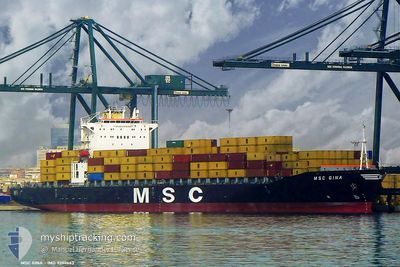
MSC GINA
Container Ship
Current Trip
INMUN
| Time Travelled | --- |
|---|---|
| Remaining Time | --- |
| Distance Travelled | --- |
| Remaining Distance | --- |
| AVG Speed | --- |
| MAX Speed | --- |
| AVG Wind | --- |
| MAX Wind | --- |
| MIN Temp | --- |
| MAX Temp | --- |
| Djupgående | 12.7 m |
| Position mottagen | 6 d sen |
Current Position
| Longitud | 76.19858° |
|---|---|
| Latitude | 8.52424° |
| Status | Under way using engine |
| Fart | 15.3 Knop |
| Kurs | 316.1° |
| Område | Laccadive Sea |
| Station | T-AIS |
| Position mottagen | 6 d sen |
Info
Information
The current position of MSC GINA is in Laccadive Sea with coordinates 8.52424° / 76.19858° as reported on 2024-06-01 04:58 by AIS to our vessel tracker app. The vessel's current speed is 15.3 Knop
The vessel MSC GINA (IMO: 9202663, MMSI: 357542000) is a Container Ship that was built in 1999 ( 25 År gammal ). It's sailing under the flag of [PA] Panama.
In this page you can find informations about the vessels current position, last detected port calls, and current voyage information. If the vessels is not in coverage by AIS you will find the latest position.
The current position of MSC GINA is detected by our AIS receivers and we are not responsible for the reliability of the data. The last position was recorded while the vessel was in Coverage by the Ais receivers of our vessel tracking app.
The current draught of MSC GINA as reported by AIS is 12.7 meters
Weather
| Temperature | 30.5°C / 86.9°F |
|---|---|
| Wind Speed | 8 knots |
| Direction | 298° WNW |
| Pressure | 1005.4 hPa |
| Humidity | 69.3 % |
| Cloud Coverage | 94 % |
Featured Company
Last Port Calls
| Port | Arrival | Departure | Time In Port |
|---|---|---|---|
| 2024-06-04 01:37 | |||
| 2024-05-30 16:50 | 2024-05-31 12:30 | 19 h | |
| 2024-05-27 23:17 | 2024-05-30 07:58 | 2 d | |
| 2024-05-13 03:00 | 2024-05-15 04:04 | 2 d | |
| 2024-04-28 11:40 | 2024-05-01 01:56 | 2 d | |
| 2024-04-26 08:02 | 2024-04-27 00:51 | 16 h | |
| 2024-04-13 19:38 | |||
| 2024-04-06 23:54 |
Last Trips
| Origin | Departure | Destination | Arrival | Distance | |
|---|---|---|---|---|---|
| 2024-05-31 18:00 | 2024-06-04 07:07 | 1246.57 nm | |||
| 2024-05-30 13:28 | 2024-05-30 22:20 | 33.90 nm | |||
| 2024-05-15 07:04 | 2024-05-28 04:47 | 2431.42 nm | |||
| 2024-05-01 07:26 | 2024-05-13 06:00 | 2221.62 nm | |||
| 2024-04-27 06:21 | 2024-04-28 17:10 | 175.65 nm | |||
| 2024-03-27 20:03 | 2024-04-07 03:54 | 2758.36 nm |
Events
| Tid | Event | Detaljer | Position / Dest | Information |
|---|---|---|---|---|
| 2024-06-04 02:11 | STOPPAR förflyttning |
22.73776 / 69.69129
[IN] MUNDRA
|
Fart: 0.1 kn Kurs: 270° |
|
| 2024-06-04 01:37 | ANLÄNDER HAMN |
|
22.73012 / 69.69478
[IN] MUNDRA
|
Fart: 4.7 kn Kurs: 326° |
| 2024-06-01 05:08 | Status ändrad | Default Under way using engine |
8.55550 / 76.16795
INMUN
|
Fart: 15.3 kn Kurs: 316.1° |
| 2024-06-01 04:58 | UTANFÖR täckningsområde |
8.52424 / 76.19858
Laccadive Sea
INMUN
|
Fart: 15.3 kn Kurs: 316.1° |
|
| 2024-06-01 03:50 | Status ändrad | Under way using engine Default |
8.32668 / 76.40669
INMUN
|
Fart: 14.9 kn Kurs: 313° |
| 2024-06-01 03:44 | Status ändrad | Default Under way using engine |
8.30913 / 76.42569
INMUN
|
Fart: 14.9 kn Kurs: 313.4° |
| 2024-06-01 03:36 | Status ändrad | Under way using engine Default |
8.28692 / 76.44961
INMUN
|
Fart: 15.1 kn Kurs: 313° |
| 2024-06-01 03:30 | Status ändrad | Default Under way using engine |
8.26813 / 76.46961
INMUN
|
Fart: 15.2 kn Kurs: 313.4° |
| 2024-06-01 02:04 | Status ändrad | Under way using engine Default |
8.01522 / 76.73959
INMUN
|
Fart: 15.2 kn Kurs: 312° |
| 2024-06-01 01:51 | Status ändrad | Default Under way using engine |
7.97760 / 76.78054
INMUN
|
Fart: 15.2 kn Kurs: 312.2° |