
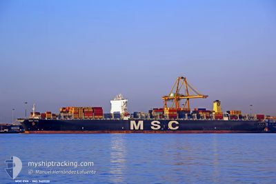
MSC EVA
Container Ship
Current Trip
| Time Travelled | 9 days |
|---|---|
| Remaining Time | 4 h, 15 mins |
| Distance Travelled | 3590.31 nm |
| Remaining Distance | 37.71 nm |
| AVG Speed | 16.2 Knots |
| MAX Speed | 16.2 Knots |
| AVG Wind | 7.5 knots |
| MAX Wind | 20.6 knots |
| MIN Temp | 24.5°C / 76.1°F |
| MAX Temp | 30.6°C / 87.08°F |
| Draught | 15.7 m |
| Position Received | Now |
Current Position
| Longitude | 54.60124° |
|---|---|
| Latitude | 25.13096° |
| Status | Under way using engine |
| Speed | 9 Knots |
| Course | 37.7° |
| Area | Persian Gulf |
| Station | T-AIS |
| Position Received | Now |
Info
Information
The current position of MSC EVA is in Persian Gulf with coordinates 25.13096° / 54.60124° as reported on 2024-04-26 23:19 by AIS to our vessel tracker app. The vessel's current speed is 9 Knots and is heading at the port of ABU DHABI. The estimated time of arrival as calculated by MyShipTracking vessel tracking app is 2024-04-27 03:34 LT
The vessel MSC EVA (IMO: 9401130, MMSI: 371218000) is a Container Ship that was built in 2010 ( 14 years old ). It's sailing under the flag of [PA] Panama.
In this page you can find informations about the vessels current position, last detected port calls, and current voyage information. If the vessels is not in coverage by AIS you will find the latest position.
The current position of MSC EVA is detected by our AIS receivers and we are not responsible for the reliability of the data. The last position was recorded while the vessel was in Coverage by the Ais receivers of our vessel tracking app.
The current draught of MSC EVA as reported by AIS is 15.7 meters
Weather
| Temperature | 26.4°C / 79.52°F |
|---|---|
| Wind Speed | 9 knots |
| Direction | 335° NNW |
| Pressure | 1006.3 hPa |
| Humidity | 70.5 % |
| Cloud Coverage | 4 % |
Featured Company
Last Port Calls
| Port | Arrival | Departure | Time In Port |
|---|---|---|---|
| 2024-04-15 23:56 | 2024-04-17 12:49 | 1 d | |
| 2024-03-28 13:21 | 2024-03-29 03:49 | 14 h | |
| 2024-03-25 21:24 | 2024-03-26 16:05 | 18 h | |
| 2024-03-19 02:38 | 2024-03-20 18:19 | 1 d | |
| 2024-03-11 03:12 | 2024-03-12 07:15 | 1 d | |
| 2024-03-10 01:57 | 2024-03-11 01:16 | 23 h | |
| 2024-03-03 00:25 | |||
| 2024-02-28 12:29 | 2024-02-29 21:02 | 1 d | |
| 2024-02-19 03:32 | 2024-02-20 07:22 | 1 d | |
| 2024-02-16 14:01 | 2024-02-17 10:45 | 20 h |
Last Trips
| Origin | Departure | Destination | Arrival | Distance | |
|---|---|---|---|---|---|
| 2024-03-29 11:49 | 2024-04-16 07:56 | 2975.31 nm | |||
| 2024-03-27 01:05 | 2024-03-28 21:21 | 506.74 nm | |||
| 2024-03-21 02:19 | 2024-03-26 06:24 | 861.01 nm | |||
| 2024-03-12 15:15 | 2024-03-19 10:38 | 2818.62 nm | |||
| 2024-03-11 09:16 | 2024-03-11 11:12 | 10.47 nm | |||
| 2024-03-01 02:32 | 2024-03-03 05:55 | 27.38 nm | |||
| 2024-02-20 12:52 | 2024-02-28 17:59 | 1244.60 nm | |||
| 2024-02-17 16:15 | 2024-02-19 09:02 | 422.16 nm | |||
| 2024-01-26 14:42 | 2024-02-16 19:31 | 7237.13 nm |
Events
| Time | Event | Details | Position / Dest | Info |
|---|---|---|---|---|
| 2024-04-26 22:39 | START Moving | 17.29 nm, North West of KHALIFA |
25.05870 / 54.51021
AEAUH
|
Speed: 3.2 kn Course: 85° |
| 2024-04-26 22:35 | STOP Moving | 17.36 nm, North West of KHALIFA |
25.05906 / 54.50814
AEAUH
|
Speed: 0.3 kn Course: 96° |
| 2024-04-26 18:05 | START Moving | 18.91 nm, North of KHALIFA |
25.10521 / 54.54985
AEAUH
|
Speed: 11.3 kn Course: 158.1° |
| 2024-04-26 12:22 | STOP Moving | 21.3 nm, North West of GHANTOOT |
25.16059 / 54.59152
AEAUH
|
Speed: 0.3 kn Course: 41° |
| 2024-04-26 12:21 | ETA Changed | 2024/04/26 22:00 2024/04/26 20:00 |
25.16040 / 54.59156
AEAUH
|
Speed: 1.2 kn Course: 34° |
| 2024-04-26 12:15 | ETA Changed | 2024/04/26 20:00 2024/04/25 20:00 |
25.15268 / 54.59145
AEAUH
|
Speed: 6.5 kn Course: 354.8° |
| 2024-04-26 03:43 | START Moving | 19.77 nm, North West of GHANTOOT |
25.14560 / 54.61518
AEAUH
|
Speed: 3.7 kn Course: 249° |
| 2024-04-26 02:30 | STOP Moving | 20.11 nm, North West of GHANTOOT |
25.14540 / 54.60563
AEAUH
|
Speed: 0.2 kn Course: 270° |
| 2024-04-26 02:30 | START Moving | 20.12 nm, North West of GHANTOOT |
25.14569 / 54.60569
AEAUH
|
Speed: 4.5 kn Course: 270° |
| 2024-04-26 00:13 | STOP Moving | 20.28 nm, North West of GHANTOOT |
25.14224 / 54.59719
AEAUH
|
Speed: 0.3 kn Course: 250° |