
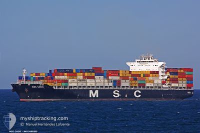
MSC CADIZ
Container Ship
Current Trip
| Time Travelled | 21 h, 28 mins |
|---|---|
| Remaining Time | 1 day |
| Distance Travelled | 284.80 nm |
| Remaining Distance | 402.03 nm |
| AVG Speed | 13 Knots |
| MAX Speed | 14.6 Knots |
| AVG Wind | 14.9 knots |
| MAX Wind | 26 knots |
| MIN Temp | 15°C / 59°F |
| MAX Temp | 17.3°C / 63.14°F |
| Draught | 11.6 m |
| Position Received | 19 h, 19 m ago |
Current Position
| Longitude | --- |
|---|---|
| Latitude | --- |
| Status | Under way using engine |
| Speed | 13.7 Knots |
| Course | 120.5° |
| Area | Balearic Sea |
| Station | T-AIS |
| Position Received | 19 h, 19 m ago |
Info
Information
The current position of MSC CADIZ is in Balearic Sea with coordinates 41.06126° / 2.65110° as reported on 2025-12-14 22:17 by AIS to our vessel tracker app. The vessel's current speed is 13.7 Knots and is heading at the port of GIOIA TAURO. The estimated time of arrival as calculated by MyShipTracking vessel tracking app is 2025-12-17 00:02 LT
The vessel MSC CADIZ (IMO: 9480203, MMSI: 218847000) is a Container Ship that was built in 2011 ( 14 years old ). It's sailing under the flag of [DE] Germany.
In this page you can find informations about the vessels current position, last detected port calls, and current voyage information. If the vessels is not in coverage by AIS you will find the latest position.
The current position of MSC CADIZ is detected by our AIS receivers and we are not responsible for the reliability of the data. The last position was recorded while the vessel was in Coverage by the Ais receivers of our vessel tracking app.
The current draught of MSC CADIZ as reported by AIS is 11.6 meters
Weather
| Temperature | 16.9°C / 62.42°F |
|---|---|
| Wind Speed | 26 knots |
| Direction | 153° SSE |
| Pressure | 1015.2 hPa |
| Humidity | 78.1 % |
| Cloud Coverage | 100 % |
Featured Company
Last Port Calls
| Port | Arrival | Departure | Time In Port |
|---|---|---|---|
| 2025-12-14 08:54 | 2025-12-14 21:08 | 12 h | |
| 2025-11-30 09:10 | 2025-11-30 22:55 | 13 h | |
| 2025-11-26 12:19 | 2025-11-27 10:39 | 22 h | |
| 2025-11-23 15:04 | 2025-11-25 07:48 | 1 d | |
| 2025-11-19 00:12 | 2025-11-19 16:42 | 16 h | |
| 2025-11-13 03:45 | 2025-11-13 19:31 | 15 h | |
| 2025-11-11 18:35 | 2025-11-12 08:03 | 13 h | |
| 2025-11-01 08:58 | 2025-11-02 02:02 | 17 h | |
| 2025-10-28 05:56 | 2025-10-29 05:23 | 23 h | |
| 2025-10-26 04:27 | 2025-10-26 20:51 | 16 h |
Last Trips
| Origin | Departure | Destination | Arrival | Distance | |
|---|---|---|---|---|---|
| 2025-11-30 22:55 | 2025-12-14 08:54 | 4562.63 nm | |||
| 2025-11-27 10:39 | 2025-11-30 09:10 | 895.84 nm | |||
| 2025-11-25 07:48 | 2025-11-26 12:19 | 444.01 nm | |||
| 2025-11-19 16:42 | 2025-11-23 15:04 | 502.00 nm | |||
| 2025-11-13 19:31 | 2025-11-19 00:12 | 1359.35 nm | |||
| 2025-11-12 08:03 | 2025-11-13 03:45 | 92.66 nm | |||
| 2025-11-02 02:02 | 2025-11-11 18:35 | 3913.12 nm | |||
| 2025-10-29 05:23 | 2025-11-01 08:58 | 717.08 nm | |||
| 2025-10-26 20:51 | 2025-10-28 05:56 | 166.58 nm | |||
| 2025-10-25 05:39 | 2025-10-26 04:27 | 361.72 nm |
Events
| Time | Event | Details | Position / Dest | Info |
|---|---|---|---|---|
| 2025-12-14 22:20 | Status Changed | Default Under way using engine |
41.05605 / 2.66276
ESBCN>ITGIT
|
Speed: 13.7 kn Course: 120.5° |
| 2025-12-14 22:17 | Status Changed | Under way using engine Default |
41.06126 / 2.65110
ESBCN>ITGIT
|
Speed: 13.7 kn Course: 120° |
| 2025-12-14 22:17 | OUT of Coverage |
41.06126 / 2.65110
Balearic Sea
ESBCN>ITGIT
|
Speed: 13.7 kn Course: 120.5° |
|
| 2025-12-14 22:12 | Status Changed | Default Under way using engine |
41.07178 / 2.62685
ESBCN>ITGIT
|
Speed: 13.7 kn Course: 118.7° |
| 2025-12-14 20:08 | PORT DEPARTURE |
|
41.31047 / 2.17113
ESBCN>ITGIT
|
Speed: 7.3 kn Course: 168° |
| 2025-12-14 20:01 | START Moving |
41.31999 / 2.16636
[ES] BARCELONA
|
Speed: 3.1 kn Course: 151° |
|
| 2025-12-14 19:54 | STOP Moving |
41.32298 / 2.16402
[ES] BARCELONA
|
Speed: 0.2 kn Course: 180° |
|
| 2025-12-14 19:35 | START Moving |
41.30696 / 2.14915
[ES] BARCELONA
|
Speed: 3.1 kn Course: 230° |
|
| 2025-12-14 19:16 | Status Changed | Under way using engine Moored |
41.30611 / 2.14606
[ES] BARCELONA
|
Speed: Course: 216° |
| 2025-12-14 18:00 | Draught Changed | 11.6 11.7 |
41.30607 / 2.14601
[ES] BARCELONA
|
Speed: Course: 216° |