
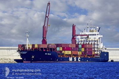
MSC BELLE
Container Ship
Current Trip
| Time Travelled | 1 day |
|---|---|
| Remaining Time | --- |
| Distance Travelled | 235.28 nm |
| Remaining Distance | --- |
| AVG Speed | 7.3 Knots |
| MAX Speed | 8.8 Knots |
| AVG Wind | 13.8 knots |
| MAX Wind | 29.7 knots |
| MIN Temp | 13.2°C / 55.76°F |
| MAX Temp | 17.9°C / 64.22°F |
| Draught | 9.7 m |
| Position Received | 15 h, 37 m ago |
Current Position
| Longitude | --- |
|---|---|
| Latitude | --- |
| Status | Under way using engine |
| Speed | 8.5 Knots |
| Course | 46° |
| Area | Ionian Sea |
| Station | T-AIS |
| Position Received | 15 h, 37 m ago |
Info
Information
The current position of MSC BELLE is in Ionian Sea with coordinates 38.73517° / 17.15900° as reported on 2026-01-05 06:24 by AIS to our vessel tracker app. The vessel's current speed is 8.5 Knots and is heading at the port of PORT SAID. The estimated time of arrival as calculated by MyShipTracking vessel tracking app is 2026-01-08 20:00 LT
The vessel MSC BELLE (IMO: 9203904, MMSI: 371743000) is a Container Ship that was built in 1998 ( 28 years old ). It's sailing under the flag of [PA] Panama.
In this page you can find informations about the vessels current position, last detected port calls, and current voyage information. If the vessels is not in coverage by AIS you will find the latest position.
The current position of MSC BELLE is detected by our AIS receivers and we are not responsible for the reliability of the data. The last position was recorded while the vessel was in Coverage by the Ais receivers of our vessel tracking app.
The current draught of MSC BELLE as reported by AIS is 9.7 meters
Weather
| Temperature | 16.5°C / 61.7°F |
|---|---|
| Wind Speed | 28 knots |
| Direction | 164° SSE |
| Pressure | 1007.7 hPa |
| Humidity | 86.1 % |
| Cloud Coverage | 12 % |
Featured Company
Last Port Calls
| Port | Arrival | Departure | Time In Port |
|---|---|---|---|
| 2026-01-03 08:59 | 2026-01-04 13:25 | 1 d | |
| 2025-12-30 05:10 | 2025-12-30 18:50 | 13 h | |
| 2025-12-28 01:20 | 2025-12-28 16:04 | 14 h | |
| 2025-12-23 11:18 | 2025-12-24 03:22 | 16 h | |
| 2025-12-20 10:53 | 2025-12-21 03:14 | 16 h | |
| 2025-12-19 18:13 | 2025-12-20 00:34 | 6 h | |
| 2025-12-17 07:38 | 2025-12-18 06:42 | 23 h | |
| 2025-12-16 06:21 | 2025-12-16 16:11 | 9 h | |
| 2025-12-15 21:24 | 2025-12-16 05:27 | 8 h | |
| 2025-12-14 21:05 | 2025-12-15 11:11 | 14 h |
Most Visited Ports (Last year)
| Port | Arrivals | |
|---|---|---|
| 16 | ||
| 15 | ||
| 13 | ||
| 9 | ||
| 9 | ||
| 8 |
Last Trips
| Origin | Departure | Destination | Arrival | Distance | |
|---|---|---|---|---|---|
| 2025-12-30 18:50 | 2026-01-03 08:59 | 511.82 nm | |||
| 2025-12-28 16:04 | 2025-12-30 05:10 | 363.72 nm | |||
| 2025-12-24 03:22 | 2025-12-28 01:20 | 1014.00 nm | |||
| 2025-12-21 03:14 | 2025-12-23 11:18 | 464.78 nm | |||
| 2025-12-20 00:34 | 2025-12-20 10:53 | 72.75 nm | |||
| 2025-12-18 06:42 | 2025-12-19 18:13 | 383.46 nm | |||
| 2025-12-16 16:11 | 2025-12-17 07:38 | 148.52 nm | |||
| 2025-12-16 05:27 | 2025-12-16 06:21 | 3.77 nm | |||
| 2025-12-15 11:11 | 2025-12-15 21:24 | 82.52 nm | |||
| 2025-12-13 02:33 | 2025-12-14 21:05 | 319.70 nm |
Events
| Time | Event | Details | Position / Dest | Info |
|---|---|---|---|---|
| 2026-01-05 06:29 | Status Changed | Default Under way using engine |
38.74400 / 17.16983
EGPSW
|
Speed: 8.5 kn Course: 46° |
| 2026-01-05 06:24 | OUT of Coverage |
38.73517 / 17.15900
Ionian Sea
EGPSW
|
Speed: 8.5 kn Course: 46° |
|
| 2026-01-05 06:22 | Status Changed | Under way using engine Default |
38.73267 / 17.15583
EGPSW
|
Speed: 8.4 kn Course: 45° |
| 2026-01-05 06:01 | Status Changed | Default Under way using engine |
38.69717 / 17.10900
EGPSW
|
Speed: 8.3 kn Course: 45° |
| 2026-01-05 05:54 | Status Changed | Under way using engine Default |
38.68583 / 17.09383
EGPSW
|
Speed: 8.4 kn Course: 45° |
| 2026-01-05 05:49 | Status Changed | Default Under way using engine |
38.67733 / 17.08333
EGPSW
|
Speed: 8.3 kn Course: 43° |
| 2026-01-05 05:33 | Status Changed | Under way using engine Default |
38.65000 / 17.05133
EGPSW
|
Speed: 8.3 kn Course: 42° |
| 2026-01-05 05:29 | Status Changed | Default Under way using engine |
38.64317 / 17.04350
EGPSW
|
Speed: 8.3 kn Course: 41° |
| 2026-01-05 05:28 | Status Changed | Under way using engine Default |
38.64217 / 17.04250
EGPSW
|
Speed: 8.3 kn Course: 41° |
| 2026-01-05 05:13 | IN Coverage |
38.64217 / 17.04250
Ionian Sea
EGPSW
|
Speed: 8.3 kn Course: 41° |