
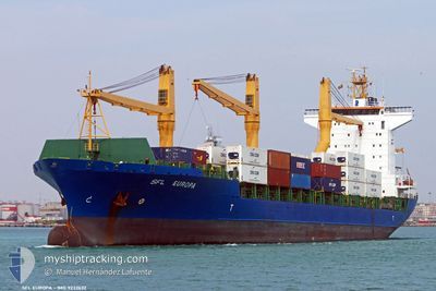
MSC ALICE II
Container Ship
Current Trip
BJCOO
| Time Travelled | 5 days |
|---|---|
| Remaining Time | --- |
| Distance Travelled | 583.41 nm |
| Remaining Distance | --- |
| AVG Speed | 10.1 Knots |
| MAX Speed | 13.3 Knots |
| AVG Wind | 7 knots |
| MAX Wind | 14.7 knots |
| MIN Temp | 24.6°C / 76.28°F |
| MAX Temp | 32.6°C / 90.68°F |
| Draught | 9.7 m |
| Position Received | 2024-11-23 08:57 |
Current Position
| Longitude | --- |
|---|---|
| Latitude | --- |
| Status | Moored |
| Speed | |
| Course | 17° |
| Area | Gulf of Guinea |
| Station | T-AIS |
| Position Received | 2024-11-23 08:57 |
Info
Information
The current position of MSC ALICE II is in Gulf of Guinea with coordinates 14.67690° / -17.42961° as reported on 2024-11-23 08:57 by AIS to our vessel tracker app. The vessel's current speed is 0 Knots
The vessel MSC ALICE II (IMO: 9232632, MMSI: 636018026) is a Container Ship that was built in 2003 ( 22 years old ). It's sailing under the flag of [LR] Liberia.
In this page you can find informations about the vessels current position, last detected port calls, and current voyage information. If the vessels is not in coverage by AIS you will find the latest position.
The current position of MSC ALICE II is detected by our AIS receivers and we are not responsible for the reliability of the data. The last position was recorded while the vessel was in Coverage by the Ais receivers of our vessel tracking app.
The current draught of MSC ALICE II as reported by AIS is 9.7 meters
Weather
| Temperature | 26.7°C / 80.06°F |
|---|---|
| Wind Speed | 4 knots |
| Direction | 224° SW |
| Pressure | 1010.8 hPa |
| Humidity | 80.9 % |
| Cloud Coverage | 49 % |
Featured Company
Last Port Calls
| Port | Arrival | Departure | Time In Port |
|---|---|---|---|
| 2025-12-08 03:16 | 2025-12-09 13:33 | 1 d | |
| 2025-12-02 19:27 | 2025-12-04 16:53 | 1 d | |
| 2025-11-22 20:16 | 2025-11-25 07:49 | 2 d | |
| 2025-11-16 13:12 | 2025-11-17 23:17 | 1 d | |
| 2025-11-06 08:08 | 2025-11-08 06:48 | 1 d | |
| 2025-10-26 09:47 | 2025-10-27 21:16 | 1 d | |
| 2025-10-20 10:20 | 2025-10-21 12:56 | 1 d | |
| 2025-10-09 09:01 | 2025-10-16 04:26 | 6 d | |
| 2025-10-03 03:40 | 2025-10-05 04:52 | 2 d |
Last Trips
| Origin | Departure | Destination | Arrival | Distance | |
|---|---|---|---|---|---|
| 2025-12-04 16:53 | 2025-12-08 03:16 | 555.85 nm | |||
| 2025-11-25 07:49 | 2025-12-02 19:27 | 1090.33 nm | |||
| 2025-11-17 23:17 | 2025-11-22 20:16 | 603.26 nm | |||
| 2025-11-08 06:48 | 2025-11-16 13:12 | 599.99 nm | |||
| 2025-10-27 21:16 | 2025-11-06 08:08 | 291.80 nm | |||
| 2025-10-21 12:56 | 2025-10-26 09:47 | 597.24 nm | |||
| 2025-10-16 04:26 | 2025-10-20 10:20 | 536.13 nm | |||
| 2025-10-05 04:52 | 2025-10-09 09:01 | 1066.66 nm | |||
| 2025-09-26 18:24 | 2025-10-03 03:40 | 603.59 nm |
Events
| Time | Event | Details | Position / Dest | Info |
|---|---|---|---|---|
| 2025-12-11 23:37 | STOP Moving | 14.51 nm, South West of DOUALA |
3.87988 / 9.52244
BJCOO
|
Speed: 0.2 kn Course: 308° |
| 2025-12-09 13:33 | PORT DEPARTURE |
|
6.13411 / 1.29614
BJCOO
|
Speed: 5.5 kn Course: 106° |
| 2025-12-09 13:29 | START Moving |
6.13643 / 1.28876
[TG] LOME
|
Speed: 5.5 kn Course: 106° |
|
| 2025-12-08 03:29 | STOP Moving |
6.13640 / 1.27858
[TG] LOME
|
Speed: 0.3 kn Course: 273° |
|
| 2025-12-08 03:16 | PORT ARRIVAL |
|
6.13593 / 1.28218
[TG] LOME
|
Speed: 5.3 kn Course: 270° |
| 2025-12-08 02:13 | START Moving | 5.02 nm, South East of LOME |
6.07665 / 1.34499
BJCOO
|
Speed: 6.4 kn Course: 340° |
| 2025-12-08 01:05 | STOP Moving | 5.1 nm, South East of LOME |
6.07662 / 1.34691
BJCOO
|
Speed: 0.2 kn Course: 45° |
| 2025-12-08 00:37 | START Moving | 5.59 nm, South East of LOME |
6.05616 / 1.33341
BJCOO
|
Speed: 3.1 kn Course: 107° |
| 2025-12-06 19:49 | STOP Moving | 5.45 nm, South East of LOME |
6.05868 / 1.33284
BJCOO
|
Speed: 0.3 kn Course: 139° |
| 2025-12-06 16:09 | START Moving | 2.65 nm, South East of LOME |
6.11539 / 1.32540
BJCOO
|
Speed: 3.7 kn Course: 337° |