
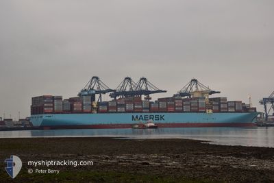
MOSCOW MAERSK
Cargo A
Current Trip
| Time Travelled | 1 day |
|---|---|
| Remaining Time | 22 days |
| Distance Travelled | 194.85 nm |
| Remaining Distance | 1163.27 nm |
| AVG Speed | 7.7 Knots |
| MAX Speed | 10.5 Knots |
| AVG Wind | 13.9 knots |
| MAX Wind | 17 knots |
| MIN Temp | 15.1°C / 59.18°F |
| MAX Temp | 17.6°C / 63.68°F |
| Draught | 13.6 m |
| Position Received | 1 m ago |
Current Position
| Longitude | --- |
|---|---|
| Latitude | --- |
| Status | Under way using engine |
| Speed | 2.3 Knots |
| Course | 297° |
| Area | North Atlantic Ocean |
| Station | T-AIS |
| Position Received | 1 m ago |
Info
Information
The current position of MOSCOW MAERSK is in North Atlantic Ocean with coordinates 36.74363° / -9.08632° as reported on 2025-12-05 12:25 by AIS to our vessel tracker app. The vessel's current speed is 2.3 Knots and is heading at the port of THAMES. The estimated time of arrival as calculated by MyShipTracking vessel tracking app is 2025-12-27 23:55 LT
The vessel MOSCOW MAERSK (IMO: 9778818, MMSI: 219864000) is a Cargo A It's sailing under the flag of [DK] Denmark.
In this page you can find informations about the vessels current position, last detected port calls, and current voyage information. If the vessels is not in coverage by AIS you will find the latest position.
The current position of MOSCOW MAERSK is detected by our AIS receivers and we are not responsible for the reliability of the data. The last position was recorded while the vessel was in Coverage by the Ais receivers of our vessel tracking app.
The current draught of MOSCOW MAERSK as reported by AIS is 13.6 meters
Weather
| Temperature | 17.3°C / 63.14°F |
|---|---|
| Wind Speed | 13 knots |
| Direction | 272° W |
| Pressure | 1024.7 hPa |
| Humidity | 87.6 % |
| Cloud Coverage | 53 % |
Featured Company
Last Port Calls
| Port | Arrival | Departure | Time In Port |
|---|---|---|---|
| 2025-12-03 12:35 | 2025-12-04 12:37 | 1 d | |
| 2025-11-06 23:08 | 2025-11-08 22:02 | 1 d | |
| 2025-10-19 06:37 | 2025-10-20 15:02 | 1 d |
Most Visited Ports (Last year)
| Port | Arrivals | |
|---|---|---|
| 6 | ||
| 5 | ||
| 3 | ||
| 2 | ||
| 2 | ||
| 2 |
Last Trips
| Origin | Departure | Destination | Arrival | Distance | |
|---|---|---|---|---|---|
| 2025-11-08 22:02 | 2025-12-03 12:35 | 10729.64 nm | |||
| 2025-10-20 15:02 | 2025-11-06 23:08 | 4501.86 nm | |||
| 2025-09-22 08:42 | 2025-10-19 06:37 | 10759.42 nm |
Events
| Time | Event | Details | Position / Dest | Info |
|---|---|---|---|---|
| 2025-12-05 03:11 | ETA Changed | 2025/12/08 21:00 2025/12/08 00:00 |
36.42873 / -7.91850
ES ALG > GB LGP
|
Speed: 10.3 kn Course: 287.8° |
| 2025-12-05 02:44 | Status Changed | Under way using engine Default |
36.40507 / -7.82998
ES ALG > GB LGP
|
Speed: 10.3 kn Course: 288° |
| 2025-12-05 02:31 | IN Coverage |
36.40595 / -7.83337
North Atlantic Ocean
ES ALG > GB LGP
|
Speed: 10.3 kn Course: 288.2° |
|
| 2025-12-05 00:59 | Status Changed | Default Under way using engine |
36.30259 / -7.47561
ES ALG > GB LGP
|
Speed: 10.4 kn Course: 291.6° |
| 2025-12-05 00:51 | Detected in Sea | Portuguese part of the North Atlantic Ocean |
36.29453 / -7.44918
North Atlantic Ocean
ES ALG > GB LGP
|
Speed: 10.4 kn Course: 291.6° |
| 2025-12-05 00:51 | OUT of Coverage |
36.29453 / -7.44918
North Atlantic Ocean
ES ALG > GB LGP
|
Speed: 10.4 kn Course: 291.6° |
|
| 2025-12-05 00:51 | Status Changed | Under way using engine Default |
36.29419 / -7.44812
ES ALG > GB LGP
|
Speed: 10.5 kn Course: 291° |
| 2025-12-05 00:23 | Status Changed | Default Under way using engine |
36.26492 / -7.35461
ES ALG > GB LGP
|
Speed: 10.4 kn Course: 290.6° |
| 2025-12-05 00:16 | Status Changed | Under way using engine Default |
36.25747 / -7.33044
ES ALG > GB LGP
|
Speed: 10.3 kn Course: 291° |
| 2025-12-05 00:15 | Status Changed | Default Under way using engine |
36.25663 / -7.32771
ES ALG > GB LGP
|
Speed: 10.5 kn Course: 290.4° |