
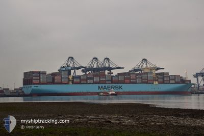
MOSCOW MAERSK
Cargo A
Current Trip
| Time Travelled | 4 days |
|---|---|
| Remaining Time | 2 h, 9 mins |
| Distance Travelled | 1367.34 nm |
| Remaining Distance | 37.46 nm |
| AVG Speed | 11.9 Knop |
| MAX Speed | 23.6 Knop |
| AVG Wind | 17.4 knots |
| MAX Wind | 39 knots |
| MIN Temp | 11.9°C / 53.42°F |
| MAX Temp | 17.6°C / 63.68°F |
| Djupgående | 13.6 m |
| Position mottagen | Nu |
Current Position
| Longitud | --- |
|---|---|
| Latitude | --- |
| Status | Under way using engine |
| Fart | 15 Knop |
| Kurs | 232.1° |
| Område | North Sea |
| Station | T-AIS |
| Position mottagen | Nu |
Info
Information
The current position of MOSCOW MAERSK is in North Sea with coordinates 51.62085° / 1.33505° as reported on 2025-12-09 02:26 by AIS to our vessel tracker app. The vessel's current speed is 15 Knop and is heading at the port of THAMES. The estimated time of arrival as calculated by MyShipTracking vessel tracking app is 2025-12-09 04:36 LT
The vessel MOSCOW MAERSK (IMO: 9778818, MMSI: 219864000) is a Cargo A It's sailing under the flag of [DK] Denmark.
In this page you can find informations about the vessels current position, last detected port calls, and current voyage information. If the vessels is not in coverage by AIS you will find the latest position.
The current position of MOSCOW MAERSK is detected by our AIS receivers and we are not responsible for the reliability of the data. The last position was recorded while the vessel was in Coverage by the Ais receivers of our vessel tracking app.
The current draught of MOSCOW MAERSK as reported by AIS is 13.6 meters
Weather
| Temperature | 11.5°C / 52.7°F |
|---|---|
| Wind Speed | 16 knots |
| Direction | 192° SSW |
| Pressure | 1009.1 hPa |
| Humidity | 93.7 % |
| Cloud Coverage | 100 % |
Featured Company
Last Port Calls
| Port | Arrival | Departure | Time In Port |
|---|---|---|---|
| 2025-12-03 12:35 | 2025-12-04 12:37 | 1 d | |
| 2025-11-06 23:08 | 2025-11-08 22:02 | 1 d | |
| 2025-10-19 06:37 | 2025-10-20 15:02 | 1 d |
Most Visited Ports (Last year)
| Port | Arrivals | |
|---|---|---|
| 6 | ||
| 5 | ||
| 3 | ||
| 2 | ||
| 2 | ||
| 2 |
Last Trips
| Origin | Departure | Destination | Arrival | Distance | |
|---|---|---|---|---|---|
| 2025-11-08 22:02 | 2025-12-03 12:35 | 10729.64 nm | |||
| 2025-10-20 15:02 | 2025-11-06 23:08 | 4501.86 nm | |||
| 2025-09-22 08:42 | 2025-10-19 06:37 | 10759.42 nm |
Events
| Tid | Event | Detaljer | Position / Dest | Information |
|---|---|---|---|---|
| 2025-12-08 19:37 | Byter havsområde | United Kingdom part of the North Sea French part of the North Sea |
51.07463 / 1.64113
North Sea
ES ALG > GB LGP
|
Fart: 10.6 kn Kurs: 32° |
| 2025-12-08 19:16 | Byter havsområde | French part of the North Sea French part of the English Channel |
51.02623 / 1.58022
North Sea
ES ALG > GB LGP
|
Fart: 11 kn Kurs: 54.9° |
| 2025-12-08 15:34 | Upptäckt i hav | French part of the English Channel |
50.49197 / .94470
English Channel
ES ALG > GB LGP
|
Fart: 11.3 kn Kurs: 71.8° |
| 2025-12-08 15:33 | Status ändrad | Under way using engine Default |
50.49148 / .94235
ES ALG > GB LGP
|
Fart: 11.4 kn Kurs: 72° |
| 2025-12-08 15:29 | Status ändrad | Default Under way using engine |
50.48727 / .92200
ES ALG > GB LGP
|
Fart: 11.7 kn Kurs: 72.1° |
| 2025-12-08 15:20 | Status ändrad | Under way using engine Default |
50.47817 / .87652
ES ALG > GB LGP
|
Fart: 13.1 kn Kurs: 74° |
| 2025-12-08 15:13 | Status ändrad | Default Under way using engine |
50.47147 / .83980
ES ALG > GB LGP
|
Fart: 13.7 kn Kurs: 74° |
| 2025-12-08 15:07 | Status ändrad | Under way using engine Default |
50.46467 / .80278
ES ALG > GB LGP
|
Fart: 13.6 kn Kurs: 74° |
| 2025-12-08 15:05 | Status ändrad | Default Under way using engine |
50.46292 / .79327
ES ALG > GB LGP
|
Fart: 13.6 kn Kurs: 74.8° |
| 2025-12-08 14:58 | Status ändrad | Under way using engine Default |
50.45578 / .75228
ES ALG > GB LGP
|
Fart: 13.6 kn Kurs: 75° |