
MONA
General Cargo
Current Trip
| Time Travelled | 11 days |
|---|---|
| Remaining Time | --- |
| Distance Travelled | 1851.47 nm |
| Remaining Distance | --- |
| AVG Speed | 6.9 Knots |
| MAX Speed | 8.7 Knots |
| AVG Wind | 16.2 knots |
| MAX Wind | 31.9 knots |
| MIN Temp | 8.9°C / 48.02°F |
| MAX Temp | 16.6°C / 61.88°F |
| Draught | 6.5 m |
| Position Received | 28 m ago |
Current Position
| Longitude | --- |
|---|---|
| Latitude | --- |
| Status | Under way using engine |
| Speed | 7.6 Knots |
| Course | 261.9° |
| Area | Alboran Sea |
| Station | T-AIS |
| Position Received | 28 m ago |
Info
Information
The current position of MONA is in Alboran Sea with coordinates 36.16810° / -4.21104° as reported on 2025-03-03 02:57 by AIS to our vessel tracker app. The vessel's current speed is 7.6 Knots and is heading at the port of TREPORT. The estimated time of arrival as calculated by MyShipTracking vessel tracking app is 2025-03-09 10:00 LT
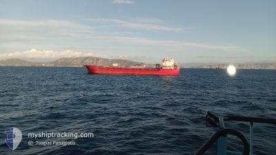
The vessel MONA (IMO: 9101534, MMSI: 314703000) is a General Cargo that was built in 1995 ( 30 years old ). It's sailing under the flag of [BB] Barbados.
In this page you can find informations about the vessels current position, last detected port calls, and current voyage information. If the vessels is not in coverage by AIS you will find the latest position.
The current position of MONA is detected by our AIS receivers and we are not responsible for the reliability of the data. The last position was recorded while the vessel was in Coverage by the Ais receivers of our vessel tracking app.
The current draught of MONA as reported by AIS is 6.5 meters
Weather
| Temperature | 15.9°C / 60.62°F |
|---|---|
| Wind Speed | 21 knots |
| Direction | 105° ESE |
| Pressure | 1012.4 hPa |
| Humidity | 79.5 % |
| Cloud Coverage | 92 % |
Featured Company
Most Visited Ports (Last year)
| Port | Arrivals | |
|---|---|---|
| 4 | ||
| 4 | ||
| 3 | ||
| 2 | ||
| 2 | ||
| 2 |
Events
| Time | Event | Details | Position / Dest | Info |
|---|---|---|---|---|
| 2025-03-03 03:04 | Status Changed | Default Under way using engine |
36.16604 / -4.22850
FRLTR
|
Speed: 7.6 kn Course: 261.9° |
| 2025-03-03 02:54 | Status Changed | Under way using engine Default |
36.16916 / -4.20267
FRLTR
|
Speed: 7.7 kn Course: 260° |
| 2025-03-03 02:05 | Status Changed | Default Under way using engine |
36.18568 / -4.07443
FRLTR
|
Speed: 7.6 kn Course: 260.4° |
| 2025-03-03 01:15 | Draught Changed | 6.5 4.8 |
36.20337 / -3.94275
FRLTR
|
Speed: 7.7 kn Course: 264° |
| 2025-03-03 01:15 | Destination Changed | FRLTR EGDAM |
36.20337 / -3.94275
FRLTR
|
Speed: 7.7 kn Course: 264° |
| 2025-03-03 01:15 | ETA Changed | 2025/03/09 09:00 2025/02/13 18:00 |
36.20337 / -3.94275
FRLTR
|
Speed: 7.7 kn Course: 264° |
| 2025-03-03 00:08 | Status Changed | Under way using engine Default |
36.22525 / -3.76702
EGDAM
|
Speed: 7.8 kn Course: 258° |
| 2025-03-03 00:08 | IN Coverage |
36.22525 / -3.76702
Alboran Sea
|
Speed: 7.7 kn Course: 260.1° |
|
| 2025-03-02 18:49 | Status Changed | Default Under way using engine |
36.34536 / -2.87297
EGDAM
|
Speed: 8.3 kn Course: 261.4° |
| 2025-03-02 18:32 | OUT of Coverage |
36.35155 / -2.82494
Alboran Sea
|
Speed: 8.3 kn Course: 261.4° |