
ONE TRUTH
Cargo
Current Trip
| Time Travelled | 16 h, 42 mins |
|---|---|
| Remaining Time | 13 h, 52 mins |
| Distance Travelled | 173.05 nm |
| Remaining Distance | 146.10 nm |
| AVG Speed | 9.9 Knots |
| MAX Speed | 11.7 Knots |
| AVG Wind | 21.3 knots |
| MAX Wind | 29 knots |
| MIN Temp | -0.7°C / 30.74°F |
| MAX Temp | 3°C / 37.4°F |
| Draught | 12.2 m |
| Position Received | 1 m ago |
Current Position
| Longitude | --- |
|---|---|
| Latitude | --- |
| Status | Under way using engine |
| Speed | 10.1 Knots |
| Course | 81.9° |
| Area | North Sea |
| Station | T-AIS |
| Position Received | 1 m ago |
Info
Information
The current position of ONE TRUTH is in North Sea with coordinates 54.12905° / 6.27319° as reported on 2026-01-10 18:52 by AIS to our vessel tracker app. The vessel's current speed is 10.1 Knots and is heading at the port of HAMBURG. The estimated time of arrival as calculated by MyShipTracking vessel tracking app is 2026-01-11 09:46 LT
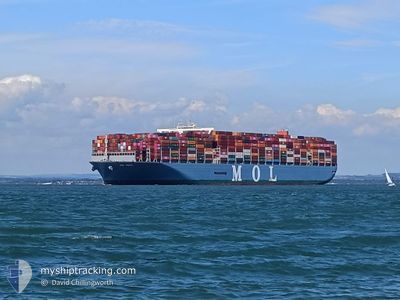
The vessel ONE TRUTH (IMO: 9773210, MMSI: 356984000) is a Cargo It's sailing under the flag of [PA] Panama.
In this page you can find informations about the vessels current position, last detected port calls, and current voyage information. If the vessels is not in coverage by AIS you will find the latest position.
The current position of ONE TRUTH is detected by our AIS receivers and we are not responsible for the reliability of the data. The last position was recorded while the vessel was in Coverage by the Ais receivers of our vessel tracking app.
The current draught of ONE TRUTH as reported by AIS is 12.2 meters
Weather
| Temperature | 2.1°C / 35.78°F |
|---|---|
| Wind Speed | 15 knots |
| Direction | 78° ENE |
| Pressure | 1021.6 hPa |
| Humidity | 72.5 % |
| Cloud Coverage | 100 % |
Featured Company
Last Port Calls
Last Trips
| Origin | Departure | Destination | Arrival | Distance | |
|---|---|---|---|---|---|
| 2025-11-28 06:24 | 2026-01-06 20:44 | 10947.78 nm | |||
| 2025-11-20 01:01 | 2025-11-26 18:19 | 1688.71 nm | |||
| 2025-11-16 10:30 | 2025-11-18 12:13 | 368.71 nm | |||
| 2025-11-05 22:10 | 2025-11-15 16:38 | 1459.35 nm | |||
| 2025-10-30 14:33 | 2025-11-05 03:22 | 1622.44 nm |
Events
| Time | Event | Details | Position / Dest | Info |
|---|---|---|---|---|
| 2026-01-10 18:03 | Detected in Sea | German part of the North Sea |
54.11007 / 6.04519
North Sea
DEHAM
|
Speed: 10.1 kn Course: 80.9° |
| 2026-01-10 17:57 | Status Changed | Under way using engine Default |
54.10774 / 6.01613
DEHAM
|
Speed: 10 kn Course: 80° |
| 2026-01-10 17:44 | IN Coverage |
54.10869 / 6.02724
North Sea
DEHAM
|
Speed: 10.2 kn Course: 81.5° |
|
| 2026-01-10 14:52 | Status Changed | Default Under way using engine |
53.85053 / 5.27008
DEHAM
|
Speed: 10.3 kn Course: 46.5° |
| 2026-01-10 14:47 | OUT of Coverage |
53.84008 / 5.25138
North Sea
DEHAM
|
Speed: 10.3 kn Course: 46.5° |
|
| 2026-01-10 12:03 | ETA Changed | 2026/01/11 00:15 2026/01/11 00:30 |
53.50175 / 4.73336
DEHAM
|
Speed: 10.3 kn Course: 25.1° |
| 2026-01-10 03:11 | Status Changed | Under way using engine Moored |
52.03961 / 3.92885
DEHAM
|
Speed: 7.7 kn Course: 339.7° |
| 2026-01-10 02:49 | ETA Changed | 2026/01/11 00:30 2026/01/23 02:00 |
52.01470 / 3.99371
DEHAM
|
Speed: 9.5 kn Course: 309.9° |
| 2026-01-10 02:12 | PORT DEPARTURE |
|
51.96279 / 4.08219
DEHAM
|
Speed: 5.7 kn Course: 54° |
| 2026-01-10 01:19 | START Moving |
51.95106 / 3.99334
[NL] MAASVLAKTE - ROTTERDAM
|
Speed: 3.2 kn Course: 35° |