
ONE TRUTH
Cargo
Current Trip
| Time Travelled | 18 days |
|---|---|
| Remaining Time | --- |
| Distance Travelled | 6907.68 nm |
| Remaining Distance | --- |
| AVG Speed | 14.9 Noeuds |
| MAX Speed | 18.8 Noeuds |
| AVG Wind | 11 knots |
| MAX Wind | 24 knots |
| MIN Temp | 16.6°C / 61.88°F |
| MAX Temp | 30.1°C / 86.18°F |
| Tirant d eau | 16 m |
| Position reçue | 2 d depuis |
Current Position
| Longitude | 13.37103° |
|---|---|
| Latitude | -30.24838° |
| Etat | Under way using engine |
| Vitesse | 15.6 Noeuds |
| Parcours | 319° |
| Zone | South Atlantic Ocean |
| Station | T-AIS |
| Position reçue | 2 d depuis |
Info
Information
The current position of ONE TRUTH is in South Atlantic Ocean with coordinates -30.24838° / 13.37103° as reported on 2024-04-20 23:58 by AIS to our vessel tracker app. The vessel's current speed is 15.6 Noeuds and is heading at the port of TANGER MED. The estimated time of arrival as calculated by MyShipTracking vessel tracking app is 2024-05-04 03:00 LT
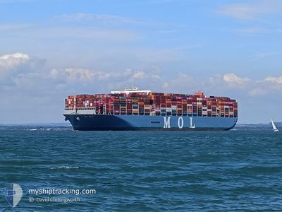
The vessel ONE TRUTH (IMO: 9773210, MMSI: 356984000) is a Cargo It's sailing under the flag of [PA] Panama.
In this page you can find informations about the vessels current position, last detected port calls, and current voyage information. If the vessels is not in coverage by AIS you will find the latest position.
The current position of ONE TRUTH is detected by our AIS receivers and we are not responsible for the reliability of the data. The last position was recorded while the vessel was in Coverage by the Ais receivers of our vessel tracking app.
The current draught of ONE TRUTH as reported by AIS is 16 meters
Weather
| Temperature | 22.8°C / 73.04°F |
|---|---|
| Wind Speed | 18 knots |
| Direction | 140° SE |
| Pressure | 1017 hPa |
| Humidity | 81.7 % |
| Cloud Coverage | 15 % |
Featured Company
Last Port Calls
Most Visited Ports (Last year)
| Port | Arrivals | |
|---|---|---|
| 8 | ||
| 4 | ||
| 4 | ||
| 4 | ||
| 4 | ||
| 3 |
Last Trips
| Origin | Departure | Destination | Arrival | Distance | |
|---|---|---|---|---|---|
| 2024-03-29 15:04 | 2024-04-03 15:53 | 1489.22 nm | |||
| 2024-03-27 22:32 | 2024-03-28 12:20 | 135.78 nm | |||
| 2024-03-17 20:25 | 2024-03-27 01:25 | 1544.34 nm | |||
| 2024-03-07 06:02 | 2024-03-15 22:15 | 2538.80 nm | |||
| 2024-01-29 21:46 | 2024-03-05 11:18 | 11222.62 nm |
Events
| Heure | Evenement | Détails | Position/ Destination | Info |
|---|---|---|---|---|
| 2024-04-21 00:02 | Etat Changé | Default Under way using engine |
-30.23580 / 13.35861
TANGIER MED
|
Vitesse: 15.6 kn Parcours: 319° |
| 2024-04-20 23:58 | Hors de la zone couverte |
-30.24838 / 13.37103
South Atlantic Ocean
TANGIER MED
|
Vitesse: 15.6 kn Parcours: 319° |
|
| 2024-04-20 23:41 | Changement de zone | Namibian part of the South Atlantic Ocean South African part of the South Atlantic Ocean |
-30.30515 / 13.42794
South Atlantic Ocean
TANGIER MED
|
Vitesse: 15.5 kn Parcours: 319.9° |
| 2024-04-20 23:41 | Etat Changé | Under way using engine Default |
-30.30554 / 13.42833
TANGIER MED
|
Vitesse: 15.5 kn Parcours: 319° |
| 2024-04-20 23:27 | Dans la zone couverte |
-30.30515 / 13.42794
South Atlantic Ocean
TANGIER MED
|
Vitesse: 15.5 kn Parcours: 319.9° |
|
| 2024-04-20 22:02 | Etat Changé | Default Under way using engine |
-30.62905 / 13.75178
TANGIER MED
|
Vitesse: 15.4 kn Parcours: 319.4° |
| 2024-04-20 21:58 | Hors de la zone couverte |
-30.63968 / 13.76243
South Atlantic Ocean
TANGIER MED
|
Vitesse: 15.4 kn Parcours: 319.4° |
|
| 2024-04-20 21:56 | Etat Changé | Under way using engine Default |
-30.64799 / 13.77070
TANGIER MED
|
Vitesse: 15.3 kn Parcours: 318° |
| 2024-04-20 21:37 | Dans la zone couverte |
-30.64644 / 13.76914
South Atlantic Ocean
TANGIER MED
|
Vitesse: 15.4 kn Parcours: 318.6° |
|
| 2024-04-20 02:17 | Hors de la zone couverte |
-34.36815 / 17.72692
South Atlantic Ocean
TANGIER MED
|
Vitesse: 15.4 kn Parcours: 315° |