
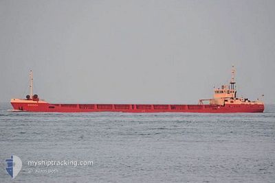
BLUE STAR
General Cargo
Current Trip
| Time Travelled | 2 days |
|---|---|
| Remaining Time | --- |
| Distance Travelled | 88.80 nm |
| Remaining Distance | --- |
| AVG Speed | 7.7 Knots |
| MAX Speed | 9.6 Knots |
| AVG Wind | 6.4 knots |
| MAX Wind | 15.7 knots |
| MIN Temp | 10.5°C / 50.9°F |
| MAX Temp | 20.6°C / 69.08°F |
| Draught | 2.6 m |
| Position Received | 3 m ago |
Current Position
| Longitude | 28.90521° |
|---|---|
| Latitude | 40.97361° |
| Status | At anchor |
| Speed | |
| Course | --- |
| Area | Sea of Marmara |
| Station | T-AIS |
| Position Received | 3 m ago |
Info
Information
The current position of BLUE STAR is in Sea of Marmara with coordinates 40.97361° / 28.90521° as reported on 2024-05-14 00:34 by AIS to our vessel tracker app. The vessel's current speed is 0 Knots
The vessel BLUE STAR (IMO: 8421705, MMSI: 373016000) is a General Cargo that was built in 1986 ( 38 years old ). It's sailing under the flag of [PA] Panama.
In this page you can find informations about the vessels current position, last detected port calls, and current voyage information. If the vessels is not in coverage by AIS you will find the latest position.
The current position of BLUE STAR is detected by our AIS receivers and we are not responsible for the reliability of the data. The last position was recorded while the vessel was in Coverage by the Ais receivers of our vessel tracking app.
The current draught of BLUE STAR as reported by AIS is 2.6 meters
Weather
| Temperature | 10°C / 50°F |
|---|---|
| Wind Speed | 3 knots |
| Direction | 47° NE |
| Pressure | 1018.6 hPa |
| Humidity | 74.8 % |
| Cloud Coverage | 4 % |
Featured Company
Last Port Calls
| Port | Arrival | Departure | Time In Port |
|---|---|---|---|
| 2024-05-09 22:47 | 2024-05-11 23:57 | 2 d | |
| 2024-04-28 13:18 | 2024-05-02 17:20 | 4 d | |
| 2024-04-17 19:18 | 2024-04-19 18:49 | 1 d | |
| 2024-04-03 14:06 | 2024-04-08 09:36 | 4 d | |
| 2024-03-08 11:26 | 2024-04-01 07:37 | 23 d | |
| 2024-03-05 18:03 | 2024-03-08 08:50 | 2 d |
Last Trips
| Origin | Departure | Destination | Arrival | Distance | |
|---|---|---|---|---|---|
| 2024-05-02 17:20 | 2024-05-09 22:47 | 379.31 nm | |||
| 2024-04-19 18:49 | 2024-04-28 13:18 | 365.71 nm | |||
| 2024-04-08 09:36 | 2024-04-17 19:18 | 300.10 nm | |||
| 2024-04-01 07:37 | 2024-04-03 14:06 | 164.80 nm | |||
| 2024-03-08 08:50 | 2024-03-08 11:26 | 19.02 nm | |||
| 2024-02-26 11:19 | 2024-03-05 18:03 | 504.84 nm |
Events
| Time | Event | Details | Position / Dest | Info |
|---|---|---|---|---|
| 2024-05-12 17:31 | Status Changed | At anchor Default |
40.97347 / 28.90615
SULINA
|
Speed: 0.2 kn Course: -1° |
| 2024-05-12 17:25 | Status Changed | Default At anchor |
40.97346 / 28.90610
SULINA
|
Speed: 0.1 kn Course: 511° |
| 2024-05-12 13:40 | STOP Moving | 0.69 nm, East of ZEYTINBURNU |
40.97508 / 28.90709
SULINA
|
Speed: Course: 220° |
| 2024-05-12 13:31 | Status Changed | At anchor Under way using engine |
40.97481 / 28.90691
SULINA
|
Speed: 1 kn Course: 217° |
| 2024-05-12 11:13 | START Moving | 1.11 nm, West of KARTAL |
40.87634 / 29.18057
SULINA
|
Speed: 5 kn Course: 187.3° |
| 2024-05-12 10:45 | Status Changed | Under way using engine At anchor |
40.87856 / 29.18155
SULINA
|
Speed: 0.1 kn Course: 234° |
| 2024-05-12 09:59 | Status Changed | At anchor Default |
40.87901 / 29.18074
SULINA
|
Speed: Course: 188° |
| 2024-05-12 09:50 | Status Changed | Default At anchor |
40.87893 / 29.18076
SULINA
|
Speed: Course: 185° |
| 2024-05-12 09:32 | Status Changed | At anchor Default |
40.87894 / 29.18045
SULINA
|
Speed: Course: 174° |
| 2024-05-12 09:26 | Status Changed | Default At anchor |
40.87894 / 29.18052
SULINA
|
Speed: Course: 172° |