
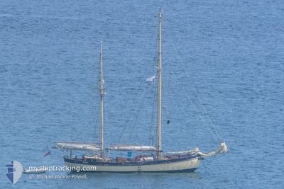
MAYBE
Pleasure Craft
Current Trip
Unknown
| Time Travelled | 16 days |
|---|---|
| Remaining Time | --- |
| Distance Travelled | 408.33 nm |
| Remaining Distance | --- |
| AVG Speed | 5.5 Knots |
| MAX Speed | 8.7 Knots |
| AVG Wind | 6.4 knots |
| MAX Wind | 13 knots |
| MIN Temp | 4.8°C / 40.64°F |
| MAX Temp | 16.7°C / 62.06°F |
| Draught | 0 m |
| Position Received | 1 d ago |
Current Position
| Longitude | -5.14784° |
|---|---|
| Latitude | 54.39059° |
| Status | Default |
| Speed | 7.6 Knots |
| Course | 148.7° |
| Area | Irish Sea and St. George's Channel |
| Station | T-AIS |
| Position Received | 1 d ago |
Info
Information
The current position of MAYBE is in Irish Sea and St. George's Channel with coordinates 54.39059° / -5.14784° as reported on 2024-05-11 09:51 by AIS to our vessel tracker app. The vessel's current speed is 7.6 Knots
The vessel MAYBE (MMSI: 235062552) is a Pleasure Craft It's sailing under the flag of [GB] United Kingdom.
In this page you can find informations about the vessels current position, last detected port calls, and current voyage information. If the vessels is not in coverage by AIS you will find the latest position.
The current position of MAYBE is detected by our AIS receivers and we are not responsible for the reliability of the data. The last position was recorded while the vessel was in Coverage by the Ais receivers of our vessel tracking app.
Weather
| Temperature | 11.4°C / 52.52°F |
|---|---|
| Wind Speed | 4 knots |
| Direction | 124° SE |
| Pressure | 1020.3 hPa |
| Humidity | 87.7 % |
| Cloud Coverage | 63 % |
Featured Company
Last Port Calls
| Port | Arrival | Departure | Time In Port |
|---|---|---|---|
| 2024-04-26 15:04 | 2024-04-26 20:14 | 5 h | |
| 2024-04-19 13:14 | 2024-04-23 07:06 | 3 d | |
| 2024-04-14 15:56 | 2024-04-16 10:59 | 1 d | |
| 2024-04-13 06:05 | |||
| 2024-04-05 00:35 | 2024-04-08 14:08 | 3 d | |
| 2024-03-28 17:14 | 2024-03-29 15:01 | 21 h | |
| 2024-03-20 15:56 | 2024-03-26 08:00 | 5 d | |
| 2024-03-18 12:08 | 2024-03-19 14:32 | 1 d |
Last Trips
| Origin | Departure | Destination | Arrival | Distance | |
|---|---|---|---|---|---|
| 2024-04-23 07:06 | 2024-04-26 15:04 | 127.15 nm | |||
| 2024-04-16 10:59 | 2024-04-19 13:14 | 132.03 nm | |||
| 2024-04-13 06:05 | 2024-04-14 15:56 | 101.50 nm | |||
| 2024-03-29 15:01 | 2024-04-05 00:35 | 124.23 nm | |||
| 2024-03-26 08:00 | 2024-03-28 17:14 | 109.24 nm | |||
| 2024-03-19 14:32 | 2024-03-20 15:56 | 114.68 nm | |||
| 2024-02-19 15:58 | 2024-03-18 12:08 | 932.84 nm |
Events
| Time | Event | Details | Position / Dest | Info |
|---|---|---|---|---|
| 2024-05-11 09:51 | OUT of Coverage |
54.39059 / -5.14784
Irish Sea and St. George's Channel
|
Speed: 7.6 kn Course: 148.7° |
|
| 2024-05-11 09:06 | Change Sea Area | United Kingdom part of the Irish Sea and St. George's Channel United Kingdom part of the Inner Seas off the West Coast of Scotland |
54.46281 / -5.25100
Irish Sea and St. George's Channel
|
Speed: 7.2 kn Course: 138.4° |
| 2024-05-11 06:02 | START Moving | 0.95 nm, West of GROOMSPORT |
54.67362 / -5.64546
|
Speed: 5.4 kn Course: 19.3° |
| 2024-05-10 12:16 | STOP Moving | 0.92 nm, North East of BANGOR |
54.67218 / -5.64833
|
Speed: 0.2 kn Course: 511° |
| 2024-05-10 10:01 | IN Coverage |
54.84787 / -5.69397
Inner Seas off the West Coast of Scotland
|
Speed: 6.5 kn Course: 155.7° |
|
| 2024-05-09 19:44 | OUT of Coverage |
55.09454 / -6.00279
Inner Seas off the West Coast of Scotland
|
Speed: 7.2 kn Course: 223.6° |
|
| 2024-05-09 17:59 | IN Coverage |
55.25258 / -5.82043
Inner Seas off the West Coast of Scotland
|
Speed: 6.2 kn Course: 201.5° |
|
| 2024-05-09 15:28 | OUT of Coverage |
55.53131 / -5.83064
Inner Seas off the West Coast of Scotland
|
Speed: 5.4 kn Course: 185.4° |
|
| 2024-05-09 13:13 | IN Coverage |
55.72704 / -5.74271
Inner Seas off the West Coast of Scotland
|
Speed: 4.6 kn Course: 231.4° |
|
| 2024-05-09 05:55 | OUT of Coverage |
55.72613 / -5.73167
Inner Seas off the West Coast of Scotland
|
Speed: Course: 270.9° |