
MAYBE
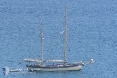
Pleasure Craft
Current Trip
Unknown
| Time Travelled | 2 days |
|---|---|
| Remaining Time | --- |
| Distance Travelled | 109.00 nm |
| Remaining Distance | --- |
| AVG Speed | 6.2 Noeuds |
| MAX Speed | 12.6 Noeuds |
| AVG Wind | 7.1 knots |
| MAX Wind | 16 knots |
| MIN Temp | 5.3°C / 41.54°F |
| MAX Temp | 9.3°C / 48.74°F |
| Tirant d eau | 0 m |
| Position reçue | 3 m depuis |
Current Position
| Longitude | -6.03224° |
|---|---|
| Latitude | 53.48506° |
| Etat | Default |
| Vitesse | |
| Parcours | --- |
| Zone | Irish Sea and St. George's Channel |
| Station | T-AIS |
| Position reçue | 3 m depuis |
Info
Information
The current position of MAYBE is in Irish Sea and St. George's Channel with coordinates 53.48506° / -6.03224° as reported on 2024-04-25 17:45 by AIS to our vessel tracker app. The vessel's current speed is 0 Noeuds
The vessel MAYBE (MMSI: 235062552) is a Pleasure Craft It's sailing under the flag of [GB] United Kingdom.
In this page you can find informations about the vessels current position, last detected port calls, and current voyage information. If the vessels is not in coverage by AIS you will find the latest position.
The current position of MAYBE is detected by our AIS receivers and we are not responsible for the reliability of the data. The last position was recorded while the vessel was in Coverage by the Ais receivers of our vessel tracking app.
Weather
| Temperature | 7.3°C / 45.14°F |
|---|---|
| Wind Speed | 12 knots |
| Direction | 72° ENE |
| Pressure | 1003.1 hPa |
| Humidity | 82 % |
| Cloud Coverage | 100 % |
Featured Company
Last Port Calls
| Port | Arrival | Departure | Time In Port |
|---|---|---|---|
| 2024-04-19 12:14 | 2024-04-23 06:06 | 3 d | |
| 2024-04-14 14:56 | 2024-04-16 09:59 | 1 d | |
| 2024-04-13 05:05 | |||
| 2024-04-04 23:35 | 2024-04-08 13:08 | 3 d | |
| 2024-03-28 17:14 | 2024-03-29 15:01 | 21 h | |
| 2024-03-20 15:56 | 2024-03-26 08:00 | 5 d | |
| 2024-03-18 12:08 | 2024-03-19 14:32 | 1 d | |
| 2024-02-19 15:58 |
Last Trips
| Origin | Departure | Destination | Arrival | Distance | |
|---|---|---|---|---|---|
| 2024-04-16 10:59 | 2024-04-19 13:14 | 132.03 nm | |||
| 2024-04-13 06:05 | 2024-04-14 15:56 | 101.50 nm | |||
| 2024-03-29 15:01 | 2024-04-05 00:35 | 124.23 nm | |||
| 2024-03-26 08:00 | 2024-03-28 17:14 | 109.24 nm | |||
| 2024-03-19 14:32 | 2024-03-20 15:56 | 114.68 nm | |||
| 2024-02-19 15:58 | 2024-03-18 12:08 | 932.84 nm |
Events
| Heure | Evenement | Détails | Position/ Destination | Info |
|---|---|---|---|---|
| 2024-04-25 15:13 | Arret | 5.78 nm, North of HOWTH |
53.48483 / -6.03243
|
Vitesse: 0.3 kn Parcours: 511° |
| 2024-04-25 12:11 | Detecté en mer | Irish part of the Irish Sea and St. George's Channel |
53.74891 / -5.95599
Irish Sea and St. George's Channel
|
Vitesse: 5.4 kn Parcours: 183.7° |
| 2024-04-25 12:11 | Dans la zone couverte |
53.74891 / -5.95599
Irish Sea and St. George's Channel
|
Vitesse: 5.4 kn Parcours: 183.7° |
|
| 2024-04-25 07:20 | Hors de la zone couverte |
54.14894 / -5.62017
Irish Sea and St. George's Channel
|
Vitesse: 6.8 kn Parcours: 202.8° |
|
| 2024-04-25 05:10 | Démarrage | 0.5 nm, West of PORTAFERRY |
54.38170 / -5.56423
|
Vitesse: 6.9 kn Parcours: 96.3° |
| 2024-04-24 18:33 | Arret | 0.59 nm, West of PORTAFERRY |
54.38038 / -5.56710
|
Vitesse: 0.3 kn Parcours: 511° |
| 2024-04-24 16:57 | Démarrage | 3.44 nm, East of WHITEROCK |
54.48987 / -5.54841
|
Vitesse: 4.1 kn Parcours: 194° |
| 2024-04-24 12:37 | Arret | 3.53 nm, East of WHITEROCK |
54.49142 / -5.54612
|
Vitesse: 0.3 kn Parcours: 511° |
| 2024-04-24 11:10 | Démarrage | 0.58 nm, West of PORTAFERRY |
54.38212 / -5.56634
|
Vitesse: 4.8 kn Parcours: 323.1° |
| 2024-04-23 11:11 | Arret | 0.52 nm, West of PORTAFERRY |
54.37985 / -5.56514
|
Vitesse: Parcours: 511° |