
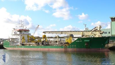
MARINUS G
Trailing Suction Hopper Dredger
Current Trip
| Time Travelled | 21 h, 43 mins |
|---|---|
| Remaining Time | 3 h, 45 mins |
| Distance Travelled | 179.94 nm |
| Remaining Distance | 46.24 nm |
| AVG Speed | 11 Knots |
| MAX Speed | 14.7 Knots |
| AVG Wind | 7.7 knots |
| MAX Wind | 15.5 knots |
| MIN Temp | 2°C / 35.6°F |
| MAX Temp | 8.4°C / 47.12°F |
| Draught | 7 m |
| Position Received | 2 h, 15 m ago |
Current Position
| Longitude | 5.92511° |
|---|---|
| Latitude | 53.57283° |
| Status | Under way using engine |
| Speed | 11.3 Knots |
| Course | 77.4° |
| Area | North Sea |
| Station | T-AIS |
| Position Received | 2 h, 15 m ago |
Info
Information
The current position of MARINUS G is in North Sea with coordinates 53.57283° / 5.92511° as reported on 2024-04-26 10:21 by AIS to our vessel tracker app. The vessel's current speed is 11.3 Knots and is heading at the port of AMELAND. The estimated time of arrival as calculated by MyShipTracking vessel tracking app is 2024-04-26 16:22 LT
The vessel MARINUS G (IMO: 9566318, MMSI: 244130717) is a Trailing Suction Hopper Dredger that was built in 2010 ( 14 years old ). It's sailing under the flag of [NL] Netherlands.
In this page you can find informations about the vessels current position, last detected port calls, and current voyage information. If the vessels is not in coverage by AIS you will find the latest position.
The current position of MARINUS G is detected by our AIS receivers and we are not responsible for the reliability of the data. The last position was recorded while the vessel was in Coverage by the Ais receivers of our vessel tracking app.
The current draught of MARINUS G as reported by AIS is 7 meters
Weather
| Temperature | 7.7°C / 45.86°F |
|---|---|
| Wind Speed | 11 knots |
| Direction | 276° W |
| Pressure | 1003.1 hPa |
| Humidity | 69.8 % |
| Cloud Coverage | 24 % |
Featured Company
Last Port Calls
| Port | Arrival | Departure | Time In Port |
|---|---|---|---|
| 2024-04-25 04:48 | 2024-04-25 14:54 | 10 h | |
| 2024-04-11 15:39 | 2024-04-11 16:48 | 1 h | |
| 2024-04-11 14:32 | 2024-04-11 15:35 | 1 h | |
| 2024-04-11 13:34 | 2024-04-11 14:28 | 54 m | |
| 2024-04-11 12:33 | 2024-04-11 13:29 | 56 m | |
| 2024-04-11 09:53 | 2024-04-11 12:29 | 2 h | |
| 2024-04-11 07:36 | 2024-04-11 09:50 | 2 h | |
| 2024-04-11 06:14 | 2024-04-11 07:22 | 1 h | |
| 2024-04-11 04:53 | 2024-04-11 06:11 | 1 h | |
| 2024-04-11 03:08 | 2024-04-11 04:49 | 1 h |
Last Trips
| Origin | Departure | Destination | Arrival | Distance | |
|---|---|---|---|---|---|
| 2024-04-11 18:48 | 2024-04-25 06:48 | 1646.36 nm | |||
| 2024-04-11 17:35 | 2024-04-11 17:39 | 0.65 nm | |||
| 2024-04-11 16:28 | 2024-04-11 16:32 | 0.50 nm | |||
| 2024-04-11 15:29 | 2024-04-11 15:34 | 0.46 nm | |||
| 2024-04-11 14:29 | 2024-04-11 14:33 | 0.49 nm | |||
| 2024-04-11 11:50 | 2024-04-11 11:53 | 0.39 nm | |||
| 2024-04-11 09:22 | 2024-04-11 09:36 | 0.95 nm | |||
| 2024-04-11 08:11 | 2024-04-11 08:14 | 0.37 nm | |||
| 2024-04-11 06:49 | 2024-04-11 06:53 | 0.44 nm | |||
| 2024-04-11 05:03 | 2024-04-11 05:08 | 0.45 nm |
Events
| Time | Event | Details | Position / Dest | Info |
|---|---|---|---|---|
| 2024-04-26 10:34 | Status Changed | Default Under way using engine |
53.58167 / 5.99094
NLAML-NLDLZ
|
Speed: 11.3 kn Course: 77.4° |
| 2024-04-26 10:21 | OUT of Coverage |
53.57283 / 5.92511
North Sea
NLAML-NLDLZ
|
Speed: 11.3 kn Course: 77.4° |
|
| 2024-04-26 09:40 | Status Changed | Under way using engine Restricted manoeuverability |
53.55432 / 5.76993
NLAML-NLDLZ
|
Speed: 2.7 kn Course: 511° |
| 2024-04-26 09:40 | Draught Changed | 7 4.4 |
53.55423 / 5.76933
NLAML-NLDLZ
|
Speed: 2.7 kn Course: 511° |
| 2024-04-26 07:45 | Status Changed | Restricted manoeuverability Under way using engine |
53.56967 / 5.82125
NLAML-NLDLZ
|
Speed: 1.9 kn Course: 511° |
| 2024-04-26 06:04 | Status Changed | Under way using engine Default |
53.60957 / 6.27687
NLAML-NLDLZ
|
Speed: 10.7 kn Course: 262° |
| 2024-04-26 05:56 | IN Coverage |
53.60957 / 6.27687
North Sea
NLAML-NLDLZ
|
Speed: 10.5 kn Course: 257.7° |
|
| 2024-04-26 04:25 | Status Changed | Default Under way using engine |
53.51301 / 6.78252
NLAML-NLDLZ
|
Speed: 12.5 kn Course: 318.5° |
| 2024-04-26 04:19 | OUT of Coverage |
53.50052 / 6.80785
North Sea
NLAML-NLDLZ
|
Speed: 12.5 kn Course: 318.5° |
|
| 2024-04-26 03:32 | ETA Changed | 2024/04/26 15:00 2024/04/26 14:00 |
53.35894 / 6.98242
NLAML-NLDLZ
|
Speed: 14.4 kn Course: 342.1° |