
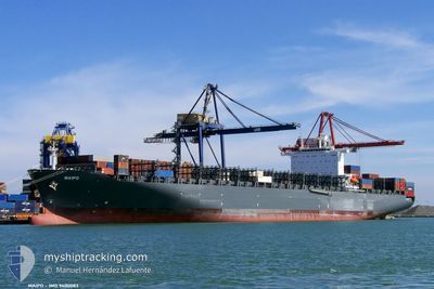
MAIPO
Container Ship
Current Trip
ZA NGQ
| Time Travelled | 5 days |
|---|---|
| Remaining Time | --- |
| Distance Travelled | 393.34 nm |
| Remaining Distance | --- |
| AVG Speed | 13.8 Knots |
| MAX Speed | 19.2 Knots |
| AVG Wind | 8.2 knots |
| MAX Wind | 25 knots |
| MIN Temp | 17.9°C / 64.22°F |
| MAX Temp | 24.3°C / 75.74°F |
| Draught | 8.2 m |
| Position Received | 5 d ago |
Current Position
| Longitude | --- |
|---|---|
| Latitude | --- |
| Status | Under way using engine |
| Speed | 14.9 Knots |
| Course | 201.1° |
| Area | Indian Ocean |
| Station | T-AIS |
| Position Received | 5 d ago |
Info
Information
The current position of MAIPO is in Indian Ocean with coordinates -30.08402° / 31.08604° as reported on 2025-12-31 19:46 by AIS to our vessel tracker app. The vessel's current speed is 14.9 Knots
The vessel MAIPO (IMO: 9400083, MMSI: 636092848) is a Container Ship that was built in 2010 ( 16 years old ). It's sailing under the flag of [LR] Liberia.
In this page you can find informations about the vessels current position, last detected port calls, and current voyage information. If the vessels is not in coverage by AIS you will find the latest position.
The current position of MAIPO is detected by our AIS receivers and we are not responsible for the reliability of the data. The last position was recorded while the vessel was in Coverage by the Ais receivers of our vessel tracking app.
The current draught of MAIPO as reported by AIS is 8.2 meters
Weather
| Temperature | 19.9°C / 67.82°F |
|---|---|
| Wind Speed | 3 knots |
| Direction | 165° SSE |
| Pressure | 1007 hPa |
| Humidity | 87.4 % |
| Cloud Coverage | 100 % |
Featured Company
Last Port Calls
Last Trips
| Origin | Departure | Destination | Arrival | Distance | |
|---|---|---|---|---|---|
| 2025-12-18 00:09 | 2025-12-29 14:23 | 4905.14 nm | |||
| 2025-12-13 18:42 | 2025-12-17 12:03 | 241.52 nm | |||
| 2025-12-08 19:41 | 2025-12-13 01:49 | 1496.97 nm | |||
| 2025-12-03 09:37 | 2025-12-08 12:25 | 974.60 nm | |||
| 2025-09-09 06:03 | 2025-12-02 22:01 | 425.40 nm |
Events
| Time | Event | Details | Position / Dest | Info |
|---|---|---|---|---|
| 2026-01-04 01:25 | STOP Moving | 5.3 nm, South East of COEGA |
-33.84521 / 25.78692
ZA NGQ
|
Speed: 0.2 kn Course: 161° |
| 2026-01-04 01:11 | START Moving | 5.31 nm, South East of COEGA |
-33.84509 / 25.78730
ZA NGQ
|
Speed: 3.1 kn Course: 167° |
| 2026-01-02 07:11 | STOP Moving | 5.26 nm, South East of COEGA |
-33.84642 / 25.78545
ZA NGQ
|
Speed: 0.3 kn Course: 115° |
| 2026-01-02 03:32 | START Moving | 20.73 nm, South East of COEGA |
-33.93923 / 26.07521
ZA NGQ
|
Speed: 3.5 kn Course: 290° |
| 2026-01-01 21:08 | STOP Moving |
-33.96757 / 26.19902
ZA NGQ
|
Speed: 0.2 kn Course: 201° |
|
| 2026-01-01 20:13 | START Moving |
-33.97303 / 26.21487
ZA NGQ
|
Speed: 3.3 kn Course: 201° |
|
| 2026-01-01 18:09 | STOP Moving |
-33.97926 / 26.24848
ZA NGQ
|
Speed: 0.3 kn Course: 209° |
|
| 2025-12-31 19:48 | Status Changed | Default Under way using engine |
-30.08913 / 31.08415
ZA NGQ
|
Speed: 14.9 kn Course: 201.1° |
| 2025-12-31 19:46 | OUT of Coverage |
-30.08402 / 31.08604
Indian Ocean
ZA NGQ
|
Speed: 14.9 kn Course: 201.1° |
|
| 2025-12-31 18:19 | PORT DEPARTURE |
|
-29.86731 / 31.05927
ZA NGQ
|
Speed: 7.8 kn Course: 36° |