
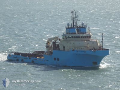
SKANDI HANDLER
Anchor Handling Vessel
Current Trip
GABET
| Time Travelled | 23 h, 35 mins |
|---|---|
| Remaining Time | --- |
| Distance Travelled | 193.36 nm |
| Remaining Distance | --- |
| AVG Speed | 9.3 Knots |
| MAX Speed | 13.1 Knots |
| AVG Wind | 13.9 knots |
| MAX Wind | 22.8 knots |
| MIN Temp | 0.5°C / 32.9°F |
| MAX Temp | 2.7°C / 36.86°F |
| Draught | 5.6 m |
| Position Received | 2 m ago |
Current Position
| Longitude | --- |
|---|---|
| Latitude | --- |
| Status | At anchor |
| Speed | 0.5 Knots |
| Course | 339° |
| Area | Kattegat |
| Station | T-AIS |
| Position Received | 2 m ago |
Info
Information
The current position of SKANDI HANDLER is in Kattegat with coordinates 55.59195° / 10.48623° as reported on 2025-03-14 06:47 by AIS to our vessel tracker app. The vessel's current speed is 0.5 Knots
The vessel SKANDI HANDLER (IMO: 9246724, MMSI: 219025390) is a Anchor Handling Vessel that was built in 2002 ( 23 years old ). It's sailing under the flag of [DK] Denmark.
In this page you can find informations about the vessels current position, last detected port calls, and current voyage information. If the vessels is not in coverage by AIS you will find the latest position.
The current position of SKANDI HANDLER is detected by our AIS receivers and we are not responsible for the reliability of the data. The last position was recorded while the vessel was in Coverage by the Ais receivers of our vessel tracking app.
The current draught of SKANDI HANDLER as reported by AIS is 5.6 meters
Weather
| Temperature | 1.8°C / 35.24°F |
|---|---|
| Wind Speed | 12 knots |
| Direction | 19° NNE |
| Pressure | 1005 hPa |
| Humidity | 73.7 % |
| Cloud Coverage | 98 % |
Featured Company
Last Port Calls
| Port | Arrival | Departure | Time In Port |
|---|---|---|---|
| 2025-02-20 08:05 | 2025-03-13 08:14 | 21 d | |
| 2025-02-06 21:56 | 2025-02-16 18:14 | 9 d | |
| 2025-01-13 21:00 | 2025-02-03 00:11 | 20 d | |
| 2025-01-09 13:10 | 2025-01-09 22:26 | 9 h | |
| 2025-01-09 00:25 |
Most Visited Ports (Last year)
| Port | Arrivals | |
|---|---|---|
| 12 | ||
| 10 | ||
| 3 | ||
| 2 | ||
| 1 | ||
| 1 |
Last Trips
| Origin | Departure | Destination | Arrival | Distance | |
|---|---|---|---|---|---|
| 2025-02-16 18:14 | 2025-02-20 08:05 | 429.89 nm | |||
| 2025-02-03 00:11 | 2025-02-06 21:56 | 279.09 nm | |||
| 2025-01-09 22:26 | 2025-01-13 21:00 | 277.57 nm | |||
| 2025-01-09 00:25 | 2025-01-09 13:10 | 87.19 nm |
Events
| Time | Event | Details | Position / Dest | Info |
|---|---|---|---|---|
| 2025-03-14 03:04 | Status Changed | At anchor Under way using engine |
55.59190 / 10.48748
GABET
|
Speed: Course: 357° |
| 2025-03-14 02:50 | STOP Moving | 6.97 nm, North of KLINTEBJERG |
55.59220 / 10.48752
GABET
|
Speed: 0.3 kn Course: 15° |
| 2025-03-13 14:04 | Change Sea Area | Danish part of the Kattegat Swedish part of the Kattegat |
57.21749 / 11.58419
Kattegat
GABET
|
Speed: 12.3 kn Course: 164.8° |
| 2025-03-13 12:40 | Change Sea Area | Swedish part of the Kattegat Danish part of the Kattegat |
57.47457 / 11.37847
Kattegat
GABET
|
Speed: 11.9 kn Course: 140.4° |
| 2025-03-13 10:34 | Change Sea Area | Danish part of the Kattegat Danish part of the Skaggerak |
57.77342 / 10.86252
Kattegat
GABET
|
Speed: 12.4 kn Course: 130.3° |
| 2025-03-13 07:14 | PORT DEPARTURE |
|
57.60033 / 9.95822
GABET
|
Speed: 6.2 kn Course: 7° |
| 2025-03-13 07:06 | Status Changed | Under way using engine Moored |
57.59362 / 9.97220
[DK] HIRTSHALS
|
Speed: 3.7 kn Course: 313° |
| 2025-03-13 07:06 | START Moving |
57.59362 / 9.97220
[DK] HIRTSHALS
|
Speed: 3.8 kn Course: 313° |
|
| 2025-03-13 06:38 | Draught Changed | 5.6 5.8 |
57.59252 / 9.97497
[DK] HIRTSHALS
|
Speed: Course: 314° |
| 2025-03-13 06:38 | ETA Changed | 2025/03/17 07:30 2025/03/15 07:30 |
57.59252 / 9.97497
[DK] HIRTSHALS
|
Speed: Course: 314° |