
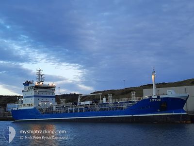
LOTUS
Oil/Chemical Tanker
Current Trip
| Time Travelled | 1 day |
|---|---|
| Remaining Time | --- |
| Distance Travelled | 274.42 nm |
| Remaining Distance | 221.10 nm |
| AVG Speed | 10.8 Knots |
| MAX Speed | 10.8 Knots |
| AVG Wind | 14.2 knots |
| MAX Wind | 19.3 knots |
| MIN Temp | 6.6°C / 43.88°F |
| MAX Temp | 9.2°C / 48.56°F |
| Draught | 6 m |
| Position Received | 15 h, 46 m ago |
Current Position
| Longitude | --- |
|---|---|
| Latitude | --- |
| Status | Under way using engine |
| Speed | 10.4 Knots |
| Course | 47° |
| Area | North Sea |
| Station | T-AIS |
| Position Received | 15 h, 46 m ago |
Info
Information
The current position of LOTUS is in North Sea with coordinates 53.57070° / 4.82982° as reported on 2025-12-05 04:33 by AIS to our vessel tracker app. The vessel's current speed is 10.4 Knots and is heading at the port of AALBORG. The estimated time of arrival as calculated by MyShipTracking vessel tracking app is 2025-12-03 20:00 LT
The vessel LOTUS (IMO: 9297137, MMSI: 266473000) is a Oil/Chemical Tanker that was built in 2004 ( 21 years old ). It's sailing under the flag of [SE] Sweden.
In this page you can find informations about the vessels current position, last detected port calls, and current voyage information. If the vessels is not in coverage by AIS you will find the latest position.
The current position of LOTUS is detected by our AIS receivers and we are not responsible for the reliability of the data. The last position was recorded while the vessel was in Coverage by the Ais receivers of our vessel tracking app.
The current draught of LOTUS as reported by AIS is 6 meters
Weather
| Temperature | 6.6°C / 43.88°F |
|---|---|
| Wind Speed | 14 knots |
| Direction | 144° SE |
| Pressure | 1008.8 hPa |
| Humidity | 78 % |
| Cloud Coverage | 100 % |
Featured Company
Last Port Calls
| Port | Arrival | Departure | Time In Port |
|---|---|---|---|
| 2025-12-03 23:13 | 2025-12-04 20:09 | 20 h | |
| 2025-12-03 21:32 | 2025-12-03 22:01 | 28 m | |
| 2025-12-01 09:57 | 2025-12-02 13:13 | 1 d | |
| 2025-11-30 16:29 | 2025-12-01 06:01 | 13 h | |
| 2025-11-29 08:23 | 2025-11-30 00:57 | 16 h | |
| 2025-11-27 07:12 | 2025-11-27 15:37 | 8 h | |
| 2025-11-26 03:54 | 2025-11-26 12:02 | 8 h | |
| 2025-11-19 19:45 | 2025-11-20 17:48 | 22 h | |
| 2025-11-16 17:05 | 2025-11-17 18:32 | 1 d | |
| 2025-11-14 10:40 | 2025-11-14 23:47 | 13 h |
Last Trips
| Origin | Departure | Destination | Arrival | Distance | |
|---|---|---|---|---|---|
| 2025-12-03 22:01 | 2025-12-03 23:13 | 7.59 nm | |||
| 2025-12-02 13:13 | 2025-12-03 21:32 | 321.82 nm | |||
| 2025-12-01 06:01 | 2025-12-01 09:57 | 34.37 nm | |||
| 2025-11-30 00:57 | 2025-11-30 16:29 | 151.07 nm | |||
| 2025-11-27 15:37 | 2025-11-29 08:23 | 332.86 nm | |||
| 2025-11-26 12:02 | 2025-11-27 07:12 | 205.94 nm | |||
| 2025-11-20 17:48 | 2025-11-26 03:54 | 249.98 nm | |||
| 2025-11-17 18:32 | 2025-11-19 19:45 | 438.93 nm | |||
| 2025-11-14 23:47 | 2025-11-16 17:05 | 89.00 nm | |||
| 2025-11-14 09:37 | 2025-11-14 10:40 | 7.27 nm |
Events
| Time | Event | Details | Position / Dest | Info |
|---|---|---|---|---|
| 2025-12-05 04:41 | Status Changed | Default Under way using engine |
53.59170 / 4.84337
DKAAL
|
Speed: 10.4 kn Course: 47° |
| 2025-12-05 04:33 | OUT of Coverage |
53.57070 / 4.82982
North Sea
|
Speed: 10.4 kn Course: 47° |
|
| 2025-12-05 04:33 | Status Changed | Under way using engine Default |
53.57020 / 4.82915
DKAAL
|
Speed: 11 kn Course: 20° |
| 2025-12-05 04:09 | Status Changed | Default Under way using engine |
53.50358 / 4.78303
DKAAL
|
Speed: 10.6 kn Course: 23° |
| 2025-12-04 23:05 | Status Changed | Under way using engine Default |
52.60217 / 4.09310
DKAAL
|
Speed: 11.2 kn Course: 336° |
| 2025-12-04 22:49 | Status Changed | Default Under way using engine |
52.55515 / 4.12622
DKAAL
|
Speed: 11.4 kn Course: 300° |
| 2025-12-04 21:08 | START Moving | 0.62 nm, East of IJMUIDEN |
52.46778 / 4.60430
DKAAL
|
Speed: 3.4 kn Course: 277° |
| 2025-12-04 20:34 | STOP Moving | 0.73 nm, East of IJMUIDEN |
52.46762 / 4.60730
DKAAL
|
Speed: 0.3 kn Course: 274° |
| 2025-12-04 19:40 | Status Changed | Under way using engine Moored |
52.43240 / 4.73268
DKAAL
|
Speed: 8.1 kn Course: 282° |
| 2025-12-04 19:09 | PORT DEPARTURE |
|
52.41812 / 4.84228
DKAAL
|
Speed: 5.4 kn Course: 291° |