
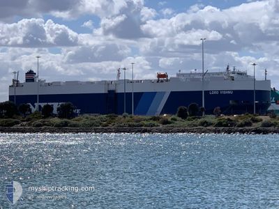
LORD VISHNU
Vehicles Carrier
Current Trip
| Time Travelled | 1 day |
|---|---|
| Remaining Time | 1 day |
| Distance Travelled | 434.52 nm |
| Remaining Distance | 674.46 nm |
| AVG Speed | 15.8 Knots |
| MAX Speed | 18.4 Knots |
| AVG Wind | 11.2 knots |
| MAX Wind | 15.8 knots |
| MIN Temp | 23.2°C / 73.76°F |
| MAX Temp | 24.6°C / 76.28°F |
| Draught | 8.6 m |
| Position Received | 1 d ago |
Current Position
| Longitude | 121.70031° |
|---|---|
| Latitude | 25.57946° |
| Status | Under way using engine |
| Speed | 16.9 Knots |
| Course | 55.7° |
| Area | Eastern China Sea |
| Station | T-AIS |
| Position Received | 1 d ago |
Info
Information
The current position of LORD VISHNU is in Eastern China Sea with coordinates 25.57946° / 121.70031° as reported on 2024-05-17 14:52 by AIS to our vessel tracker app. The vessel's current speed is 16.9 Knots and is heading at the port of NAGOYA. The estimated time of arrival as calculated by MyShipTracking vessel tracking app is 2024-05-20 14:44 LT
The vessel LORD VISHNU (IMO: 9367578, MMSI: 352002881) is a Vehicles Carrier that was built in 2008 ( 16 years old ). It's sailing under the flag of [PA] Panama.
In this page you can find informations about the vessels current position, last detected port calls, and current voyage information. If the vessels is not in coverage by AIS you will find the latest position.
The current position of LORD VISHNU is detected by our AIS receivers and we are not responsible for the reliability of the data. The last position was recorded while the vessel was in Coverage by the Ais receivers of our vessel tracking app.
The current draught of LORD VISHNU as reported by AIS is 8.6 meters
Weather
| Temperature | 24.1°C / 75.38°F |
|---|---|
| Wind Speed | 15 knots |
| Direction | 126° SE |
| Pressure | 1012.7 hPa |
| Humidity | 80.7 % |
| Cloud Coverage | 68 % |
Featured Company
Last Port Calls
| Port | Arrival | Departure | Time In Port |
|---|---|---|---|
| 2024-05-17 16:05 | 2024-05-17 20:28 | 4 h | |
| 2024-05-11 04:56 | 2024-05-11 23:00 | 18 h | |
| 2024-04-26 14:13 | 2024-04-29 17:17 | 3 d | |
| 2024-04-24 10:54 | 2024-04-25 00:35 | 13 h | |
| 2024-04-09 05:05 | 2024-04-10 14:37 | 1 d | |
| 2024-03-20 11:28 | 2024-03-22 15:11 | 2 d | |
| 2024-03-18 04:33 | 2024-03-18 17:20 | 12 h | |
| 2024-03-04 12:53 | 2024-03-04 20:25 | 7 h |
Most Visited Ports (Last year)
| Port | Arrivals | |
|---|---|---|
| 20 | ||
| 10 | ||
| 2 | ||
| 2 | ||
| 2 | ||
| 1 |
Last Trips
| Origin | Departure | Destination | Arrival | Distance | |
|---|---|---|---|---|---|
| 2024-05-11 23:00 | 2024-05-17 16:05 | 1926.80 nm | |||
| 2024-04-29 17:17 | 2024-05-11 04:56 | 4631.45 nm | |||
| 2024-04-25 00:35 | 2024-04-26 14:13 | 552.89 nm | |||
| 2024-04-10 14:37 | 2024-04-24 10:54 | 5023.10 nm | |||
| 2024-03-22 15:11 | 2024-04-09 05:05 | 4672.87 nm | |||
| 2024-03-18 17:20 | 2024-03-20 11:28 | 562.33 nm | |||
| 2024-03-04 20:25 | 2024-03-18 04:33 | 4203.42 nm | |||
| 2024-02-17 12:47 | 2024-03-04 12:53 | 1544.95 nm |
Events
| Time | Event | Details | Position / Dest | Info |
|---|---|---|---|---|
| 2024-05-17 14:54 | Status Changed | Default Under way using engine |
25.58500 / 121.70834
JP NGO
|
Speed: 16.9 kn Course: 55.7° |
| 2024-05-17 14:52 | OUT of Coverage |
25.57946 / 121.70031
Eastern China Sea
JP NGO
|
Speed: 16.9 kn Course: 55.7° |
|
| 2024-05-17 14:34 | ETA Changed | 2024/05/20 18:50 2024/05/20 20:50 |
25.53193 / 121.62515
JP NGO
|
Speed: 17.1 kn Course: 55.9° |
| 2024-05-17 14:02 | Status Changed | Under way using engine Default |
25.44554 / 121.47841
JP NGO
|
Speed: 18 kn Course: 56° |
| 2024-05-17 13:37 | Status Changed | Default Under way using engine |
25.37061 / 121.36410
JP NGO
|
Speed: 18.2 kn Course: 52.3° |
| 2024-05-17 13:30 | Status Changed | Under way using engine Default |
25.35075 / 121.33566
JP NGO
|
Speed: 18.2 kn Course: 52° |
| 2024-05-17 13:29 | Status Changed | Default Under way using engine |
25.34572 / 121.32836
JP NGO
|
Speed: 18.1 kn Course: 52.6° |
| 2024-05-17 13:21 | Change Sea Area | Taiwanese part of the Eastern China Sea Taiwanese part of the South China Sea |
25.32139 / 121.29328
Eastern China Sea
JP NGO
|
Speed: 18.1 kn Course: 52.6° |
| 2024-05-17 13:21 | Status Changed | Under way using engine Default |
25.32139 / 121.29328
JP NGO
|
Speed: 17.3 kn Course: 31° |
| 2024-05-17 13:17 | Status Changed | Default Under way using engine |
25.30813 / 121.27637
JP NGO
|
Speed: 16.7 kn Course: 6.8° |