
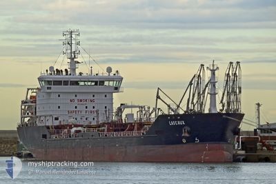
LASCAUX
Oil/Chemical Tanker
Current Trip
| Time Travelled | 7 days |
|---|---|
| Remaining Time | 6 h, 52 mins |
| Distance Travelled | 1277.29 nm |
| Remaining Distance | 48.32 nm |
| AVG Speed | 6.4 Knots |
| MAX Speed | 11 Knots |
| AVG Wind | 16.8 knots |
| MAX Wind | 35.2 knots |
| MIN Temp | 1.9°C / 35.42°F |
| MAX Temp | 13.6°C / 56.48°F |
| Draught | 5.8 m |
| Position Received | 6 h, 10 m ago |
Current Position
| Longitude | --- |
|---|---|
| Latitude | --- |
| Status | Under way using engine |
| Speed | 7.3 Knots |
| Course | 6.9° |
| Area | North Sea |
| Station | T-AIS |
| Position Received | 6 h, 10 m ago |
Info
Information
The current position of LASCAUX is in North Sea with coordinates 52.01749° / 3.38566° as reported on 2026-01-06 20:13 by AIS to our vessel tracker app. The vessel's current speed is 7.3 Knots and is heading at the port of ROTTERDAM. The estimated time of arrival as calculated by MyShipTracking vessel tracking app is 2026-01-07 10:16 LT
The vessel LASCAUX (IMO: 9405746, MMSI: 229291000) is a Oil/Chemical Tanker that was built in 2007 ( 19 years old ). It's sailing under the flag of [MT] Malta.
In this page you can find informations about the vessels current position, last detected port calls, and current voyage information. If the vessels is not in coverage by AIS you will find the latest position.
The current position of LASCAUX is detected by our AIS receivers and we are not responsible for the reliability of the data. The last position was recorded while the vessel was in Coverage by the Ais receivers of our vessel tracking app.
The current draught of LASCAUX as reported by AIS is 5.8 meters
Weather
| Temperature | 5.2°C / 41.36°F |
|---|---|
| Wind Speed | 36 knots |
| Direction | 222° SW |
| Pressure | 1004.4 hPa |
| Humidity | 95 % |
| Cloud Coverage | 100 % |
Featured Company
Last Port Calls
| Port | Arrival | Departure | Time In Port |
|---|---|---|---|
| 2025-12-28 18:42 | 2025-12-30 03:02 | 1 d | |
| 2025-12-11 01:59 | 2025-12-12 05:14 | 1 d | |
| 2025-12-01 23:05 | 2025-12-03 22:18 | 1 d | |
| 2025-11-09 19:42 | 2025-11-11 07:33 | 1 d | |
| 2025-11-08 23:44 | 2025-11-09 00:25 | 41 m | |
| 2025-11-07 08:35 | 2025-11-08 22:52 | 1 d | |
| 2025-11-07 07:07 | 2025-11-07 07:42 | 34 m | |
| 2025-11-03 01:17 | 2025-11-04 07:36 | 1 d | |
| 2025-11-01 15:02 |
Last Trips
| Origin | Departure | Destination | Arrival | Distance | |
|---|---|---|---|---|---|
| 2025-12-12 05:14 | 2025-12-28 18:42 | 1563.80 nm | |||
| 2025-12-03 22:18 | 2025-12-11 01:59 | 79.54 nm | |||
| 2025-11-11 07:33 | 2025-12-01 23:05 | 358.43 nm | |||
| 2025-11-09 00:25 | 2025-11-09 19:42 | 194.17 nm | |||
| 2025-11-08 22:52 | 2025-11-08 23:44 | 4.64 nm | |||
| 2025-11-07 07:42 | 2025-11-07 08:35 | 5.54 nm | |||
| 2025-11-04 07:36 | 2025-11-07 07:07 | 338.13 nm | |||
| 2025-11-01 15:02 | 2025-11-03 01:17 | 327.22 nm |
Events
| Time | Event | Details | Position / Dest | Info |
|---|---|---|---|---|
| 2026-01-06 20:21 | Status Changed | Default Under way using engine |
52.03153 / 3.38322
NLRTM
|
Speed: 7.3 kn Course: 6.9° |
| 2026-01-06 20:13 | OUT of Coverage |
52.01749 / 3.38566
North Sea
|
Speed: 7.3 kn Course: 6.9° |
|
| 2026-01-06 18:45 | START Moving | 17.95 nm, North West of BURGHSLUIS |
51.83632 / 3.35184
NLRTM
|
Speed: 3.3 kn Course: 291° |
| 2026-01-06 18:39 | Status Changed | Under way using engine Default |
51.83669 / 3.35271
NLRTM
|
Speed: 0.3 kn Course: 223° |
| 2026-01-06 18:26 | Status Changed | Default At anchor |
51.83593 / 3.35319
NLRTM
|
Speed: 0.2 kn Course: 224° |
| 2026-01-06 18:05 | Status Changed | At anchor Default |
51.83605 / 3.35427
NLRTM
|
Speed: 0.2 kn Course: 223° |
| 2026-01-06 17:59 | Status Changed | Default At anchor |
51.83601 / 3.35436
NLRTM
|
Speed: 0.3 kn Course: 224° |
| 2026-01-06 17:53 | Status Changed | At anchor Default |
51.83607 / 3.35435
NLRTM
|
Speed: 0.1 kn Course: 224° |
| 2026-01-06 17:50 | Status Changed | Default At anchor |
51.83598 / 3.35439
NLRTM
|
Speed: 0.2 kn Course: 218° |
| 2026-01-06 17:32 | Status Changed | At anchor Default |
51.83601 / 3.35427
NLRTM
|
Speed: 0.2 kn Course: 223° |