
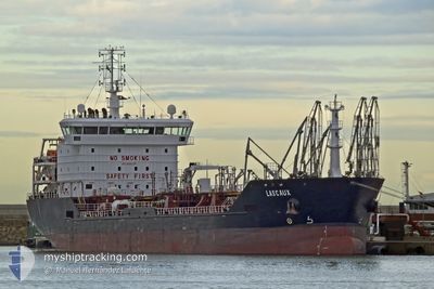
LASCAUX
Oil/Chemical Tanker
Current Trip
| Time Travelled | 16 days |
|---|---|
| Remaining Time | --- |
| Distance Travelled | 2092.03 nm |
| Remaining Distance | --- |
| AVG Speed | 8.1 Knopen |
| MAX Speed | 13.5 Knopen |
| AVG Wind | 16.4 knots |
| MAX Wind | 35.2 knots |
| MIN Temp | 11°C / 51.8°F |
| MAX Temp | 25.6°C / 78.08°F |
| Diepgang | 5.5 M |
| Positie ontvangen | 1 m geleden |
Current Position
| Lengtegraad | -8.86904° |
|---|---|
| Breedtegraat | 37.90692° |
| Status | At anchor |
| Snelheid | 0.2 Knopen |
| Koers | 9° |
| Gebied | North Atlantic Ocean |
| Station | T-AIS |
| Positie ontvangen | 1 m geleden |
Info
Information
The current position of LASCAUX is in North Atlantic Ocean with coordinates 37.90692° / -8.86904° as reported on 2024-04-23 06:16 by AIS to our vessel tracker app. The vessel's current speed is 0.2 Knopen
The vessel LASCAUX (IMO: 9405746, MMSI: 229291000) is a Oil/Chemical Tanker that was built in 2007 ( 17 Jaar oud ). It's sailing under the flag of [MT] Malta.
In this page you can find informations about the vessels current position, last detected port calls, and current voyage information. If the vessels is not in coverage by AIS you will find the latest position.
The current position of LASCAUX is detected by our AIS receivers and we are not responsible for the reliability of the data. The last position was recorded while the vessel was in Coverage by the Ais receivers of our vessel tracking app.
The current draught of LASCAUX as reported by AIS is 5.5 meters
Weather
| Temperature | 11.3°C / 52.34°F |
|---|---|
| Wind Speed | 9 knots |
| Direction | 61° ENE |
| Pressure | 1016.4 hPa |
| Humidity | 44.3 % |
| Cloud Coverage | --- |
Featured Company
Events
| Tijd | Evenement | Details | Positie / Bestemming | Info |
|---|---|---|---|---|
| 2024-04-21 13:03 | ETA Changed | 2024/04/21 13:00 2024/04/21 11:00 |
37.90915 / -8.86740
PT SIE
|
Snelheid: 0.2 kn Koers: 221° |
| 2024-04-21 12:58 | Status Changed | At anchor Under way using engine |
37.90922 / -8.86743
PT SIE
|
Snelheid: 0.2 kn Koers: 220° |
| 2024-04-21 12:18 | Stop beweging | 2.16 nm, South of SINES |
37.90798 / -8.86870
PT SIE
|
Snelheid: 0.3 kn Koers: 225° |
| 2024-04-20 20:27 | Status Changed | Under way using engine Default |
36.50654 / -8.18245
PT SIE
|
Snelheid: 7.5 kn Koers: 285° |
| 2024-04-20 20:26 | Status Changed | Default Under way using engine |
36.50641 / -8.18195
PT SIE
|
Snelheid: 7.6 kn Koers: 285.1° |
| 2024-04-20 18:46 | Status Changed | Under way using engine Default |
36.44614 / -7.92155
PT SIE
|
Snelheid: 7.7 kn Koers: 283° |
| 2024-04-20 18:42 | Status Changed | Default Under way using engine |
36.44449 / -7.91284
PT SIE
|
Snelheid: 7.6 kn Koers: 283.9° |
| 2024-04-20 17:53 | Status Changed | Under way using engine Default |
36.41915 / -7.78670
PT SIE
|
Snelheid: 7.6 kn Koers: 285° |
| 2024-04-20 17:06 | Status Changed | Default Under way using engine |
36.39022 / -7.66444
PT SIE
|
Snelheid: 7.9 kn Koers: 285.5° |
| 2024-04-20 17:01 | Status Changed | Under way using engine Default |
36.38639 / -7.64768
PT SIE
|
Snelheid: 7.9 kn Koers: 285° |