
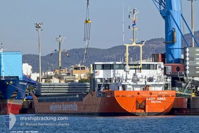
LADY ANNA
General Cargo
Current Trip
| Time Travelled | 1 day |
|---|---|
| Remaining Time | 1 day |
| Distance Travelled | 301.61 nm |
| Remaining Distance | 314.28 nm |
| AVG Speed | 8.7 Knots |
| MAX Speed | 10.6 Knots |
| AVG Wind | 13 knots |
| MAX Wind | 20 knots |
| MIN Temp | 5.5°C / 41.9°F |
| MAX Temp | 7.9°C / 46.22°F |
| Draught | 3.3 m |
| Position Received | 1 m ago |
Current Position
| Longitude | 9.88644° |
|---|---|
| Latitude | 57.63293° |
| Status | Under way using engine |
| Speed | 8.7 Knots |
| Course | 62.3° |
| Area | Skaggerak |
| Station | T-AIS |
| Position Received | 1 m ago |
Info
Information
The current position of LADY ANNA is in Skaggerak with coordinates 57.63293° / 9.88644° as reported on 2024-04-26 18:06 by AIS to our vessel tracker app. The vessel's current speed is 8.7 Knots and is heading at the port of KARLSHAMN. The estimated time of arrival as calculated by MyShipTracking vessel tracking app is 2024-04-28 06:22 LT
The vessel LADY ANNA (IMO: 9624811, MMSI: 246838000) is a General Cargo that was built in 2012 ( 12 years old ). It's sailing under the flag of [NL] Netherlands.
In this page you can find informations about the vessels current position, last detected port calls, and current voyage information. If the vessels is not in coverage by AIS you will find the latest position.
The current position of LADY ANNA is detected by our AIS receivers and we are not responsible for the reliability of the data. The last position was recorded while the vessel was in Coverage by the Ais receivers of our vessel tracking app.
The current draught of LADY ANNA as reported by AIS is 3.3 meters
Weather
| Temperature | 7.5°C / 45.5°F |
|---|---|
| Wind Speed | 19 knots |
| Direction | 56° NE |
| Pressure | 1007.9 hPa |
| Humidity | 67.2 % |
| Cloud Coverage | 37 % |
Featured Company
Last Port Calls
| Port | Arrival | Departure | Time In Port |
|---|---|---|---|
| 2024-04-24 13:03 | 2024-04-25 07:59 | 18 h | |
| 2024-04-24 12:43 | |||
| 2024-04-21 13:31 | 2024-04-23 09:50 | 1 d | |
| 2024-04-21 05:04 | 2024-04-21 05:29 | 25 m | |
| 2024-04-12 03:11 | 2024-04-12 16:09 | 12 h | |
| 2024-03-30 16:07 | 2024-03-30 16:30 | 22 m | |
| 2024-03-29 20:38 | 2024-03-30 15:04 | 18 h | |
| 2024-03-27 22:45 | 2024-03-29 20:14 | 1 d | |
| 2024-03-23 13:05 | 2024-03-25 16:12 | 2 d | |
| 2024-03-21 17:28 | 2024-03-22 15:02 | 21 h |
Most Visited Ports (Last year)
| Port | Arrivals | |
|---|---|---|
| 6 | ||
| 4 | ||
| 4 | ||
| 4 | ||
| 4 | ||
| 3 |
Last Trips
| Origin | Departure | Destination | Arrival | Distance | |
|---|---|---|---|---|---|
| 2024-04-23 11:50 | 2024-04-24 15:03 | 259.88 nm | |||
| 2024-04-23 11:50 | 2024-04-24 14:43 | 257.67 nm | |||
| 2024-04-21 07:29 | 2024-04-21 15:31 | 60.24 nm | |||
| 2024-04-12 18:09 | 2024-04-21 07:04 | 940.15 nm | |||
| 2024-03-30 17:30 | 2024-04-12 05:11 | 1118.64 nm | |||
| 2024-03-30 16:04 | 2024-03-30 17:07 | 8.38 nm | |||
| 2024-03-29 21:14 | 2024-03-29 21:38 | 1.82 nm | |||
| 2024-03-25 17:12 | 2024-03-27 23:45 | 503.11 nm | |||
| 2024-03-22 16:02 | 2024-03-23 14:05 | 204.73 nm | |||
| 2024-03-14 10:06 | 2024-03-21 18:28 | 1289.63 nm |
Events
| Time | Event | Details | Position / Dest | Info |
|---|---|---|---|---|
| 2024-04-26 12:02 | Change Sea Area | Danish part of the Skaggerak Danish part of the North Sea |
57.23117 / 8.42740
Skaggerak
|
Speed: 9.1 kn Course: 61.6° |
| 2024-04-25 20:55 | Change Sea Area | Danish part of the North Sea German part of the North Sea |
55.19079 / 7.43519
North Sea
|
Speed: 7.7 kn Course: 355.5° |
| 2024-04-25 20:43 | ETA Changed | 2024/04/17 12:00 2024/04/27 12:00 |
55.16427 / 7.43910
SEKAN
|
Speed: 7.5 kn Course: 355.7° |
| 2024-04-25 20:08 | Status Changed | Under way using engine Default |
55.09213 / 7.44810
SEKAN
|
Speed: 7 kn Course: 356° |
| 2024-04-25 20:08 | IN Coverage |
55.09213 / 7.44810
North Sea
SEKAN
|
Speed: 7.6 kn Course: 356.3° |
|
| 2024-04-25 11:32 | Status Changed | Default Under way using engine |
53.86134 / 7.93786
SEKAN
|
Speed: 8.9 kn Course: 283.3° |
| 2024-04-25 11:29 | OUT of Coverage |
53.85973 / 7.94975
North Sea
SEKAN
|
Speed: 8.9 kn Course: 283.3° |
|
| 2024-04-25 07:59 | PORT DEPARTURE |
|
53.52625 / 8.56090
SEKAN
|
Speed: 9 kn Course: 59° |
| 2024-04-25 07:57 | START Moving |
53.52357 / 8.55346
[DE] NORDENHAM
|
Speed: 3.5 kn Course: 57° |
|
| 2024-04-25 07:52 | Draught Changed | 3.3 3.4 |
53.52346 / 8.55272
[DE] NORDENHAM
|
Speed: Course: 51° |