
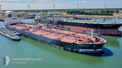
KYRAKATINGO
Tanker
Current Trip
| Time Travelled | 2 days |
|---|---|
| Remaining Time | --- |
| Distance Travelled | 650.83 nm |
| Remaining Distance | --- |
| AVG Speed | 9.1 Knots |
| MAX Speed | 13.5 Knots |
| AVG Wind | 14.2 knots |
| MAX Wind | 31.7 knots |
| MIN Temp | 16.4°C / 61.52°F |
| MAX Temp | 20.9°C / 69.62°F |
| Draught | 12 m |
| Position Received | 2 d ago |
Current Position
| Longitude | --- |
|---|---|
| Latitude | --- |
| Status | Under way using engine |
| Speed | 13.1 Knots |
| Course | 185.3° |
| Area | Gulf of Mexico |
| Station | T-AIS |
| Position Received | 2 d ago |
Info
Information
The current position of KYRAKATINGO is in Gulf of Mexico with coordinates 29.18635° / -93.65559° as reported on 2024-12-10 22:37 by AIS to our vessel tracker app. The vessel's current speed is 13.1 Knots and is heading at the port of WHITEGATE. The estimated time of arrival as calculated by MyShipTracking vessel tracking app is 2024-12-25 23:00 LT
The vessel KYRAKATINGO (IMO: 9779965, MMSI: 249997000) is a Tanker It's sailing under the flag of [MT] Malta.
In this page you can find informations about the vessels current position, last detected port calls, and current voyage information. If the vessels is not in coverage by AIS you will find the latest position.
The current position of KYRAKATINGO is detected by our AIS receivers and we are not responsible for the reliability of the data. The last position was recorded while the vessel was in Coverage by the Ais receivers of our vessel tracking app.
The current draught of KYRAKATINGO as reported by AIS is 12 meters
Weather
| Temperature | 19.6°C / 67.28°F |
|---|---|
| Wind Speed | 21 knots |
| Direction | 45° NE |
| Pressure | 1022.7 hPa |
| Humidity | 68.8 % |
| Cloud Coverage | --- |
Featured Company
Last Port Calls
| Port | Arrival | Departure | Time In Port |
|---|---|---|---|
| 2024-12-06 15:59 | 2024-12-10 15:21 | 3 d | |
| 2024-12-06 12:58 | 2024-12-06 14:15 | 1 h | |
| 2024-11-27 17:13 | 2024-11-28 20:03 | 1 d | |
| 2024-10-27 10:16 | 2024-10-28 23:36 | 1 d | |
| 2024-10-24 07:53 | 2024-10-25 06:54 | 23 h | |
| 2024-10-20 16:23 | 2024-10-22 14:37 | 1 d | |
| 2024-10-16 21:16 | 2024-10-18 19:40 | 1 d |
Most Visited Ports (Last year)
| Port | Arrivals | |
|---|---|---|
| 6 | ||
| 4 | ||
| 3 | ||
| 2 | ||
| 1 | ||
| 1 |
Last Trips
| Origin | Departure | Destination | Arrival | Distance | |
|---|---|---|---|---|---|
| 2024-12-06 08:15 | 2024-12-06 09:59 | 10.73 nm | |||
| 2024-11-28 14:03 | 2024-12-06 06:58 | 336.43 nm | |||
| 2024-10-28 18:36 | 2024-11-27 11:13 | 6438.68 nm | |||
| 2024-10-25 01:54 | 2024-10-27 05:16 | 487.39 nm | |||
| 2024-10-22 09:37 | 2024-10-24 02:53 | 485.56 nm | |||
| 2024-10-18 14:40 | 2024-10-20 11:23 | 77.87 nm | |||
| 2024-09-14 13:02 | 2024-10-16 16:16 | 3296.45 nm |
Events
| Time | Event | Details | Position / Dest | Info |
|---|---|---|---|---|
| 2024-12-10 22:42 | Status Changed | Default Under way using engine |
29.16651 / -93.65775
IEWHI
|
Speed: 13.1 kn Course: 185.3° |
| 2024-12-10 22:37 | Status Changed | Under way using engine Default |
29.18635 / -93.65559
IEWHI
|
Speed: 13.1 kn Course: 189° |
| 2024-12-10 22:37 | OUT of Coverage |
29.18635 / -93.65559
Gulf of Mexico
IEWHI
|
Speed: 13.1 kn Course: 185.3° |
|
| 2024-12-10 22:24 | Status Changed | Default Under way using engine |
29.23262 / -93.64710
IEWHI
|
Speed: 12 kn Course: 194.3° |
| 2024-12-10 22:14 | Status Changed | Under way using engine Default |
29.26351 / -93.64628
IEWHI
|
Speed: 11.1 kn Course: 162° |
| 2024-12-10 22:01 | Status Changed | Default Under way using engine |
29.30241 / -93.65991
IEWHI
|
Speed: 10.8 kn Course: 169.3° |
| 2024-12-10 16:47 | ETA Changed | 2024/12/25 23:00 2024/12/25 18:00 |
29.93843 / -93.86721
IEWHI
|
Speed: 6 kn Course: 219.4° |
| 2024-12-10 15:21 | PORT DEPARTURE |
|
30.01450 / -93.96342
IEWHI
|
Speed: 7.1 kn Course: 96° |
| 2024-12-10 15:04 | START Moving |
30.01131 / -93.99227
[US] SUNOCO LOGISTICS
|
Speed: 3.1 kn Course: 105° |
|
| 2024-12-10 14:32 | ETA Changed | 2024/12/25 18:00 2024/12/24 05:00 |
30.01155 / -93.99700
[US] SUNOCO LOGISTICS
|
Speed: Course: 107° |