
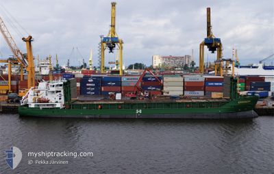
KURLAND
General Cargo
Current Trip
| Time Travelled | 1 day |
|---|---|
| Remaining Time | --- |
| Distance Travelled | 256.23 nm |
| Remaining Distance | --- |
| AVG Speed | 10.1 Knots |
| MAX Speed | 12 Knots |
| AVG Wind | 13.6 knots |
| MAX Wind | 19.8 knots |
| MIN Temp | -7.9°C / 17.78°F |
| MAX Temp | 3.8°C / 38.84°F |
| Draught | 4.1 m |
| Position Received | 1 m ago |
Current Position
| Longitude | --- |
|---|---|
| Latitude | --- |
| Status | Under way using engine |
| Speed | 0.7 Knots |
| Course | 268° |
| Area | Gulf of Bothnia |
| Station | T-AIS |
| Position Received | 1 m ago |
Info
Information
The current position of KURLAND is in Gulf of Bothnia with coordinates 61.19749° / 21.05844° as reported on 2025-12-24 07:47 by AIS to our vessel tracker app. The vessel's current speed is 0.7 Knots and is heading at the port of OLKILUOTO. The estimated time of arrival as calculated by MyShipTracking vessel tracking app is 2025-12-24 10:00 LT
The vessel KURLAND (IMO: 9226803, MMSI: 210853000) is a General Cargo that was built in 2002 ( 23 years old ). It's sailing under the flag of [CY] Cyprus.
In this page you can find informations about the vessels current position, last detected port calls, and current voyage information. If the vessels is not in coverage by AIS you will find the latest position.
The current position of KURLAND is detected by our AIS receivers and we are not responsible for the reliability of the data. The last position was recorded while the vessel was in Coverage by the Ais receivers of our vessel tracking app.
The current draught of KURLAND as reported by AIS is 4.1 meters
Weather
| Temperature | 3.7°C / 38.66°F |
|---|---|
| Wind Speed | 12 knots |
| Direction | 306° NW |
| Pressure | 1031.4 hPa |
| Humidity | 68.5 % |
| Cloud Coverage | 20 % |
Featured Company
Last Port Calls
| Port | Arrival | Departure | Time In Port |
|---|---|---|---|
| 2025-12-21 22:54 | 2025-12-23 08:02 | 1 d | |
| 2025-12-19 22:50 | 2025-12-19 23:39 | 49 m | |
| 2025-12-18 10:14 | 2025-12-19 16:09 | 1 d | |
| 2025-12-18 03:31 | 2025-12-18 03:54 | 22 m | |
| 2025-12-14 22:10 | 2025-12-16 10:04 | 1 d | |
| 2025-12-07 20:16 | 2025-12-09 08:51 | 1 d | |
| 2025-11-27 22:12 | 2025-11-28 23:26 | 1 d | |
| 2025-11-25 07:14 | 2025-11-26 19:35 | 1 d | |
| 2025-11-23 01:51 | 2025-11-23 04:12 | 2 h | |
| 2025-11-22 16:55 | 2025-11-22 17:53 | 58 m |
Most Visited Ports (Last year)
| Port | Arrivals | |
|---|---|---|
| 9 | ||
| 8 | ||
| 8 | ||
| 6 | ||
| 5 | ||
| 5 |
Last Trips
| Origin | Departure | Destination | Arrival | Distance | |
|---|---|---|---|---|---|
| 2025-12-19 23:39 | 2025-12-21 22:54 | 475.18 nm | |||
| 2025-12-19 16:09 | 2025-12-19 22:50 | 65.94 nm | |||
| 2025-12-18 03:54 | 2025-12-18 10:14 | 66.47 nm | |||
| 2025-12-16 10:04 | 2025-12-18 03:31 | 400.47 nm | |||
| 2025-12-09 08:51 | 2025-12-14 22:10 | 992.46 nm | |||
| 2025-11-28 23:26 | 2025-12-07 20:16 | 1576.12 nm | |||
| 2025-11-26 19:35 | 2025-11-27 22:12 | 25.92 nm | |||
| 2025-11-23 04:12 | 2025-11-25 07:14 | 344.13 nm | |||
| 2025-11-22 17:53 | 2025-11-23 01:51 | 50.35 nm | |||
| 2025-11-20 01:13 | 2025-11-22 16:55 | 649.63 nm |
Events
| Time | Event | Details | Position / Dest | Info |
|---|---|---|---|---|
| 2025-12-24 07:41 | STOP Moving | 11.39 nm, West of OLKILUOTO |
61.19789 / 21.05501
OLKILUOTO
|
Speed: 0.2 kn Course: 295° |
| 2025-12-24 07:04 | Status Changed | Under way using engine Default |
61.26708 / 21.05663
OLKILUOTO
|
Speed: 10.3 kn Course: 185° |
| 2025-12-24 06:58 | Status Changed | Default Under way using engine |
61.28351 / 21.05966
OLKILUOTO
|
Speed: 10.2 kn Course: 180.3° |
| 2025-12-24 06:17 | Status Changed | Under way using engine Default |
61.39845 / 21.03523
OLKILUOTO
|
Speed: 10.6 kn Course: 166° |
| 2025-12-24 06:14 | Status Changed | Default Under way using engine |
61.40843 / 21.03003
OLKILUOTO
|
Speed: 10.3 kn Course: 169° |
| 2025-12-24 05:49 | Draught Changed | 4.1 5.6 |
61.47836 / 20.99409
OLKILUOTO
|
Speed: 10.7 kn Course: 168.2° |
| 2025-12-24 05:49 | Destination Changed | OLKILUOTO HARAHOLMEN |
61.47836 / 20.99409
OLKILUOTO
|
Speed: 10.7 kn Course: 168.2° |
| 2025-12-24 05:49 | ETA Changed | 2025/12/24 08:00 2025/12/21 22:00 |
61.47836 / 20.99409
OLKILUOTO
|
Speed: 10.7 kn Course: 168.2° |
| 2025-12-24 05:28 | Status Changed | Under way using engine Default |
61.53793 / 20.97058
HARAHOLMEN
|
Speed: 10.2 kn Course: 176° |
| 2025-12-24 05:10 | Status Changed | Default Under way using engine |
61.58805 / 20.95089
HARAHOLMEN
|
Speed: 10.4 kn Course: 165° |