
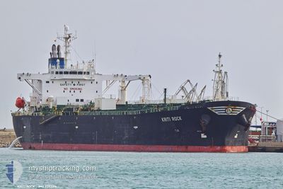
KRITI ROCK
Oil Products Tanker
Current Trip
| Time Travelled | 9 days |
|---|---|
| Remaining Time | --- |
| Distance Travelled | 2492.89 nm |
| Remaining Distance | --- |
| AVG Speed | 11.5 Knots |
| MAX Speed | 15.5 Knots |
| AVG Wind | 11.6 knots |
| MAX Wind | 37 knots |
| MIN Temp | 8°C / 46.4°F |
| MAX Temp | 18°C / 64.4°F |
| Draught | 12 m |
| Position Received | 16 h, 11 m ago |
Current Position
| Longitude | --- |
|---|---|
| Latitude | --- |
| Status | Under way using engine |
| Speed | 12.7 Knots |
| Course | 91° |
| Area | Mediterranean Sea - Eastern Basin |
| Station | T-AIS |
| Position Received | 16 h, 11 m ago |
Info
Information
The current position of KRITI ROCK is in Mediterranean Sea - Eastern Basin with coordinates 35.76048° / 14.41603° as reported on 2025-12-11 18:35 by AIS to our vessel tracker app. The vessel's current speed is 12.7 Knots
The vessel KRITI ROCK (IMO: 9392315, MMSI: 636019277) is a Oil Products Tanker that was built in 2008 ( 17 years old ). It's sailing under the flag of [LR] Liberia.
In this page you can find informations about the vessels current position, last detected port calls, and current voyage information. If the vessels is not in coverage by AIS you will find the latest position.
The current position of KRITI ROCK is detected by our AIS receivers and we are not responsible for the reliability of the data. The last position was recorded while the vessel was in Coverage by the Ais receivers of our vessel tracking app.
The current draught of KRITI ROCK as reported by AIS is 12 meters
Weather
| Temperature | 16.4°C / 61.52°F |
|---|---|
| Wind Speed | 5 knots |
| Direction | 87° E |
| Pressure | 1022 hPa |
| Humidity | 66.9 % |
| Cloud Coverage | 100 % |
Featured Company
Last Port Calls
| Port | Arrival | Departure | Time In Port |
|---|---|---|---|
| 2025-11-29 16:17 | 2025-12-02 21:43 | 3 d | |
| 2025-11-17 19:14 | 2025-11-19 16:05 | 1 d | |
| 2025-11-04 13:37 | 2025-11-08 09:23 | 3 d | |
| 2025-10-25 13:28 | 2025-10-27 18:56 | 2 d | |
| 2025-10-14 14:42 | 2025-10-17 04:32 | 2 d | |
| 2025-10-10 11:27 | 2025-10-12 13:25 | 2 d | |
| 2025-10-02 06:20 |
Most Visited Ports (Last year)
| Port | Arrivals | |
|---|---|---|
| 3 | ||
| 3 | ||
| 3 | ||
| 3 | ||
| 2 | ||
| 2 |
Last Trips
| Origin | Departure | Destination | Arrival | Distance | |
|---|---|---|---|---|---|
| 2025-11-19 16:05 | 2025-11-29 16:17 | 1634.92 nm | |||
| 2025-11-08 09:23 | 2025-11-17 19:14 | 2032.05 nm | |||
| 2025-10-27 18:56 | 2025-11-04 13:37 | 660.06 nm | |||
| 2025-10-17 04:32 | 2025-10-25 13:28 | 1024.89 nm | |||
| 2025-10-12 13:25 | 2025-10-14 14:42 | 349.24 nm | |||
| 2025-10-02 06:20 | 2025-10-10 11:27 | 388.40 nm |
Events
| Time | Event | Details | Position / Dest | Info |
|---|---|---|---|---|
| 2025-12-12 06:09 | STOP Moving | 6.43 nm, East of MARSAXLOKK |
35.80207 / 14.67587
MTMAR
|
Speed: 0.2 kn Course: 69° |
| 2025-12-12 04:25 | START Moving | 14.03 nm, East of MARSAXLOKK |
35.87567 / 14.82743
MTMAR
|
Speed: 5.4 kn Course: 217° |
| 2025-12-11 21:39 | STOP Moving | 14.06 nm, East of MARSAXLOKK |
35.87955 / 14.82687
MTMAR
|
Speed: 0.2 kn Course: 39° |
| 2025-12-11 21:13 | START Moving | 13.23 nm, East of MARSAXLOKK |
35.87268 / 14.81130
MTMAR
|
Speed: 6 kn Course: 66° |
| 2025-12-11 20:29 | STOP Moving | 13.06 nm, East of MARSAXLOKK |
35.86985 / 14.80858
MTMAR
|
Speed: 0.2 kn Course: 212° |
| 2025-12-11 18:41 | Status Changed | Default Under way using engine |
35.76025 / 14.44017
MTMAR
|
Speed: 12.7 kn Course: 91° |
| 2025-12-11 18:35 | OUT of Coverage |
35.76048 / 14.41603
Mediterranean Sea - Eastern Basin
MTMAR
|
Speed: 12.7 kn Course: 91° |
|
| 2025-12-11 17:42 | Status Changed | Under way using engine Default |
35.84678 / 14.21315
MTMAR
|
Speed: 13.2 kn Course: 122° |
| 2025-12-11 17:37 | Status Changed | Default Under way using engine |
35.85828 / 14.19072
MTMAR
|
Speed: 13 kn Course: 121° |
| 2025-12-11 17:14 | Status Changed | Under way using engine Default |
35.90208 / 14.10383
MTMAR
|
Speed: 12.7 kn Course: 121° |