
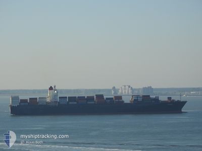
KOTA LIMA
Container Ship
Current Trip
| Time Travelled | 4 days |
|---|---|
| Remaining Time | --- |
| Distance Travelled | 1872.48 nm |
| Remaining Distance | 345.77 nm |
| AVG Speed | 15.4 Knots |
| MAX Speed | 19 Knots |
| AVG Wind | 20.1 knots |
| MAX Wind | 27.3 knots |
| MIN Temp | 11.9°C / 53.42°F |
| MAX Temp | 27°C / 80.6°F |
| Draught | 11.3 m |
| Position Received | 4 d ago |
Current Position
| Longitude | --- |
|---|---|
| Latitude | --- |
| Status | Under way using engine |
| Speed | 16.2 Knots |
| Course | 57.7° |
| Area | Singapore Strait |
| Station | T-AIS |
| Position Received | 4 d ago |
Info
Information
The current position of KOTA LIMA is in Singapore Strait with coordinates 1.28390° / 104.33324° as reported on 2026-01-04 00:27 by AIS to our vessel tracker app. The vessel's current speed is 16.2 Knots and is heading at the port of SHANGHAI. The estimated time of arrival as calculated by MyShipTracking vessel tracking app is 2026-01-09 14:00 LT
The vessel KOTA LIMA (IMO: 9267651, MMSI: 636022006) is a Container Ship that was built in 2002 ( 24 years old ). It's sailing under the flag of [LR] Liberia.
In this page you can find informations about the vessels current position, last detected port calls, and current voyage information. If the vessels is not in coverage by AIS you will find the latest position.
The current position of KOTA LIMA is detected by our AIS receivers and we are not responsible for the reliability of the data. The last position was recorded while the vessel was in Coverage by the Ais receivers of our vessel tracking app.
The current draught of KOTA LIMA as reported by AIS is 11.3 meters
Weather
| Temperature | 11.5°C / 52.7°F |
|---|---|
| Wind Speed | 18 knots |
| Direction | 30° NNE |
| Pressure | 1026.6 hPa |
| Humidity | 47.2 % |
| Cloud Coverage | --- |
Featured Company
Last Port Calls
| Port | Arrival | Departure | Time In Port |
|---|---|---|---|
| 2026-01-03 15:08 | 2026-01-04 05:33 | 14 h | |
| 2026-01-02 18:52 | 2026-01-03 13:05 | 18 h | |
| 2025-12-24 12:20 | 2025-12-24 13:23 | 1 h | |
| 2025-12-23 13:14 | 2025-12-24 11:58 | 22 h | |
| 2025-12-21 12:28 | 2025-12-22 16:24 | 1 d | |
| 2025-12-17 23:44 | 2025-12-19 02:40 | 1 d | |
| 2025-12-11 21:21 | 2025-12-12 13:57 | 16 h | |
| 2025-12-08 11:47 | 2025-12-09 07:51 | 20 h | |
| 2025-12-02 08:11 | 2025-12-03 01:15 | 17 h | |
| 2025-11-29 11:17 | 2025-11-29 23:44 | 12 h |
Most Visited Ports (Last year)
| Port | Arrivals | |
|---|---|---|
| 11 | ||
| 6 | ||
| 4 | ||
| 4 | ||
| 4 | ||
| 4 |
Last Trips
| Origin | Departure | Destination | Arrival | Distance | |
|---|---|---|---|---|---|
| 2026-01-03 13:05 | 2026-01-03 15:08 | 13.33 nm | |||
| 2025-12-24 13:23 | 2026-01-02 18:52 | 2932.48 nm | |||
| 2025-12-24 11:58 | 2025-12-24 12:20 | 2.74 nm | |||
| 2025-12-22 16:24 | 2025-12-23 13:14 | 283.26 nm | |||
| 2025-12-19 02:40 | 2025-12-21 12:28 | 434.58 nm | |||
| 2025-12-12 13:57 | 2025-12-17 23:44 | 2296.56 nm | |||
| 2025-12-09 07:51 | 2025-12-11 21:21 | 264.15 nm | |||
| 2025-12-03 01:15 | 2025-12-08 11:47 | 1478.88 nm | |||
| 2025-11-29 23:44 | 2025-12-02 08:11 | 775.10 nm | |||
| 2025-11-27 03:17 | 2025-11-29 11:17 | 240.63 nm |
Events
| Time | Event | Details | Position / Dest | Info |
|---|---|---|---|---|
| 2026-01-04 00:33 | Status Changed | Default Under way using engine |
1.30330 / 104.35228
SGSIN>CNSHA
|
Speed: 16.2 kn Course: 57.7° |
| 2026-01-04 00:27 | OUT of Coverage |
1.28390 / 104.33324
Singapore Strait
SGSIN>CNSHA
|
Speed: 16.2 kn Course: 57.7° |
|
| 2026-01-04 00:11 | Draught Changed | 11.3 11.1 |
1.26265 / 104.26412
SGSIN>CNSHA
|
Speed: 16.7 kn Course: 80.5° |
| 2026-01-04 00:04 | Change Sea Area | Malaysian part of the Singapore Strait Indonesian part of the Singapore Strait |
1.25797 / 104.23339
Singapore Strait
SGSIN>CNSHA
|
Speed: 16.7 kn Course: 83° |
| 2026-01-03 22:31 | Change Sea Area | Indonesian part of the Singapore Strait Singaporean part of the Singapore Strait |
1.18328 / 103.83585
Singapore Strait
SGSIN>CNSHA
|
Speed: 9.4 kn Course: 80.7° |
| 2026-01-03 21:33 | PORT DEPARTURE |
|
1.27982 / 103.74588
SGSIN>CNSHA
|
Speed: 6.2 kn Course: 182° |
| 2026-01-03 21:17 | START Moving |
1.28455 / 103.76389
[SG] SINGAPORE
|
Speed: 3.1 kn Course: 293° |
|
| 2026-01-03 21:01 | Status Changed | Under way using engine Moored |
1.28736 / 103.76560
[SG] SINGAPORE
|
Speed: Course: 120° |
| 2026-01-03 19:34 | Destination Changed | SGSIN>CNSHA PKKHI>SGSIN |
1.28738 / 103.76562
[SG] SINGAPORE
|
Speed: Course: 120° |
| 2026-01-03 19:34 | ETA Changed | 2026/01/09 06:00 2026/01/02 10:00 |
1.28738 / 103.76562
[SG] SINGAPORE
|
Speed: Course: 120° |