
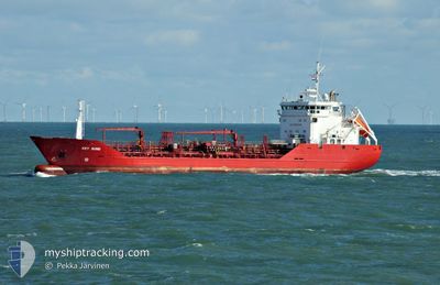
KEY SUND
Oil/Chemical Tanker
Current Trip
| Time Travelled | 4 days |
|---|---|
| Remaining Time | 2 days |
| Distance Travelled | 1310.36 nm |
| Remaining Distance | 685.96 nm |
| AVG Speed | 12.3 Knots |
| MAX Speed | 15.5 Knots |
| AVG Wind | 14.2 knots |
| MAX Wind | 24 knots |
| MIN Temp | 5.5°C / 41.9°F |
| MAX Temp | 17.2°C / 62.96°F |
| Draught | 5.2 m |
| Position Received | 14 h, 11 m ago |
Current Position
| Longitude | --- |
|---|---|
| Latitude | --- |
| Status | Under way using engine |
| Speed | 12 Knots |
| Course | 170.1° |
| Area | North Atlantic Ocean |
| Station | T-AIS |
| Position Received | 14 h, 11 m ago |
Info
Information
The current position of KEY SUND is in North Atlantic Ocean with coordinates 38.16120° / -10.05233° as reported on 2024-12-14 15:59 by AIS to our vessel tracker app. The vessel's current speed is 12 Knots and is heading at the port of BARCELONA. The estimated time of arrival as calculated by MyShipTracking vessel tracking app is 2024-12-17 16:40 LT
The vessel KEY SUND (IMO: 8920567, MMSI: 259360000) is a Oil/Chemical Tanker that was built in 1993 ( 31 years old ). It's sailing under the flag of [NO] Norway.
In this page you can find informations about the vessels current position, last detected port calls, and current voyage information. If the vessels is not in coverage by AIS you will find the latest position.
The current position of KEY SUND is detected by our AIS receivers and we are not responsible for the reliability of the data. The last position was recorded while the vessel was in Coverage by the Ais receivers of our vessel tracking app.
The current draught of KEY SUND as reported by AIS is 5.2 meters
Weather
| Temperature | 16.9°C / 62.42°F |
|---|---|
| Wind Speed | 18 knots |
| Direction | 66° ENE |
| Pressure | 1029.1 hPa |
| Humidity | 62.3 % |
| Cloud Coverage | 100 % |
Featured Company
Last Port Calls
| Port | Arrival | Departure | Time In Port |
|---|---|---|---|
| 2024-12-10 14:05 | 2024-12-10 19:27 | 5 h | |
| 2024-12-10 13:15 | 2024-12-10 13:36 | 21 m | |
| 2024-12-09 11:24 | |||
| 2024-12-04 19:32 | 2024-12-05 07:52 | 12 h | |
| 2024-11-28 17:12 | 2024-11-29 16:48 | 23 h | |
| 2024-11-26 16:03 | 2024-11-26 17:18 | 1 h | |
| 2024-11-23 07:07 | 2024-11-26 14:32 | 3 d | |
| 2024-11-15 01:42 | 2024-11-16 07:32 | 1 d | |
| 2024-11-09 18:00 | 2024-11-09 22:49 | 4 h | |
| 2024-11-09 01:18 | 2024-11-09 15:35 | 14 h |
Last Trips
| Origin | Departure | Destination | Arrival | Distance | |
|---|---|---|---|---|---|
| 2024-12-10 13:36 | 2024-12-10 14:05 | 2.24 nm | |||
| 2024-12-05 07:52 | 2024-12-10 13:15 | 859.89 nm | |||
| 2024-12-05 07:52 | 2024-12-09 11:24 | 859.76 nm | |||
| 2024-11-29 16:48 | 2024-12-04 19:32 | 880.17 nm | |||
| 2024-11-26 17:18 | 2024-11-28 17:12 | 510.04 nm | |||
| 2024-11-26 14:32 | 2024-11-26 16:03 | 9.24 nm | |||
| 2024-11-16 07:32 | 2024-11-23 07:07 | 1373.22 nm | |||
| 2024-11-09 22:49 | 2024-11-15 01:42 | 935.18 nm | |||
| 2024-11-09 15:35 | 2024-11-09 18:00 | 25.57 nm | |||
| 2024-11-07 13:54 | 2024-11-09 01:18 | 412.52 nm |
Events
| Time | Event | Details | Position / Dest | Info |
|---|---|---|---|---|
| 2024-12-14 16:07 | Status Changed | Default Under way using engine |
38.13246 / -10.04540
ES BCN
|
Speed: 12 kn Course: 170.1° |
| 2024-12-14 15:59 | OUT of Coverage |
38.16120 / -10.05233
North Atlantic Ocean
ES BCN
|
Speed: 12 kn Course: 170.1° |
|
| 2024-12-14 15:26 | Status Changed | Under way using engine Default |
38.27137 / -10.07856
ES BCN
|
Speed: 12.2 kn Course: 168° |
| 2024-12-14 14:59 | Status Changed | Default Under way using engine |
38.36182 / -10.10188
ES BCN
|
Speed: 12 kn Course: 168.7° |
| 2024-12-14 14:51 | Status Changed | Under way using engine Default |
38.38714 / -10.10847
ES BCN
|
Speed: 11.8 kn Course: 168° |
| 2024-12-14 14:47 | Status Changed | Default Under way using engine |
38.40146 / -10.11207
ES BCN
|
Speed: 11.8 kn Course: 169.2° |
| 2024-12-14 13:58 | Status Changed | Under way using engine Default |
38.55651 / -10.16328
ES BCN
|
Speed: 11.9 kn Course: 162° |
| 2024-12-14 13:27 | Status Changed | Default Under way using engine |
38.65664 / -10.19266
ES BCN
|
Speed: 11.9 kn Course: 168.6° |
| 2024-12-14 12:12 | Status Changed | Under way using engine Default |
38.90146 / -10.19359
ES BCN
|
Speed: 11.8 kn Course: 182° |
| 2024-12-14 12:07 | Status Changed | Default Under way using engine |
38.91934 / -10.19211
ES BCN
|
Speed: 11.9 kn Course: 183.1° |