
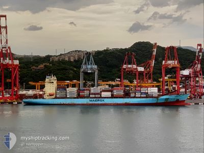
JOSEPHINE MAERSK
Container Ship
Current Trip
| Time Travelled | 5 days |
|---|---|
| Remaining Time | --- |
| Distance Travelled | 2161.04 nm |
| Remaining Distance | 2655.95 nm |
| AVG Speed | 17.4 Knots |
| MAX Speed | 21.1 Knots |
| AVG Wind | 21.7 knots |
| MAX Wind | 35.8 knots |
| MIN Temp | 3.4°C / 38.12°F |
| MAX Temp | 18.8°C / 65.84°F |
| Draught | 10.6 m |
| Position Received | 3 d ago |
Current Position
| Longitude | 141.86502° |
|---|---|
| Latitude | 41.66113° |
| Status | Under way using engine |
| Speed | 17.4 Knots |
| Course | 89.8° |
| Area | North Pacific Ocean |
| Station | T-AIS |
| Position Received | 3 d ago |
Info
Information
The current position of JOSEPHINE MAERSK is in North Pacific Ocean with coordinates 41.66113° / 141.86502° as reported on 2024-05-06 20:51 by AIS to our vessel tracker app. The vessel's current speed is 17.4 Knots and is heading at the port of TACOMA. The estimated time of arrival as calculated by MyShipTracking vessel tracking app is 2024-05-16 06:00 LT
The vessel JOSEPHINE MAERSK (IMO: 9215191, MMSI: 220008000) is a Container Ship that was built in 2002 ( 22 years old ). It's sailing under the flag of [DK] Denmark.
In this page you can find informations about the vessels current position, last detected port calls, and current voyage information. If the vessels is not in coverage by AIS you will find the latest position.
The current position of JOSEPHINE MAERSK is detected by our AIS receivers and we are not responsible for the reliability of the data. The last position was recorded while the vessel was in Coverage by the Ais receivers of our vessel tracking app.
The current draught of JOSEPHINE MAERSK as reported by AIS is 10.6 meters
Weather
| Temperature | 4.8°C / 40.64°F |
|---|---|
| Wind Speed | 14 knots |
| Direction | 266° W |
| Pressure | 1012.5 hPa |
| Humidity | 84.7 % |
| Cloud Coverage | 100 % |
Featured Company
Last Port Calls
| Port | Arrival | Departure | Time In Port |
|---|---|---|---|
| 2024-05-04 08:40 | 2024-05-05 01:29 | 16 h | |
| 2024-04-30 13:33 | 2024-04-30 23:09 | 9 h | |
| 2024-04-25 11:20 | 2024-04-25 22:04 | 10 h | |
| 2024-03-30 13:18 | 2024-03-31 11:35 | 22 h | |
| 2024-03-09 19:47 |
Last Trips
| Origin | Departure | Destination | Arrival | Distance | |
|---|---|---|---|---|---|
| 2024-05-01 07:09 | 2024-05-04 17:40 | 593.85 nm | |||
| 2024-04-26 06:04 | 2024-04-30 21:33 | 446.03 nm | |||
| 2024-03-31 05:35 | 2024-04-25 19:20 | 7604.63 nm | |||
| 2024-03-10 03:47 | 2024-03-30 07:18 | 7506.51 nm |
Events
| Time | Event | Details | Position / Dest | Info |
|---|---|---|---|---|
| 2024-05-06 20:56 | Status Changed | Default Under way using engine |
41.66082 / 141.89998
USTAC
|
Speed: 17.4 kn Course: 89.8° |
| 2024-05-06 20:51 | OUT of Coverage |
41.66113 / 141.86502
North Pacific Ocean
USTAC
|
Speed: 17.4 kn Course: 89.8° |
|
| 2024-05-06 19:26 | Change Sea Area | Japanese part of the North Pacific Ocean Japanese part of the Japan Sea |
41.64460 / 141.29621
North Pacific Ocean
USTAC
|
Speed: 17.2 kn Course: 85.1° |
| 2024-05-06 18:18 | Status Changed | Under way using engine Default |
41.58760 / 140.81923
USTAC
|
Speed: 20.3 kn Course: 56° |
| 2024-05-06 18:10 | Status Changed | Default Under way using engine |
41.56398 / 140.77196
USTAC
|
Speed: 20.9 kn Course: 58.4° |
| 2024-05-06 16:49 | Status Changed | Under way using engine Default |
41.31186 / 140.24912
USTAC
|
Speed: 19.2 kn Course: 53° |
| 2024-05-06 16:16 | Status Changed | Default Under way using engine |
41.21312 / 140.05652
USTAC
|
Speed: 18.9 kn Course: 53.6° |
| 2024-05-06 16:06 | Change Sea Area | Japanese part of the Japan Sea South Korean part of the Japan Sea |
41.18133 / 139.99950
Japan Sea
USTAC
|
Speed: 18.9 kn Course: 53.6° |
| 2024-05-06 16:06 | Status Changed | Under way using engine Default |
41.18133 / 139.99950
USTAC
|
Speed: 18.9 kn Course: 50° |
| 2024-05-06 15:56 | IN Coverage |
41.18133 / 139.99950
Japan Sea
USTAC
|
Speed: 18.9 kn Course: 53.6° |