
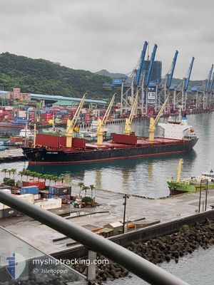
JING SHUN
Bulk Carrier
Current Trip
JP_NAGOYA
| Time Travelled | 2 days |
|---|---|
| Remaining Time | --- |
| Distance Travelled | 327.39 nm |
| Remaining Distance | --- |
| AVG Speed | 9.6 Knots |
| MAX Speed | 14.9 Knots |
| AVG Wind | 16.4 knots |
| MAX Wind | 28 knots |
| MIN Temp | 16.8°C / 62.24°F |
| MAX Temp | 20°C / 68°F |
| Draught | 6 m |
| Position Received | 4 d ago |
Current Position
| Longitude | --- |
|---|---|
| Latitude | --- |
| Status | Under way using engine |
| Speed | 9.5 Knots |
| Course | 188° |
| Area | South China Sea |
| Station | T-AIS |
| Position Received | 4 d ago |
Info
Information
The current position of JING SHUN is in South China Sea with coordinates 25.22917° / 121.30332° as reported on 2025-12-06 18:17 by AIS to our vessel tracker app. The vessel's current speed is 9.5 Knots
The vessel JING SHUN (IMO: 9246841, MMSI: 477848300) is a Bulk Carrier that was built in 2001 ( 24 years old ). It's sailing under the flag of [HK] Hong Kong.
In this page you can find informations about the vessels current position, last detected port calls, and current voyage information. If the vessels is not in coverage by AIS you will find the latest position.
The current position of JING SHUN is detected by our AIS receivers and we are not responsible for the reliability of the data. The last position was recorded while the vessel was in Coverage by the Ais receivers of our vessel tracking app.
The current draught of JING SHUN as reported by AIS is 6 meters
Weather
| Temperature | 14.5°C / 58.1°F |
|---|---|
| Wind Speed | 12 knots |
| Direction | 22° NNE |
| Pressure | 1026.1 hPa |
| Humidity | 72.7 % |
| Cloud Coverage | 41 % |
Featured Company
Last Port Calls
| Port | Arrival | Departure | Time In Port |
|---|---|---|---|
| 2025-12-07 02:58 | 2025-12-09 03:17 | 2 d | |
| 2025-11-25 00:33 | 2025-12-02 19:25 | 7 d | |
| 2025-11-15 06:25 | 2025-11-18 20:12 | 3 d | |
| 2025-11-13 12:52 | 2025-11-14 16:12 | 1 d | |
| 2025-11-08 22:58 | 2025-11-10 14:16 | 1 d | |
| 2025-11-07 14:23 | 2025-11-08 11:12 | 20 h | |
| 2025-11-03 22:23 | 2025-11-06 21:59 | 2 d | |
| 2025-11-02 11:04 | 2025-11-03 06:56 | 19 h | |
| 2025-10-29 19:13 | 2025-10-31 23:44 | 2 d | |
| 2025-10-20 07:24 | 2025-10-25 11:56 | 5 d |
Last Trips
| Origin | Departure | Destination | Arrival | Distance | |
|---|---|---|---|---|---|
| 2025-12-02 19:25 | 2025-12-07 02:58 | 1064.05 nm | |||
| 2025-11-18 20:12 | 2025-11-25 00:33 | 1042.87 nm | |||
| 2025-11-14 16:12 | 2025-11-15 06:25 | 133.05 nm | |||
| 2025-11-10 14:16 | 2025-11-13 12:52 | 239.63 nm | |||
| 2025-11-08 11:12 | 2025-11-08 22:58 | 122.58 nm | |||
| 2025-11-06 21:59 | 2025-11-07 14:23 | 135.51 nm | |||
| 2025-11-03 06:56 | 2025-11-03 22:23 | 139.53 nm | |||
| 2025-10-31 23:44 | 2025-11-02 11:04 | 147.33 nm | |||
| 2025-10-25 11:56 | 2025-10-29 19:13 | 1051.65 nm | |||
| 2025-10-16 19:56 | 2025-10-20 07:24 | 1041.65 nm |
Events
| Time | Event | Details | Position / Dest | Info |
|---|---|---|---|---|
| 2025-12-10 04:31 | STOP Moving | 11.57 nm, South West of ZHOUSHAN |
29.79023 / 122.10970
JP_NAGOYA
|
Speed: Course: 241° |
| 2025-12-08 19:17 | PORT DEPARTURE |
|
25.15580 / 121.34377
JP_NAGOYA
|
Speed: 8.3 kn Course: 244° |
| 2025-12-08 19:05 | START Moving |
25.15788 / 121.38140
[TW] TAIPEI
|
Speed: 8.3 kn Course: 244° |
|
| 2025-12-06 19:37 | STOP Moving |
25.15505 / 121.38965
[TW] TAIPEI
|
Speed: Course: 44° |
|
| 2025-12-06 18:58 | PORT ARRIVAL |
|
25.15257 / 121.36882
[TW] TAIPEI
|
Speed: 10.9 kn Course: 139° |
| 2025-12-06 18:32 | Status Changed | Default Under way using engine |
25.19203 / 121.31132
JP_NAGOYA
|
Speed: 9.5 kn Course: 188° |
| 2025-12-06 18:17 | Status Changed | Under way using engine Default |
25.22917 / 121.30332
JP_NAGOYA
|
Speed: 9 kn Course: 187° |
| 2025-12-06 18:17 | OUT of Coverage |
25.22917 / 121.30332
South China Sea
[TW] TAIPEI
|
Speed: 9.5 kn Course: 188° |
|
| 2025-12-06 17:53 | Status Changed | Default Under way using engine |
25.28288 / 121.32667
JP_NAGOYA
|
Speed: 8.5 kn Course: 235° |
| 2025-12-06 17:51 | Detected in Sea | Taiwanese part of the South China Sea |
25.28480 / 121.32982
South China Sea
|
Speed: 8.5 kn Course: 235° |