
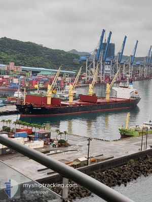
JING SHUN
Bulk Carrier
Current Trip
| Time Travelled | 16 h, 5 mins |
|---|---|
| Remaining Time | --- |
| Distance Travelled | 13.73 nm |
| Remaining Distance | --- |
| AVG Speed | 12 Knopen |
| MAX Speed | 12.4 Knopen |
| AVG Wind | 10.3 knots |
| MAX Wind | 10.8 knots |
| MIN Temp | 23°C / 73.4°F |
| MAX Temp | 23.1°C / 73.58°F |
| Diepgang | 6 M |
| Positie ontvangen | 14 h, 55 m geleden |
Current Position
| Lengtegraad | 121.18872° |
|---|---|
| Breedtegraat | 25.34662° |
| Status | Under way using engine |
| Snelheid | 12.5 Knopen |
| Koers | 324° |
| Gebied | Eastern China Sea |
| Station | T-AIS |
| Positie ontvangen | 14 h, 55 m geleden |
Info
Information
The current position of JING SHUN is in Eastern China Sea with coordinates 25.34662° / 121.18872° as reported on 2024-04-18 18:30 by AIS to our vessel tracker app. The vessel's current speed is 12.5 Knopen and is heading at the port of LUOYUAN. The estimated time of arrival as calculated by MyShipTracking vessel tracking app is 2024-04-19 14:00 LT
The vessel JING SHUN (IMO: 9246841, MMSI: 477848300) is a Bulk Carrier that was built in 2001 ( 23 Jaar oud ). It's sailing under the flag of [HK] Hong Kong.
In this page you can find informations about the vessels current position, last detected port calls, and current voyage information. If the vessels is not in coverage by AIS you will find the latest position.
The current position of JING SHUN is detected by our AIS receivers and we are not responsible for the reliability of the data. The last position was recorded while the vessel was in Coverage by the Ais receivers of our vessel tracking app.
The current draught of JING SHUN as reported by AIS is 6 meters
Weather
| Temperature | 23.1°C / 73.58°F |
|---|---|
| Wind Speed | 10 knots |
| Direction | 93° E |
| Pressure | 1010.1 hPa |
| Humidity | 72.5 % |
| Cloud Coverage | 84 % |
Featured Company
Last Port Calls
| Port | Arrival | Departure | Time In Port |
|---|---|---|---|
| 2024-04-16 02:47 | 2024-04-18 17:21 | 2 d | |
| 2024-04-08 08:26 | 2024-04-11 14:58 | 3 d | |
| 2024-04-04 21:13 | 2024-04-06 00:09 | 1 d | |
| 2024-03-07 12:28 | 2024-03-09 15:37 | 2 d | |
| 2024-03-03 18:02 | 2024-03-05 09:09 | 1 d | |
| 2024-03-02 01:27 | 2024-03-03 06:02 | 1 d | |
| 2024-02-27 19:13 | 2024-03-01 01:53 | 2 d | |
| 2024-02-26 06:20 | 2024-02-27 02:51 | 20 h | |
| 2024-02-23 15:17 | 2024-02-25 15:49 | 2 d | |
| 2024-02-22 05:08 | 2024-02-23 01:07 | 19 h |
Last Trips
| Origin | Departure | Destination | Arrival | Distance | |
|---|---|---|---|---|---|
| 2024-04-11 23:58 | 2024-04-16 10:47 | 1166.27 nm | |||
| 2024-04-06 09:09 | 2024-04-08 17:26 | 582.41 nm | |||
| 2024-03-09 23:37 | 2024-04-05 06:13 | 1606.15 nm | |||
| 2024-03-05 17:09 | 2024-03-07 20:28 | 31.02 nm | |||
| 2024-03-03 14:02 | 2024-03-04 02:02 | 120.93 nm | |||
| 2024-03-01 09:53 | 2024-03-02 09:27 | 144.72 nm | |||
| 2024-02-27 10:51 | 2024-02-28 03:13 | 131.82 nm | |||
| 2024-02-25 23:49 | 2024-02-26 14:20 | 131.37 nm | |||
| 2024-02-23 09:07 | 2024-02-23 23:17 | 123.38 nm | |||
| 2024-02-21 22:05 | 2024-02-22 13:08 | 126.93 nm |
Events
| Tijd | Evenement | Details | Positie / Bestemming | Info |
|---|---|---|---|---|
| 2024-04-18 18:30 | Buitenbereik |
25.34662 / 121.18872
Eastern China Sea
LUOYUAN
|
Snelheid: 12.5 kn Koers: 324° |
|
| 2024-04-18 18:30 | Gevonden in zee | Taiwanese part of the Eastern China Sea |
25.34662 / 121.18872
Eastern China Sea
LUOYUAN
|
Snelheid: 12.5 kn Koers: 324° |
| 2024-04-18 17:21 | Vertrekhaven |
|
25.16217 / 121.33878
LUOYUAN
|
Snelheid: 9.1 kn Koers: 248° |
| 2024-04-18 17:00 | Draught Changed | 6 9.9 |
25.15982 / 121.38927
[TW] TAIPEI
|
Snelheid: 4.3 kn Koers: 269° |
| 2024-04-18 17:00 | Destination Changed | LUOYUAN TAIPEI |
25.15982 / 121.38927
[TW] TAIPEI
|
Snelheid: 4.3 kn Koers: 269° |
| 2024-04-18 17:00 | ETA Changed | 2024/04/19 14:00 2024/04/16 10:30 |
25.15982 / 121.38927
[TW] TAIPEI
|
Snelheid: 4.3 kn Koers: 269° |
| 2024-04-18 16:55 | Binnenbereik |
25.15628 / 121.39013
South China Sea
[TW] TAIPEI
|
Snelheid: 2.6 kn Koers: 27° |
|
| 2024-04-16 03:26 | Stop beweging |
25.15495 / 121.38979
[TW] TAIPEI
|
Snelheid: 0.1 kn Koers: 45° |
|
| 2024-04-16 03:07 | Status Changed | Default Under way using engine |
25.15715 / 121.39043
[TW] TAIPEI
|
Snelheid: 3.8 kn Koers: 108° |
| 2024-04-16 03:01 | Buitenbereik |
25.15915 / 121.38698
South China Sea
[TW] TAIPEI
|
Snelheid: 3.8 kn Koers: 96° |