
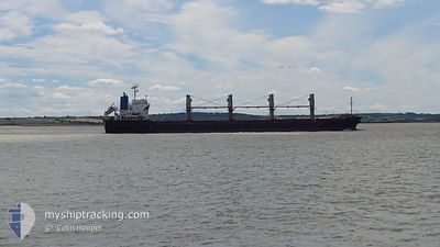
ITALIDA
Bulk Carrier
Current Trip
Current Position
| Longitude | --- |
|---|---|
| Latitude | --- |
| Status | Moored |
| Speed | |
| Course | 140° |
| Area | Aegean Sea |
| Station | T-AIS |
| Position Received | 3 m ago |
Info
Information
The current position of ITALIDA is in Aegean Sea with coordinates 37.43873° / 24.94043° as reported on 2025-03-05 10:33 by AIS to our vessel tracker app. The vessel's current speed is 0 Knots and is currently inside the port of SYROS.
The vessel ITALIDA (IMO: 9522817, MMSI: 311001082) is a Bulk Carrier that was built in 2009 ( 16 years old ). It's sailing under the flag of [BS] Bahamas.
In this page you can find informations about the vessels current position, last detected port calls, and current voyage information. If the vessels is not in coverage by AIS you will find the latest position.
The current position of ITALIDA is detected by our AIS receivers and we are not responsible for the reliability of the data. The last position was recorded while the vessel was in Coverage by the Ais receivers of our vessel tracking app.
The current draught of ITALIDA as reported by AIS is 5.5 meters
Weather
| Temperature | 12.6°C / 54.68°F |
|---|---|
| Wind Speed | 20 knots |
| Direction | 9° N |
| Pressure | 1023.7 hPa |
| Humidity | 62.4 % |
| Cloud Coverage | --- |
Featured Company
Last Port Calls
Most Visited Ports (Last year)
| Port | Arrivals | |
|---|---|---|
| 5 | ||
| 2 | ||
| 2 | ||
| 2 | ||
| 1 | ||
| 1 |
Last Trips
| Origin | Departure | Destination | Arrival | Distance | |
|---|---|---|---|---|---|
| 2025-02-25 09:45 | 2025-02-28 17:07 | 580.38 nm | |||
| 2025-02-15 01:03 | 2025-02-22 14:20 | 1499.11 nm | |||
| 2025-02-06 22:32 | 2025-02-15 00:22 | 84.10 nm | |||
| 2025-01-29 16:56 | 2025-02-01 22:12 | 696.92 nm | |||
| 2025-01-17 23:11 | 2025-01-29 06:45 | 2581.36 nm | |||
| 2024-12-27 15:05 | 2025-01-15 21:50 | 2988.40 nm |
Events
| Time | Event | Details | Position / Dest | Info |
|---|---|---|---|---|
| 2025-03-01 00:04 | ETA Changed | 2026/02/28 13:00 2025/02/28 13:00 |
37.43872 / 24.94043
[GR] SYROS
|
Speed: Course: 141° |
| 2025-02-28 16:00 | Status Changed | Moored Under way using engine |
37.43885 / 24.94040
[GR] SYROS
|
Speed: Course: 141° |
| 2025-02-28 15:15 | STOP Moving |
37.43697 / 24.94380
[GR] SYROS
|
Speed: 0.3 kn Course: 109° |
|
| 2025-02-28 15:07 | PORT ARRIVAL |
|
37.43545 / 24.94730
[GR] SYROS
|
Speed: 3 kn Course: 294° |
| 2025-02-28 14:15 | START Moving | 3.05 nm, East of SYROS |
37.45212 / 25.00362
ALROM/GRJSY
|
Speed: 3.1 kn Course: 140° |
| 2025-02-28 13:39 | STOP Moving | 2.74 nm, North East of SYROS |
37.45593 / 24.99447
ALROM/GRJSY
|
Speed: 0.3 kn Course: 349° |
| 2025-02-28 03:06 | Status Changed | Under way using engine Default |
36.71230 / 23.85420
ALROM/GRJSY
|
Speed: 11.6 kn Course: 57° |
| 2025-02-28 02:43 | Status Changed | Default Under way using engine |
36.67373 / 23.78055
ALROM/GRJSY
|
Speed: 11.5 kn Course: 57° |
| 2025-02-28 01:52 | Detected in Sea | Greek part of the Aegean Sea |
36.58948 / 23.61035
Aegean Sea
ALROM/GRJSY
|
Speed: 11.1 kn Course: 59° |
| 2025-02-28 01:52 | Status Changed | Under way using engine Default |
36.58948 / 23.61035
ALROM/GRJSY
|
Speed: 11.2 kn Course: 56° |