
ITALIDA
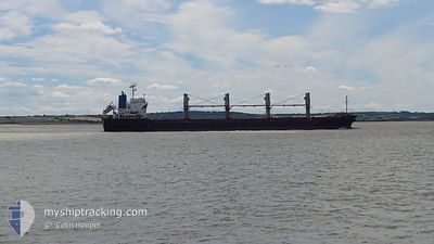
Bulk Carrier
Current Trip
| Time Travelled | 9 days |
|---|---|
| Remaining Time | --- |
| Distance Travelled | 2073.93 nm |
| Remaining Distance | --- |
| AVG Speed | 10.5 Knots |
| MAX Speed | 13 Knots |
| AVG Wind | 9.2 knots |
| MAX Wind | 25 knots |
| MIN Temp | 16.1°C / 60.98°F |
| MAX Temp | 27.7°C / 81.86°F |
| Dybgang | 8.4 m |
| Position Modtaget | Nu |
Current Position
| Longitude | -5.99686° |
|---|---|
| Latitude | 35.95582° |
| Status | Under way using engine |
| Fart | 9.9 Knots |
| Kurs | 268.9° |
| Område | North Atlantic Ocean |
| Station | T-AIS |
| Position Modtaget | Nu |
Info
Information
The current position of ITALIDA is in North Atlantic Ocean with coordinates 35.95582° / -5.99686° as reported on 2024-06-08 08:02 by AIS to our vessel tracker app. The vessel's current speed is 9.9 Knots and is heading at the port of BARRANQUILLA. The estimated time of arrival as calculated by MyShipTracking vessel tracking app is 2024-06-24 02:00 LT
The vessel ITALIDA (IMO: 9522817, MMSI: 311001082) is a Bulk Carrier that was built in 2009 ( 15 år gamle ). It's sailing under the flag of [BS] Bahamas.
In this page you can find informations about the vessels current position, last detected port calls, and current voyage information. If the vessels is not in coverage by AIS you will find the latest position.
The current position of ITALIDA is detected by our AIS receivers and we are not responsible for the reliability of the data. The last position was recorded while the vessel was in Coverage by the Ais receivers of our vessel tracking app.
The current draught of ITALIDA as reported by AIS is 8.4 meters
Weather
| Temperature | 19.5°C / 67.1°F |
|---|---|
| Wind Speed | 10 knots |
| Direction | 239° WSW |
| Pressure | 1015 hPa |
| Humidity | 72.4 % |
| Cloud Coverage | 100 % |
Featured Company
Last Port Calls
| Port | Arrival | Departure | Time In Port |
|---|---|---|---|
| 2024-05-24 23:59 | 2024-05-29 11:42 | 4 d | |
| 2024-05-08 03:57 | 2024-05-08 17:33 | 13 h | |
| 2024-05-08 01:32 | 2024-05-08 03:40 | 2 h | |
| 2024-05-07 22:58 | 2024-05-07 23:13 | 14 m | |
| 2024-05-07 04:13 | 2024-05-07 22:39 | 18 h | |
| 2024-04-22 18:31 | 2024-04-23 22:58 | 1 d | |
| 2024-04-09 12:22 | 2024-04-17 12:26 | 8 d |
Last Trips
| Origin | Departure | Destination | Arrival | Distance | |
|---|---|---|---|---|---|
| 2024-05-08 17:33 | 2024-05-24 23:59 | 71.41 nm | |||
| 2024-05-08 03:40 | 2024-05-08 03:57 | 10.42 nm | |||
| 2024-05-07 23:13 | 2024-05-08 01:32 | 13.64 nm | |||
| 2024-05-07 22:39 | 2024-05-07 22:58 | 4.24 nm | |||
| 2024-04-23 22:58 | 2024-05-07 04:13 | 2728.11 nm | |||
| 2024-04-17 12:26 | 2024-04-22 18:31 | 262.52 nm | |||
| 2024-03-20 11:28 | 2024-04-09 12:22 | 4751.83 nm |
Events
| Tid | Hændelsen | Detaljer | Position / Dest | Info |
|---|---|---|---|---|
| 2024-06-08 07:55 | Fundet i havområde | Moroccan part of the North Atlantic Ocean |
35.95560 / -5.97195
North Atlantic Ocean
MTWTW>COBAQ
|
Fart: 9.8 kn Kurs: 270.9° |
| 2024-06-08 07:44 | Fundet i havområde | Moroccan part of the Strait of Gibraltar |
35.95563 / -5.93618
Strait of Gibraltar
MTWTW>COBAQ
|
Fart: 9.7 kn Kurs: 268.9° |
| 2024-06-08 07:30 | Status er ændret | Under way using engine Default |
35.95605 / -5.89123
MTWTW>COBAQ
|
Fart: 9.6 kn Kurs: 268° |
| 2024-06-08 06:43 | Status er ændret | Default Under way using engine |
35.95569 / -5.74333
MTWTW>COBAQ
|
Fart: 8.7 kn Kurs: 272° |
| 2024-06-08 06:37 | Status er ændret | Under way using engine Default |
35.95495 / -5.72432
MTWTW>COBAQ
|
Fart: 8.8 kn Kurs: 276° |
| 2024-06-08 06:26 | Status er ændret | Default Under way using engine |
35.95463 / -5.69235
MTWTW>COBAQ
|
Fart: 8.3 kn Kurs: 268° |
| 2024-06-08 05:32 | Status er ændret | Under way using engine Default |
35.97955 / -5.53973
MTWTW>COBAQ
|
Fart: 9 kn Kurs: 251° |
| 2024-06-08 05:31 | Status er ændret | Default Under way using engine |
35.98030 / -5.53680
MTWTW>COBAQ
|
Fart: 9 kn Kurs: 253° |
| 2024-06-08 04:25 | Ændre havområde | Spanish part of the Strait of Gibraltar Gibraltarian part of the Strait of Gibraltar |
36.02525 / -5.34745
Strait of Gibraltar
MTWTW>COBAQ
|
Fart: 10.7 kn Kurs: 251° |
| 2024-06-08 04:20 | Ændre havområde | Gibraltarian part of the Strait of Gibraltar Gibraltarian part of the Alboran Sea |
36.03005 / -5.32767
Strait of Gibraltar
MTWTW>COBAQ
|
Fart: 11 kn Kurs: 257° |