
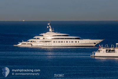
I.J.E
Pleasure Craft
Current Trip
| Time Travelled | 2 days |
|---|---|
| Remaining Time | --- |
| Distance Travelled | 200.90 nm |
| Remaining Distance | --- |
| AVG Speed | 10.7 Knots |
| MAX Speed | 13.1 Knots |
| AVG Wind | 15.1 knots |
| MAX Wind | 19 knots |
| MIN Temp | 25.8°C / 78.44°F |
| MAX Temp | 26.8°C / 80.24°F |
| Draught | 4.4 m |
| Position Received | 22 m ago |
Current Position
| Longitude | --- |
|---|---|
| Latitude | --- |
| Status | At anchor |
| Speed | 0.2 Knots |
| Course | 91° |
| Area | Caribbean Sea |
| Station | T-AIS |
| Position Received | 22 m ago |
Info
Information
The current position of I.J.E is in Caribbean Sea with coordinates 18.43887° / -64.44978° as reported on 2025-12-21 19:28 by AIS to our vessel tracker app. The vessel's current speed is 0.2 Knots
The vessel I.J.E (IMO: 1013004, MMSI: 538071332) is a Pleasure Craft It's sailing under the flag of [MH] Marshall Is.
In this page you can find informations about the vessels current position, last detected port calls, and current voyage information. If the vessels is not in coverage by AIS you will find the latest position.
The current position of I.J.E is detected by our AIS receivers and we are not responsible for the reliability of the data. The last position was recorded while the vessel was in Coverage by the Ais receivers of our vessel tracking app.
The current draught of I.J.E as reported by AIS is 4.4 meters
Weather
| Temperature | 26.5°C / 79.7°F |
|---|---|
| Wind Speed | 15 knots |
| Direction | 82° E |
| Pressure | 1014.7 hPa |
| Humidity | 75 % |
| Cloud Coverage | 3 % |
Featured Company
Events
| Time | Event | Details | Position / Dest | Info |
|---|---|---|---|---|
| 2025-12-20 11:19 | Status Changed | At anchor Under way using engine |
18.43850 / -64.44932
VIRGIN GORDA
|
Speed: Course: 68° |
| 2025-12-20 11:16 | STOP Moving | 0.94 nm, South West of VIRGIN GORDA |
18.43866 / -64.44916
VIRGIN GORDA
|
Speed: Course: 80° |
| 2025-12-20 08:43 | Detected in Sea | British Virgin Islands part of the Caribbean Sea |
18.05630 / -64.22255
Caribbean Sea
VIRGIN GORDA
|
Speed: 11 kn Course: 325° |
| 2025-12-20 08:43 | IN Coverage |
18.05630 / -64.22255
Caribbean Sea
VIRGIN GORDA
|
Speed: 11 kn Course: 325° |
|
| 2025-12-20 03:54 | OUT of Coverage |
17.90773 / -63.45000
Caribbean Sea
VIRGIN GORDA
|
Speed: 11.7 kn Course: 250.3° |
|
| 2025-12-20 02:41 | Change Sea Area | Saint-Martin part of the Caribbean Sea Sint-Maarten part of the Caribbean Sea |
17.98753 / -63.22223
Caribbean Sea
VIRGIN GORDA
|
Speed: 11.5 kn Course: 250.4° |
| 2025-12-20 02:05 | START Moving | 1.29 nm, South West of ST MAARTEN |
18.02627 / -63.11138
VIRGIN GORDA
|
Speed: 6.7 kn Course: 238.9° |
| 2025-12-20 01:56 | Status Changed | Under way using engine At anchor |
18.02692 / -63.10872
VIRGIN GORDA
|
Speed: 0.1 kn Course: 87° |
| 2025-12-20 00:33 | Destination Changed | VIRGIN GORDA SIMPSON BAY SM |
18.02632 / -63.10872
VIRGIN GORDA
|
Speed: 0.1 kn Course: 96° |
| 2025-12-20 00:33 | ETA Changed | 2025/12/20 07:00 2025/12/19 08:00 |
18.02632 / -63.10872
VIRGIN GORDA
|
Speed: 0.1 kn Course: 96° |