
I.J.E
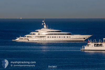
Pleasure Craft
Current Trip
| Time Travelled | 21 days |
|---|---|
| Remaining Time | --- |
| Distance Travelled | 1168.26 nm |
| Remaining Distance | --- |
| AVG Speed | 12.3 Noeuds |
| MAX Speed | 15.8 Noeuds |
| AVG Wind | 11.1 knots |
| MAX Wind | 19.8 knots |
| MIN Temp | 22.5°C / 72.5°F |
| MAX Temp | 28°C / 82.4°F |
| Tirant d eau | 4.4 m |
| Position reçue | 36 m depuis |
Current Position
| Longitude | --- |
|---|---|
| Latitude | --- |
| Etat | Under way using engine |
| Vitesse | 13.2 Noeuds |
| Parcours | 160.9° |
| Zone | Caribbean Sea |
| Station | T-AIS |
| Position reçue | 36 m depuis |
Info
Information
The current position of I.J.E is in Caribbean Sea with coordinates 15.01991° / -61.48062° as reported on 2026-01-09 06:10 by AIS to our vessel tracker app. The vessel's current speed is 13.2 Noeuds
The vessel I.J.E (IMO: 1013004, MMSI: 538071332) is a Pleasure Craft It's sailing under the flag of [MH] Marshall Is.
In this page you can find informations about the vessels current position, last detected port calls, and current voyage information. If the vessels is not in coverage by AIS you will find the latest position.
The current position of I.J.E is detected by our AIS receivers and we are not responsible for the reliability of the data. The last position was recorded while the vessel was in Coverage by the Ais receivers of our vessel tracking app.
The current draught of I.J.E as reported by AIS is 4.4 meters
Weather
| Temperature | 26.5°C / 79.7°F |
|---|---|
| Wind Speed | 16 knots |
| Direction | 67° ENE |
| Pressure | 1014.7 hPa |
| Humidity | 72.3 % |
| Cloud Coverage | --- |
Featured Company
Events
| Heure | Evenement | Détails | Position/ Destination | Info |
|---|---|---|---|---|
| 2026-01-09 04:50 | Dans la zone couverte |
15.31288 / -61.57225
Caribbean Sea
|
Vitesse: 14 kn Parcours: 164.6° |
|
| 2026-01-09 03:47 | Hors de la zone couverte |
15.54255 / -61.64721
Caribbean Sea
|
Vitesse: 13.8 kn Parcours: 160.4° |
|
| 2026-01-09 03:36 | Detecté en mer | Dominican part of the Caribbean Sea |
15.58151 / -61.66118
Caribbean Sea
|
Vitesse: 13.7 kn Parcours: 160.6° |
| 2026-01-09 03:36 | Dans la zone couverte |
15.58151 / -61.66118
Caribbean Sea
|
Vitesse: 13.7 kn Parcours: 160.6° |
|
| 2026-01-09 00:45 | Hors de la zone couverte |
16.12987 / -61.77963
Caribbean Sea
|
Vitesse: 0.1 kn Parcours: 229.3° |
|
| 2026-01-08 22:09 | Dans la zone couverte |
16.12998 / -61.77979
Caribbean Sea
|
Vitesse: 0.1 kn Parcours: 62.5° |
|
| 2026-01-08 19:09 | Hors de la zone couverte |
16.12954 / -61.77931
Caribbean Sea
|
Vitesse: Parcours: 144° |
|
| 2026-01-08 15:06 | Dans la zone couverte |
16.12936 / -61.77922
Caribbean Sea
|
Vitesse: Parcours: 144° |
|
| 2026-01-08 11:24 | Hors de la zone couverte |
16.13965 / -61.86647
Caribbean Sea
GUADELOUPE
|
Vitesse: 12 kn Parcours: 102.5° |
|
| 2026-01-08 10:50 | Changement de destination | GUADELOUPE ANTIGUA |
16.16571 / -61.98613
GUADELOUPE
|
Vitesse: 12.8 kn Parcours: 101° |