
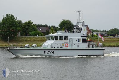
HMS TRUMPETER
Military ops
Current Trip
Unknown
| Time Travelled | 17 h, 32 mins |
|---|---|
| Remaining Time | --- |
| Distance Travelled | 35.44 nm |
| Remaining Distance | --- |
| AVG Speed | 20.6 Knots |
| MAX Speed | 21.8 Knots |
| AVG Wind | 12.9 knots |
| MAX Wind | 13 knots |
| MIN Temp | 16.8°C / 62.24°F |
| MAX Temp | 18.6°C / 65.48°F |
| Draught | --- |
| Position Received | 15 h, 23 m ago |
Current Position
| Longitude | -0.21995° |
|---|---|
| Latitude | 50.77960° |
| Status | Default |
| Speed | 21 Knots |
| Course | 21.6° |
| Area | English Channel |
| Station | T-AIS |
| Position Received | 15 h, 23 m ago |
Info
Information
The current position of HMS TRUMPETER is in English Channel with coordinates 50.77960° / -0.21995° as reported on 2024-07-26 13:43 by AIS to our vessel tracker app. The vessel's current speed is 21 Knots
The vessel HMS TRUMPETER (MMSI: 232002978) is a Military ops It's sailing under the flag of [GB] United Kingdom.
In this page you can find informations about the vessels current position, last detected port calls, and current voyage information. If the vessels is not in coverage by AIS you will find the latest position.
The current position of HMS TRUMPETER is detected by our AIS receivers and we are not responsible for the reliability of the data. The last position was recorded while the vessel was in Coverage by the Ais receivers of our vessel tracking app.
Weather
| Temperature | 16.8°C / 62.24°F |
|---|---|
| Wind Speed | 13 knots |
| Direction | 235° SW |
| Pressure | 1012.5 hPa |
| Humidity | 78.1 % |
| Cloud Coverage | 100 % |
Featured Company
Last Port Calls
| Port | Arrival | Departure | Time In Port |
|---|---|---|---|
| 2024-07-12 09:07 | 2024-07-26 12:34 | 14 d | |
| 2024-07-11 16:45 | 2024-07-12 08:09 | 15 h | |
| 2024-07-01 15:45 | 2024-07-11 16:00 | 10 d | |
| 2024-06-26 12:14 | 2024-06-28 13:15 | 2 d | |
| 2024-06-21 13:47 | 2024-06-25 13:10 | 3 d | |
| 2024-06-19 14:12 | 2024-06-21 13:09 | 1 d | |
| 2024-06-17 15:42 | 2024-06-19 08:54 | 1 d | |
| 2024-06-09 16:53 | |||
| 2024-06-06 11:13 | 2024-06-09 12:15 | 3 d | |
| 2024-06-04 09:24 |
Most Visited Ports (Last year)
| Port | Arrivals | |
|---|---|---|
| 7 | ||
| 3 | ||
| 2 | ||
| 2 | ||
| 2 | ||
| 2 |
Last Trips
| Origin | Departure | Destination | Arrival | Distance | |
|---|---|---|---|---|---|
| 2024-07-12 08:09 | 2024-07-12 09:07 | 10.77 nm | |||
| 2024-07-11 16:00 | 2024-07-11 16:45 | 6.16 nm | |||
| 2024-06-28 13:15 | 2024-07-01 15:45 | 137.35 nm | |||
| 2024-06-25 13:10 | 2024-06-26 12:14 | 108.24 nm | |||
| 2024-06-21 13:09 | 2024-06-21 13:47 | 10.31 nm | |||
| 2024-06-19 08:54 | 2024-06-19 14:12 | 58.80 nm | |||
| 2024-06-09 12:15 | 2024-06-17 15:42 | 51.80 nm | |||
| 2024-06-09 12:15 | 2024-06-09 16:53 | 48.01 nm | |||
| 2024-06-04 08:19 | 2024-06-04 09:24 | 0.70 nm | |||
| 2024-05-01 10:19 | 2024-05-03 18:32 | 159.47 nm |
Events
| Time | Event | Details | Position / Dest | Info |
|---|---|---|---|---|
| 2024-07-26 13:43 | OUT of Coverage |
50.77960 / -.21995
English Channel
|
Speed: 21 kn Course: 21.6° |
|
| 2024-07-26 13:21 | IN Coverage |
50.72697 / -.38669
English Channel
|
Speed: 19.7 kn Course: 65.3° |
|
| 2024-07-26 11:34 | OUT of Coverage |
50.80515 / -1.11553
English Channel
|
Speed: 4.9 kn Course: 188.4° |
|
| 2024-07-26 11:34 | PORT DEPARTURE |
|
50.80515 / -1.11553
|
Speed: 5.4 kn Course: 231.6° |
| 2024-07-26 11:29 | IN Coverage |
50.80783 / -1.10840
English Channel
[GB] PORTSMOUTH
|
Speed: 6 kn Course: 287.8° |
|
| 2024-07-26 07:28 | OUT of Coverage |
50.80614 / -1.10708
English Channel
[GB] PORTSMOUTH
|
Speed: Course: 0° |
|
| 2024-07-25 13:08 | IN Coverage |
50.80619 / -1.10710
English Channel
[GB] PORTSMOUTH
|
Speed: Course: 242° |
|
| 2024-07-24 12:47 | OUT of Coverage |
50.80622 / -1.10748
English Channel
[GB] PORTSMOUTH
|
Speed: Course: 232.2° |
|
| 2024-07-24 11:56 | IN Coverage |
50.80622 / -1.10750
English Channel
[GB] PORTSMOUTH
|
Speed: Course: 63° |