
HIGHWAY
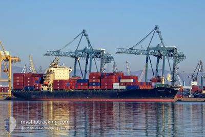
Container Ship
Current Trip
| Time Travelled | 5 days |
|---|---|
| Remaining Time | --- |
| Distance Travelled | 1305.64 nm |
| Remaining Distance | 656.77 nm |
| AVG Speed | 12.1 Knots |
| MAX Speed | 18.3 Knots |
| AVG Wind | 8.6 knots |
| MAX Wind | 17.3 knots |
| MIN Temp | 25°C / 77°F |
| MAX Temp | 30.5°C / 86.9°F |
| Draught | 7.7 m |
| Position Received | 2 d ago |
Current Position
| Longitude | --- |
|---|---|
| Latitude | --- |
| Status | Under way using engine |
| Speed | 16.4 Knots |
| Course | 302.1° |
| Area | Java Sea |
| Station | T-AIS |
| Position Received | 2 d ago |
Info
Information
The current position of HIGHWAY is in Java Sea with coordinates -5.24374° / 110.11844° as reported on 2026-01-03 05:00 by AIS to our vessel tracker app. The vessel's current speed is 16.4 Knots and is heading at the port of LAEM CHABANG. The estimated time of arrival as calculated by MyShipTracking vessel tracking app is 2026-01-06 22:00 LT
The vessel HIGHWAY (IMO: 9158575, MMSI: 353848000) is a Container Ship that was built in 1998 ( 28 years old ). It's sailing under the flag of [PA] Panama.
In this page you can find informations about the vessels current position, last detected port calls, and current voyage information. If the vessels is not in coverage by AIS you will find the latest position.
The current position of HIGHWAY is detected by our AIS receivers and we are not responsible for the reliability of the data. The last position was recorded while the vessel was in Coverage by the Ais receivers of our vessel tracking app.
The current draught of HIGHWAY as reported by AIS is 7.7 meters
Weather
| Temperature | 26.4°C / 79.52°F |
|---|---|
| Wind Speed | 17 knots |
| Direction | 80° E |
| Pressure | 1011.5 hPa |
| Humidity | 78 % |
| Cloud Coverage | 100 % |
Featured Company
Last Port Calls
| Port | Arrival | Departure | Time In Port |
|---|---|---|---|
| 2025-12-30 16:55 | 2025-12-31 13:43 | 20 h | |
| 2025-12-25 01:34 | 2025-12-25 19:42 | 18 h | |
| 2025-12-16 11:37 | 2025-12-17 17:49 | 1 d | |
| 2025-12-11 15:52 | 2025-12-12 14:41 | 22 h | |
| 2025-12-02 11:46 | 2025-12-03 14:44 | 1 d | |
| 2025-11-27 08:13 | 2025-11-28 06:33 | 22 h | |
| 2025-11-18 11:59 | 2025-11-19 18:07 | 1 d | |
| 2025-11-13 04:00 | 2025-11-14 01:16 | 21 h | |
| 2025-11-04 11:43 | 2025-11-05 15:15 | 1 d |
Last Trips
| Origin | Departure | Destination | Arrival | Distance | |
|---|---|---|---|---|---|
| 2025-12-25 19:42 | 2025-12-30 16:55 | 1290.67 nm | |||
| 2025-12-17 17:49 | 2025-12-25 01:34 | 1972.75 nm | |||
| 2025-12-12 14:41 | 2025-12-16 11:37 | 1263.86 nm | |||
| 2025-12-03 14:44 | 2025-12-11 15:52 | 2002.73 nm | |||
| 2025-11-28 06:33 | 2025-12-02 11:46 | 1269.02 nm | |||
| 2025-11-19 18:07 | 2025-11-27 08:13 | 1948.18 nm | |||
| 2025-11-14 01:16 | 2025-11-18 11:59 | 1276.31 nm | |||
| 2025-11-05 15:15 | 2025-11-13 04:00 | 1943.95 nm | |||
| 2025-10-31 06:44 | 2025-11-04 11:43 | 1250.84 nm |
Events
| Time | Event | Details | Position / Dest | Info |
|---|---|---|---|---|
| 2026-01-03 05:41 | Status Changed | Default Under way using engine |
-5.14446 / 109.96114
THLCH
|
Speed: 16.4 kn Course: 302.1° |
| 2026-01-03 05:00 | OUT of Coverage |
-5.24374 / 110.11844
Java Sea
THLCH
|
Speed: 16.4 kn Course: 302.1° |
|
| 2026-01-03 01:35 | Status Changed | Under way using engine Default |
-5.70833 / 110.92365
THLCH
|
Speed: 16.2 kn Course: 298° |
| 2026-01-03 01:31 | IN Coverage |
-5.70339 / 110.91496
Java Sea
THLCH
|
Speed: 15.9 kn Course: 299.1° |
|
| 2026-01-02 21:18 | Status Changed | Default Under way using engine |
-6.28366 / 111.94102
THLCH
|
Speed: 16.5 kn Course: 300.4° |
| 2026-01-02 21:08 | OUT of Coverage |
-6.30779 / 111.98408
Java Sea
THLCH
|
Speed: 16.5 kn Course: 300.4° |
|
| 2026-01-02 20:35 | Status Changed | Under way using engine Default |
-6.37718 / 112.11692
THLCH
|
Speed: 16.8 kn Course: 300° |
| 2026-01-02 19:54 | Status Changed | Default Under way using engine |
-6.47439 / 112.28314
THLCH
|
Speed: 17.1 kn Course: 303.8° |
| 2026-01-02 19:45 | Status Changed | Under way using engine Default |
-6.49912 / 112.31989
THLCH
|
Speed: 17.1 kn Course: 301° |
| 2026-01-02 19:42 | Status Changed | Default Under way using engine |
-6.50608 / 112.33064
THLCH
|
Speed: 17 kn Course: 292.7° |