
HARVEST RAIN
Cargo
Current Trip
| Time Travelled | 8 days |
|---|---|
| Remaining Time | --- |
| Distance Travelled | 2183.58 nm |
| Remaining Distance | --- |
| AVG Speed | 11.3 Knots |
| MAX Speed | 14.3 Knots |
| AVG Wind | 16.8 knots |
| MAX Wind | 32 knots |
| MIN Temp | --- |
| MAX Temp | 29.3°C / 84.74°F |
| Draught | 13.8 m |
| Position Received | 2024-10-29 00:52 |
Current Position
| Longitude | --- |
|---|---|
| Latitude | --- |
| Status | Under way using engine |
| Speed | 6 Knots |
| Course | 245.8° |
| Area | North Pacific Ocean |
| Station | T-AIS |
| Position Received | 2024-10-29 00:52 |
Info
Information
The current position of HARVEST RAIN is in North Pacific Ocean with coordinates 48.15581° / -125.74116° as reported on 2024-10-29 00:52 by AIS to our vessel tracker app. The vessel's current speed is 6 Knots and is heading at the port of BAYUQUAN.
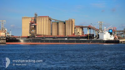
The vessel HARVEST RAIN (IMO: 9643893, MMSI: 538006315) is a Cargo It's sailing under the flag of [MH] Marshall Is.
In this page you can find informations about the vessels current position, last detected port calls, and current voyage information. If the vessels is not in coverage by AIS you will find the latest position.
The current position of HARVEST RAIN is detected by our AIS receivers and we are not responsible for the reliability of the data. The last position was recorded while the vessel was in Coverage by the Ais receivers of our vessel tracking app.
The current draught of HARVEST RAIN as reported by AIS is 13.8 meters
Weather
| Temperature | 29.4°C / 84.92°F |
|---|---|
| Wind Speed | 15 knots |
| Direction | 74° ENE |
| Pressure | 1009.1 hPa |
| Humidity | 69 % |
| Cloud Coverage | 23 % |
Featured Company
Events
| Time | Event | Details | Position / Dest | Info |
|---|---|---|---|---|
| 2024-12-06 14:29 | START Moving | 5.29 nm, South of JINHAI HEAVY INDUSTR |
30.16721 / 122.25566
BAYUQUAN
|
Speed: 3.5 kn Course: 118° |
| 2024-12-06 04:17 | STOP Moving | 5.28 nm, South of JINHAI HEAVY INDUSTR |
30.16725 / 122.24933
BAYUQUAN
|
Speed: 0.1 kn Course: 121° |
| 2024-12-03 21:12 | PORT DEPARTURE |
|
39.73204 / 124.14394
BAYUQUAN
|
Speed: 6 kn Course: 204° |
| 2024-12-03 21:09 | START Moving |
39.73930 / 124.14815
[CN] DANDONG
|
Speed: 6 kn Course: 204° |