
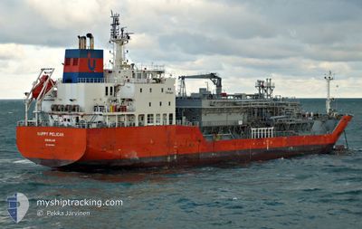
HAPPY PELICAN
Tanker D
Current Trip
| Time Travelled | 10 days |
|---|---|
| Remaining Time | 1 day |
| Distance Travelled | 2795.33 nm |
| Remaining Distance | 328.16 nm |
| AVG Speed | 11 Knots |
| MAX Speed | 14.3 Knots |
| AVG Wind | 12.3 knots |
| MAX Wind | 28.7 knots |
| MIN Temp | 10.2°C / 50.36°F |
| MAX Temp | 20°C / 68°F |
| Draught | 6.4 m |
| Position Received | 40 m ago |
Current Position
| Longitude | -4.04309° |
|---|---|
| Latitude | 49.36993° |
| Status | Under way using engine |
| Speed | 13 Knots |
| Course | 59.1° |
| Area | English Channel |
| Station | T-AIS |
| Position Received | 40 m ago |
Info
Information
The current position of HAPPY PELICAN is in English Channel with coordinates 49.36993° / -4.04309° as reported on 2024-04-26 05:12 by AIS to our vessel tracker app. The vessel's current speed is 13 Knots and is heading at the port of TERNEUZEN. The estimated time of arrival as calculated by MyShipTracking vessel tracking app is 2024-04-27 07:59 LT
The vessel HAPPY PELICAN (IMO: 9618850, MMSI: 235094449) is a Tanker D It's sailing under the flag of [GB] United Kingdom.
In this page you can find informations about the vessels current position, last detected port calls, and current voyage information. If the vessels is not in coverage by AIS you will find the latest position.
The current position of HAPPY PELICAN is detected by our AIS receivers and we are not responsible for the reliability of the data. The last position was recorded while the vessel was in Coverage by the Ais receivers of our vessel tracking app.
The current draught of HAPPY PELICAN as reported by AIS is 6.4 meters
Weather
| Temperature | 10.4°C / 50.72°F |
|---|---|
| Wind Speed | 10 knots |
| Direction | 235° SW |
| Pressure | 1000.1 hPa |
| Humidity | 83.7 % |
| Cloud Coverage | 100 % |
Featured Company
Last Port Calls
| Port | Arrival | Departure | Time In Port |
|---|---|---|---|
| 2024-04-14 09:17 | 2024-04-15 07:28 | 22 h | |
| 2024-03-20 22:47 | 2024-03-23 14:40 | 2 d | |
| 2024-02-13 10:34 | 2024-02-15 22:20 | 2 d |
Most Visited Ports (Last year)
| Port | Arrivals | |
|---|---|---|
| 15 | ||
| 10 | ||
| 6 | ||
| 4 | ||
| 3 | ||
| 2 |
Last Trips
| Origin | Departure | Destination | Arrival | Distance | |
|---|---|---|---|---|---|
| 2024-03-23 15:40 | 2024-04-14 11:17 | 3767.42 nm | |||
| 2024-02-15 19:20 | 2024-03-20 23:47 | 6852.86 nm | |||
| 2024-01-13 05:04 | 2024-02-13 07:34 | 6091.09 nm |
Events
| Time | Event | Details | Position / Dest | Info |
|---|---|---|---|---|
| 2024-04-26 05:18 | Status Changed | Default Under way using engine |
49.38087 / -4.01420
GIGIB >> NL TNZ
|
Speed: 13 kn Course: 59.1° |
| 2024-04-26 05:12 | Status Changed | Under way using engine Default |
49.36900 / -4.04547
GIGIB >> NL TNZ
|
Speed: 13.1 kn Course: 60° |
| 2024-04-26 04:40 | Status Changed | Default Under way using engine |
49.31167 / -4.19667
GIGIB >> NL TNZ
|
Speed: 12.9 kn Course: 59.9° |
| 2024-04-26 03:07 | Status Changed | Under way using engine Default |
49.14450 / -4.63413
GIGIB >> NL TNZ
|
Speed: 12 kn Course: 62° |
| 2024-04-26 03:01 | Status Changed | Default Under way using engine |
49.13334 / -4.66167
GIGIB >> NL TNZ
|
Speed: 12.6 kn Course: 62.5° |
| 2024-04-26 02:37 | ETA Changed | 2024/04/27 05:00 2024/04/27 04:00 |
49.09683 / -4.77220
GIGIB >> NL TNZ
|
Speed: 12.3 kn Course: 62.2° |
| 2024-04-26 02:10 | Change Sea Area | French part of the English Channel French part of the Celtic Sea |
49.05258 / -4.89537
English Channel
GIGIB >> NL TNZ
|
Speed: 12 kn Course: 60.4° |
| 2024-04-26 02:07 | Status Changed | Under way using engine Default |
49.04703 / -4.91015
GIGIB >> NL TNZ
|
Speed: 11 kn Course: 60° |
| 2024-04-26 01:31 | Status Changed | Default Under way using engine |
48.99500 / -5.06667
GIGIB >> NL TNZ
|
Speed: 11.2 kn Course: 55.2° |
| 2024-04-26 01:19 | Change Sea Area | French part of the Celtic Sea Spanish part of the North Atlantic Ocean |
48.97510 / -5.11327
Celtic Sea
GIGIB >> NL TNZ
|
Speed: 11.1 kn Course: 55.2° |