
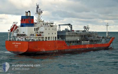
HAPPY PELICAN
Tanker D
Current Trip
| Time Travelled | 4 days |
|---|---|
| Remaining Time | 3 days |
| Distance Travelled | 774.68 nm |
| Remaining Distance | 963.42 nm |
| AVG Speed | 11.2 Knop |
| MAX Speed | 14 Knop |
| AVG Wind | 12.5 knots |
| MAX Wind | 28.7 knots |
| MIN Temp | 15.3°C / 59.54°F |
| MAX Temp | 20°C / 68°F |
| Djupgående | 6 m |
| Position mottagen | 1 d sen |
Current Position
| Longitud | 14.17999° |
|---|---|
| Latitude | 36.56887° |
| Status | Under way using engine |
| Fart | 8.3 Knop |
| Kurs | 292.5° |
| Område | Mediterranean Sea - Eastern Basin |
| Station | T-AIS |
| Position mottagen | 1 d sen |
Info
Information
The current position of HAPPY PELICAN is in Mediterranean Sea - Eastern Basin with coordinates 36.56887° / 14.17999° as reported on 2024-04-18 04:11 by AIS to our vessel tracker app. The vessel's current speed is 8.3 Knop and is heading at the port of GIBRALTAR. The estimated time of arrival as calculated by MyShipTracking vessel tracking app is 2024-04-22 23:41 LT
The vessel HAPPY PELICAN (IMO: 9618850, MMSI: 235094449) is a Tanker D It's sailing under the flag of [GB] United Kingdom.
In this page you can find informations about the vessels current position, last detected port calls, and current voyage information. If the vessels is not in coverage by AIS you will find the latest position.
The current position of HAPPY PELICAN is detected by our AIS receivers and we are not responsible for the reliability of the data. The last position was recorded while the vessel was in Coverage by the Ais receivers of our vessel tracking app.
The current draught of HAPPY PELICAN as reported by AIS is 6 meters
Weather
| Temperature | 15.4°C / 59.72°F |
|---|---|
| Wind Speed | 24 knots |
| Direction | 302° WNW |
| Pressure | 1011.1 hPa |
| Humidity | 65.8 % |
| Cloud Coverage | --- |
Featured Company
Last Port Calls
| Port | Arrival | Departure | Time In Port |
|---|---|---|---|
| 2024-04-14 09:17 | 2024-04-15 07:28 | 22 h | |
| 2024-03-20 22:47 | 2024-03-23 14:40 | 2 d | |
| 2024-02-13 10:34 | 2024-02-15 22:20 | 2 d |
Most Visited Ports (Last year)
| Port | Arrivals | |
|---|---|---|
| 15 | ||
| 10 | ||
| 6 | ||
| 4 | ||
| 3 | ||
| 3 |
Last Trips
| Origin | Departure | Destination | Arrival | Distance | |
|---|---|---|---|---|---|
| 2024-03-23 15:40 | 2024-04-14 11:17 | 3767.42 nm | |||
| 2024-02-15 19:20 | 2024-03-20 23:47 | 6852.86 nm | |||
| 2024-01-13 05:04 | 2024-02-13 07:34 | 6091.09 nm |
Events
| Tid | Event | Detaljer | Position / Dest | Information |
|---|---|---|---|---|
| 2024-04-18 04:13 | Status ändrad | Default Under way using engine |
36.56833 / 14.17500
ITPMA >> GB GIB
|
Fart: 8.3 kn Kurs: 292.5° |
| 2024-04-18 04:11 | UTANFÖR täckningsområde |
36.56887 / 14.17999
Mediterranean Sea - Eastern Basin
ITPMA >> GB GIB
|
Fart: 8.3 kn Kurs: 292.5° |
|
| 2024-04-18 04:05 | Status ändrad | Under way using engine Default |
36.56330 / 14.19650
ITPMA >> GB GIB
|
Fart: 8 kn Kurs: 293° |
| 2024-04-18 03:58 | Status ändrad | Default Under way using engine |
36.55667 / 14.21500
ITPMA >> GB GIB
|
Fart: 9 kn Kurs: 292.1° |
| 2024-04-18 03:51 | Status ändrad | Under way using engine Default |
36.55135 / 14.23329
ITPMA >> GB GIB
|
Fart: 8.3 kn Kurs: 295° |
| 2024-04-18 03:31 | Status ändrad | Default Under way using engine |
36.53333 / 14.28500
ITPMA >> GB GIB
|
Fart: 7.7 kn Kurs: 296.2° |
| 2024-04-18 02:15 | Status ändrad | Under way using engine Default |
36.46207 / 14.47853
ITPMA >> GB GIB
|
Fart: 8.5 kn Kurs: 292° |
| 2024-04-18 01:55 | Status ändrad | Default Under way using engine |
36.44167 / 14.53333
ITPMA >> GB GIB
|
Fart: 8.5 kn Kurs: 294° |
| 2024-04-18 01:11 | Status ändrad | Under way using engine Default |
36.40185 / 14.64189
ITPMA >> GB GIB
|
Fart: 8.2 kn Kurs: 268° |
| 2024-04-18 00:56 | Status ändrad | Default Under way using engine |
36.39665 / 14.68210
ITPMA >> GB GIB
|
Fart: 8.7 kn Kurs: 268.5° |